Related Research Articles

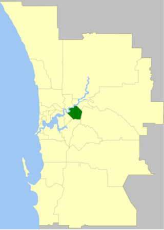
The City of Bayswater is a local government area in the Western Australian capital city of Perth, about 7 kilometres (4 mi) northeast of Perth's central business district. The city covers an area of 34.6 square kilometres (13.4 sq mi) and had a population of 69,283 as at the 2021 Census. The City of Bayswater is a member of the Eastern Metropolitan Regional Council.

The City of Belmont is a local government area in the inner eastern suburbs of the Western Australian capital city of Perth, located about 8 kilometres (5 mi) east of Perth's central business district on the south bank of the Swan River. The City covers an area of 39.8 square kilometres (15.4 sq mi), maintains 225 km of roads and had a population of almost 40,000 as at the 2016 Census.]

Mundaring is a suburb located 34 km east of Perth, Western Australia on the Great Eastern Highway. The suburb is located within the Shire of Mundaring.

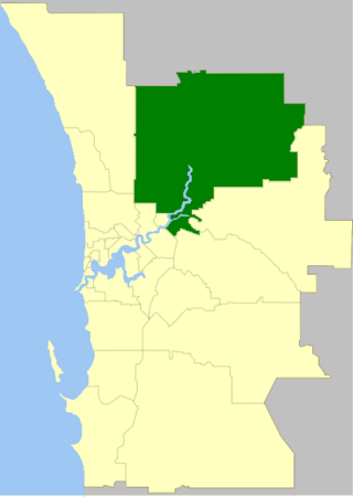
The City of Swan is a local government area of Western Australia, in the eastern metropolitan region of Perth. It is named after the Swan River which traverses most of the City's urban area.
Mount Helena is a suburb on the outskirts of Perth, in Western Australia, 35 km from the city, in the Shire of Mundaring. Its population in 2016 was 3,185 people.

Bellevue is an eastern suburb of Perth, Western Australia in the local government areas of the City of Swan and the Shire of Mundaring. It is at the foot of the slopes of Greenmount, a landmark on the Darling Scarp that is noted in the earliest of travel journals of the early Swan River Colony.

The Upper Darling Range Railway was a branch railway from Midland Junction, Western Australia, that rose up the southern side of the Helena Valley and on to the Darling Scarp via the Kalamunda Zig Zag. At the time of construction it was the only section of railway in Western Australia to have had a zig zag formation.

Chidlow is a small community in the Shire of Mundaring approximately 45 kilometres east of Perth, Western Australia.

Guildford is a suburb of Perth, Western Australia, 12 km northeast of the city centre within the City of Swan. Guildford was founded in 1829 as one of the earliest settlements of the Swan River Colony. It is one of only three towns in the metropolitan area listed on the Register of the National Trust.

Swan View is an eastern suburb of Perth, Western Australia. Its local government areas are the City of Swan and the Shire of Mundaring. It is 25 kilometres (16 mi) from Perth in the Perth Hills on the edge of the Darling Scarp, just to the west of the John Forrest National Park, east of Roe Highway and north of the Great Eastern Highway.

The City of Perth is a local government area and body, within the Perth metropolitan area, which is the capital of Western Australia. The local government is commonly known as Perth City Council. The City covers the Perth city centre and surrounding suburbs. The City covers an area of 20.01 square kilometres (8 sq mi) and had an estimated population of 21,092 as at 30 June 2015. On 1 July 2016 the City expanded, absorbing 1,247 residents from the City of Subiaco.

The Midland Junction railway station was an important junction station on the Eastern Railway of Western Australia until its closure in 1966.

The Town of Cottesloe is a local government area in the western suburbs of Perth, the capital of Western Australia. It covers the suburb of the same name as well as a tiny portion of the suburb of Claremont. Cottesloe is located 11 kilometres (7 mi) west of Perth's central business district, covers an area of 3.9 square kilometres (1.5 sq mi), maintains 45.7 km of roads and had a population of approximately 7,500 as at the 2016 Census. Cottesloe is served by Swanbourne, Victoria Street, Grant Street and Cottesloe train stations, all operated through the Fremantle Railway Line. Various bus routes operate along Stirling Highway, enabling transport through the suburb's western and eastern precincts with Perth and Fremantle. All services are operated by the Public Transport Authority. The Town of Cottesloe's inclusion of walk and cycle paths enable it to be a walkable precinct.

The Shire of Peppermint Grove is a local government area in Perth, Western Australia, 12 kilometres (7.5 mi) southwest of the Perth central business district. At 1.1 km2 (0.42 sq mi), it is the smallest local government area in Australia; it contains only the eponymous suburb, Peppermint Grove. The council comprises seven elected councillors, with no ward divisions.

The Town of Bassendean is a local government area in the northeastern suburbs of the Western Australian capital city of Perth, 6 kilometres (4 mi) west of the industrial centre of Midland and about 12 kilometres (7 mi) northeast of Perth's central business district. The Town covers an area of 10.4 square kilometres (4.0 sq mi), maintains 97 km of roads and had a population of approximately 15,000 as at the 2016 Census. The Town of Bassendean is a member of the Eastern Metropolitan Regional Council.
Helena Vale was the original name for Midland Junction in Western Australia between 1885 and 1901. It was also the earlier name of the Midland Junction Municipality between 1895 and 1901. The name has been long associated with the area between Midland and the Darling Scarp.

Bellevue railway station was a junction station on the Eastern Railway in the Perth suburb of Bellevue.

Midland is a suburb and historic town of Perth, Western Australia, located 15 km (9.3 mi) northeast of Perth's central business district. It is the administrative seat and commercial centre of the City of Swan local government area. It is also a designated strategic metropolitan centre for the larger Perth metropolitan area.
The Helena Vale Racecourse was a Thoroughbred horse racing track in the eastern suburb of Perth, Western Australia now known as Midvale. The course operated from the 1890s until the late 1960s.
References
- 1 2 "Municipal Boundary Amendments Register" (PDF). Western Australian Government Gazette. 4 August 2003. p. 89. Retrieved 30 June 2015.
- 1 2 "History of Midland". City of Swan. Retrieved 29 June 2015.
- ↑ "Perth suburb names". Landgate. Retrieved 29 June 2015.