Related Research Articles

Oakville is a town and lower-tier municipality in Halton Region, Ontario, Canada. It is located on Lake Ontario between Toronto and Hamilton. At its 2021 census the town had a population of 213,759, with an estimated 233,700 people as of 2024, making it Ontario's largest town. Oakville is part of the Greater Toronto Area and one of the most densely populated areas of Canada. According to the town about 36% do not have English as their mother tongue and that land available for culture and recreation is over 300,000 m (1,000,000 ft).

Milton is a town in Southern Ontario, Canada, and part of the Halton Region in the Greater Toronto Area. Between 2001 and 2011, Milton was the fastest growing municipality in Canada, with a 71.4% increase in population from 2001 to 2006 and another 56.5% increase from 2006 to 2011. In 2016, Milton's census population was 110,128 with an estimated growth to 228,000 by 2031. It remained the fastest growing community in Ontario but was deemed to be the sixth fastest growing in Canada at that time.

Georgetown is a large unincorporated community in the town of Halton Hills, Ontario, Canada, in the Regional Municipality of Halton. The town includes several small villages or settlements such as Norval, Limehouse, Stewarttown and Glen Williams near Georgetown and another large population centre, Acton. In 2016, the population of Georgetown was 42,123. It sits on the banks of the Credit River, approximately 40 km west of Toronto, and is part of the Greater Toronto Area. Georgetown was named after entrepreneur George Kennedy who settled in the area in 1821 and built several mills and other businesses.
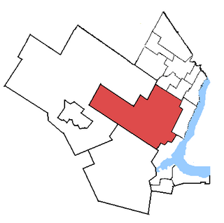
Halton was a federal electoral district in Ontario, Canada, represented in the House of Commons of Canada from 1867 to 1988 before being abolished in an electoral district redistribution, and again from 1997 to 2015, when it was again abolished in another electoral district redistribution. When it was last contested in 2011, its population was 203,437, of whom 115,255 were eligible electors.
Halton County is a former county in the Canadian province of Ontario, with an area of 92,342 hectares. It is also one of the oldest counties in Canada.

Bronte is the community that makes up much of the west end of Oakville, in Ontario, Canada. Twelve Mile Creek flows through the middle of town and empties into Lake Ontario. Main roads include Bronte Road (north-south), Lakeshore Road West and Rebecca Street (east-west). Streets in the business section include Lakeshore, Jones, Marine, and Ontario Street. Bronte is also accessed via a superhighway located to the north of the former village. Other main roads include Third Line, Speers Road and Burloak Drive to the west
The Trafalgar Moraine is a geological landform straddling Oakville and Milton in Ontario, Canada. A small portion of the moraine extends into Burlington at Milton's southern border. It is a subtler topological feature than the better-known Oak Ridges Moraine, primarily because it was formed as an end moraine at the terminus of a glacial ice sheet, instead of between two retreating ice lobes. The ice sheet pushed material to form the ridge, which is composed of Halton Till sediment, rich in silt and clay. By contrast, the Oak Ridges Moraine is primarily sand and gravel. The ridge was probably formed during a pause in the retreat of the ice sheet. The moraine covers an area of 892.5 hectares of primarily private land, though a small portion is public.

Sixteen Mile Creek is a river in Halton Region in the Greater Toronto Area of Ontario, Canada. It is in the Great Lakes Basin, and flows from the Niagara Escarpment through the towns of Milton and Oakville to Lake Ontario.

James Wilfred Snow was a politician in Ontario, Canada. He was a Progressive Conservative Party member of the Legislative Assembly of Ontario from 1967 to 1985 who represented the GTA ridings of Halton East and Oakville. He served as a cabinet minister in the governments of Bill Davis and Frank Miller.

Conservation Halton, also known as the Halton Region Conservation Authority, is a conservation authority established under the Conservation Authorities Act of Ontario. It forms a partnership with the Province of Ontario, the Ministry of Natural Resources and the regional municipalities of Halton, Peel, The County of Wellington, and surrounding municipalities.

Toronto Gore is a former incorporated and now geographic township in Ontario, Canada. It is today split between Mississauga and Brampton.

William McCraney was a businessman and political figure in Ontario, Canada. He represented Halton in the House of Commons of Canada as a Liberal member from 1875 to 1878 and from 1882 to 1887.
Halton was a provincial electoral district in Central Ontario, Canada. It elected one member to the Legislative Assembly of Ontario.

Winston Churchill Boulevard is a long north-south roadway that predominantly forms the western boundary of Peel Region with the eastern boundaries of Halton Region and Wellington County, in Ontario, Canada. The road begins at Lakeshore Road in the south at the boundaries of the City of Mississauga the Town of Oakville, and ends in Caledon at East Garafraxa-Caledon Townline. The road is named in honour of British Prime Minister Sir Winston Churchill.
Palermo, founded as Hagartown, is a former hamlet in Halton County, Ontario, Canada, within the town of Oakville.
The Mississauga Halton LHIN is a Local Health Integration Network (LHIN) in the Canadian province of Ontario. It is a community-based, non-profit organization funded by the Government of Ontario through the Ministry of Health and Long-Term Care.
Esquesing Township was a municipality within the historic Halton County in Ontario, Canada. It is today a geographic township in the town of Halton Hills in the Regional Municipality of Halton.

Burnhamthorpe Road is a major arterial road in the cities of Toronto and Mississauga, Ontario; beginning at Dundas Street, near Islington Avenue, running west and becoming a rural road in the Town of Oakville, where it terminates at Tremaine Road, where it changes name.

Lakeshore Road is a historic roadway in the Canadian province of Ontario, running through the city of Burlington and the town of Oakville in Halton Region, as well as the city of Mississauga in Peel Region. As its name implies, the road closely follows the shoreline of Lake Ontario, although the lake itself is not visible from the road in most areas. Lakeshore Road was once a key section of the historic Highway 2, which traversed the province, but has since been downloaded to local municipalities. Despite this historical role as a major route, however, most of the road is a lower-capacity picturesque residential and historic commercial street with only two through lanes until it becomes a four-lane, higher-volume artery after it enters Mississauga and jogs to the north.

Lisgar is a residential neighbourhood in the city of Mississauga, Ontario, Canada. It is located in the extreme northwestern corner of the city, bordering the larger Meadowvale district to the east and the Churchill Meadows neighbourhood to the south. It is named after the former hamlet located at the corner of Winston Churchill Boulevard and Derry Road, which is actually outside the present neighbourhood in Meadowvale.
References
- ↑ "Map of the County of Halton, Ontario" (JPG). 1880 Map of Ontario Counties - The Canadian County Atlas Digital Project. McGill University . Retrieved 2012-06-10.
- ↑ "Trafalgar". Geographical Names Data Base . Natural Resources Canada . Retrieved 2012-06-10.
- ↑ Fairbairn, Gardiner (2009). Nothing But Names: An Inquiry Into the Origin of the Names of the Counties and Townships of Ontario. BiblioBazaar. p. 243. ISBN 978-1-110-32611-2.
- 1 2 3 "Appendix J: Cultural Heritage Assessment Report" (PDF). Draft Environmental Assessment Report -- Bruce to Milton Transmission Reinforcement Project. Hydro One. September 2008. pp. 40–42. Archived from the original (PDF) on 27 September 2011.
- 1 2 "About Trafalgar Township". Trafalgar Township Historical Society. Retrieved 2009-09-22.