Trois-Pistoles | |
---|---|
| |
![]() Location within Les Basques RCM | |
Coordinates: 48°07′12″N069°10′48″W / 48.12000°N 69.18000°W Coordinates: 48°07′12″N069°10′48″W / 48.12000°N 69.18000°W [1] | |
Country | Canada |
Province | Quebec |
Region | Bas-Saint-Laurent |
RCM | Les Basques |
Constituted | 9 March 1916 |
Government | |
• Mayor | Philippe Guilbert |
• Federal riding | Rimouski-Neigette—Témiscouata —Les Basques |
• Prov. riding | Rivière-du-Loup–Témiscouata |
Area | |
• Total | 9.60 km2 (3.71 sq mi) |
• Land | 7.66 km2 (2.96 sq mi) |
Population | |
• Total | 3,456 |
• Density | 450.9/km2 (1,168/sq mi) |
• Pop 2006–2011 | ![]() |
• Dwellings | 1,757 |
Time zone | UTC−05:00 (EST) |
• Summer (DST) | UTC−04:00 (EDT) |
Postal code(s) | |
Area code(s) | 418 and 581 |
Highways | ![]() ![]() |
Website | www |
Trois-Pistoles is a city in Les Basques Regional County Municipality in the Bas-Saint-Laurent region of Quebec, Canada. It is also the county seat. The town is located on the south shore of the Saint Lawrence River.
A ferry crosses the river to Les Escoumins on the north shore. The port facilities are also used by fishing boats and scuba divers.
The town is the site of the University of Western Ontario's annual French immersion program, which has existed since 1932. It is the oldest such program in Canada.
Just offshore of the town lies Île aux Basques, an island that was used by Basque whalers in the 16th century. The island, part of the surrounding Municipality of Notre-Dame-des-Neiges, is a National Historic Site of Canada and is now a migratory bird sanctuary. [4]
The town has hosted the Festival Échofête de Trois-Pistoles, an environmentalism-themed music festival and fair each July since 2002. It is Quebec's largest environmental festival. [5] [6]
The town can be reached by Via Rail on the named train The Ocean, between Montreal and Halifax.
The town is said to have been named for a silver goblet worth three pistoles, an old French coin, that was lost in the river in the 17th century. [1]
2011 | |
---|---|
Population | 3,456 (-1.3% from 2006) |
Land area | 7.66 km2 (2.96 sq mi) |
Population density | 450.9/km2 (1,168/sq mi) |
Median age | 55.2 (M: 53.0, F: 56.7) |
Total private dwellings | 1,757 |
Median household income | $38,395 |
Year | Pop. | ±% |
---|---|---|
1991 | 3,886 | — |
1996 | 3,807 | −2.0% |
2001 | 3,635 | −4.5% |
2006 | 3,500 | −3.7% |
2011 | 3,253 | −7.1% |
2016 | 3,058 | −6.0% |
Canada Census Mother Tongue – Trois-Pistoles, Quebec [10] | ||||||||||||||||||
---|---|---|---|---|---|---|---|---|---|---|---|---|---|---|---|---|---|---|
Census | Total | French | English | French & English | Other | |||||||||||||
Year | Responses | Count | Trend | Pop % | Count | Trend | Pop % | Count | Trend | Pop % | Count | Trend | Pop % | |||||
2011 | 3,395 | 3,375 | ![]() | 99.41% | 15 | ![]() | 0.44% | 5 | ![]() | 0.15% | 0 | ![]() | 0.00% | |||||
2006 | 3,250 | 3,195 | ![]() | 98.31% | 0 | ![]() | 0.00% | 0 | ![]() | 0.00% | 55 | ![]() | 1.69% | |||||
2001 | 3,430 | 3,405 | ![]() | 99.27% | 25 | ![]() | 0.73% | 0 | ![]() | 0.00% | 0 | ![]() | 0.00% | |||||
1996 | 3,580 | 3,535 | n/a | 98.74% | 35 | n/a | 0.98% | 10 | n/a | 0.28% | 0 | n/a | 0.00% |
Climate data for Trois-Pistoles | |||||||||||||
---|---|---|---|---|---|---|---|---|---|---|---|---|---|
Month | Jan | Feb | Mar | Apr | May | Jun | Jul | Aug | Sep | Oct | Nov | Dec | Year |
Record high °C (°F) | 12 (54) | 11 (52) | 17.8 (64.0) | 27 (81) | 31.7 (89.1) | 32 (90) | 35 (95) | 33.9 (93.0) | 31 (88) | 23.3 (73.9) | 21 (70) | 15 (59) | 35 (95) |
Average high °C (°F) | −8 (18) | −6.4 (20.5) | −0.4 (31.3) | 6.4 (43.5) | 14.3 (57.7) | 20.2 (68.4) | 23 (73) | 21.4 (70.5) | 16 (61) | 9.4 (48.9) | 2.4 (36.3) | −4.7 (23.5) | 7.8 (46.0) |
Daily mean °C (°F) | −12 (10) | −10.1 (13.8) | −4.2 (24.4) | 2.5 (36.5) | 9.3 (48.7) | 15 (59) | 17.7 (63.9) | 16.5 (61.7) | 11.6 (52.9) | 5.9 (42.6) | −0.5 (31.1) | −8.1 (17.4) | 3.6 (38.5) |
Average low °C (°F) | −15.8 (3.6) | −13.9 (7.0) | −8.1 (17.4) | −1.4 (29.5) | 4.2 (39.6) | 9.7 (49.5) | 12.5 (54.5) | 11.5 (52.7) | 7.2 (45.0) | 2.4 (36.3) | −3.3 (26.1) | −11.4 (11.5) | −0.6 (30.9) |
Record low °C (°F) | −34.4 (−29.9) | −31.7 (−25.1) | −25.5 (−13.9) | −18 (0) | −7.2 (19.0) | 0 (32) | 3.3 (37.9) | 1.7 (35.1) | −2.8 (27.0) | −7.8 (18.0) | −18 (0) | −28.5 (−19.3) | −34.4 (−29.9) |
Average precipitation mm (inches) | 83.9 (3.30) | 67.8 (2.67) | 77.3 (3.04) | 73.9 (2.91) | 88.3 (3.48) | 84.2 (3.31) | 93.3 (3.67) | 87.6 (3.45) | 90.5 (3.56) | 92.5 (3.64) | 78.3 (3.08) | 87.6 (3.45) | 1,005.3 (39.58) |
Source: Environment Canada [11] |
Terrebonne is an off-island suburb of Montreal, in southwestern Quebec, Canada. It is located on the north shores of the Rivière des Mille-Îles and of the Rivière des Prairies, north of Montreal and Laval.
Sept-Îles is a city in the Côte-Nord region of eastern Quebec. It is among the northernmost locales with a paved connection to the rest of Quebec's road network. The population was 25,686 as of the 2011 Canadian census. The town is called Uashat, meaning "bay" in Innu-aimun.
Vaudreuil-Dorion is a suburb of Greater Montreal, in the Montérégie region of southwestern Quebec, Canada. The result of the merger of two towns, Vaudreuil and Dorion, it is located in the Vaudreuil-Soulanges Regional County Municipality.
Baie-Comeau is a city located approximately 420 km (260 mi) north-east of Quebec City in the Côte-Nord region of the province of Quebec, Canada. It is located on the shores of the Saint Lawrence River near the mouth of the Manicouagan River, and is the seat of Manicouagan Regional County Municipality.
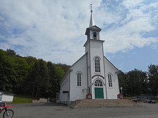
Les Basques(the Basques) is a regional county municipality in the Bas-Saint-Laurent region in eastern Quebec, Canada. It is located on the south bank of the Saint Lawrence River halfway between Rimouski and Rivière-du-Loup.
Les Îles-de-la-Madeleine is one of two municipalities forming the urban agglomeration of Magdalen Islands in Quebec, Canada. It is part of the Gaspésie–Îles-de-la-Madeleine region and its population was 12,010 as of the 2016 Census.
Manicouagan is a regional county municipality in the Côte-Nord region of Quebec, Canada. It is located on the north shore of the Saint Lawrence River with its seat in Baie-Comeau. It was created in 1981, and named after the Manicouagan River.
Dolbeau-Mistassini is a town in northern Quebec, Canada, at the confluence of the Mistassibi River, Riviere aux Rats and the Mistassini River, on Lac Saint-Jean. Dolbeau-Mistassini is in the Maria-Chapdelaine Regional County Municipality and is the commercial hub of Lac-St-Jean with big stores and shopping centres.
The Town of Île-Perrot is a town and municipality on Île Perrot in southwestern Quebec, Canada. The population as of the Canada 2016 Census was 10,756. The town is at the western end of Lake Saint-Louis, and borders the local island communities of Terrasse-Vaudreuil, Pincourt and Notre-Dame-de-l'Île-Perrot. It also includes Dowker Island and the small Claude and Bellevue Islands.
Les Escoumins is a municipality in La Haute-Côte-Nord Regional County Municipality in the Côte-Nord region of Quebec. It is located on the north shore of the Saint Lawrence River.
Havre-Saint-Pierre is a town on Pointe-aux-Esquimaux, which is on the Quebec north shore (Côte-Nord) of the Saint Lawrence River in Canada]. Located along Route 138 some 200 kilometres (120 mi) east of Sept-Îles, it is the largest town and seat of the Minganie RCM, and home to many government, municipal, and regional services.
Carignan is a suburban municipality in southwestern Quebec, Canada, on the Richelieu River in La Vallée-du-Richelieu Regional County Municipality, about 27 km (17 mi) from Montreal. The population as of the Canada 2021 Census was 11,740.
Pincourt is a municipality on the island of Île Perrot, off the western tip of the island of Montreal, Quebec. The population as of the Canada 2011 Census was 14,305. The town shares the island with the three other municipalities of Notre-Dame-de-l'Île-Perrot, Terrasse Vaudreuil and L'Île-Perrot, bordering on each one. The south end of the Ottawa River flows between Vaudreuil-Dorion and Pincourt, defining the town's western boundary.
Coteau-du-Lac is a small city in southwestern Quebec, Canada. It is on the north shore of the St. Lawrence River in the Vaudreuil-Soulanges Regional County Municipality.
Port-Cartier is a city in the Côte-Nord region of Quebec, Canada. It is located on the north shore of the Saint Lawrence River at the mouth of the Aux-Rochers River, exactly 63 kilometres (39 mi) southwest of Sept-Îles, Quebec.
Notre-Dame-de-l'Île-Perrot is the largest of four municipalities located on Île Perrot, west of the island of Montreal, Quebec. The population as of the Canada 2016 Census was 10,654. It hosts the island's first church built in 1740 originally situated at Pointe-du-Moulin which was reconstituted as the Chapelle du Souvenir in 1953 beside the church of Sainte-Jeanne-de-Chantal across from the town hall.
L'Isle-aux-Allumettes is a municipality in the Outaouais region, part of the Pontiac Regional County Municipality, Quebec, Canada. The municipality consists primarily of Allumette Island, and also includes Morrison Island, Marcotte Island, and some minor islets, all in the Ottawa River north of Pembroke.
Saint-Paul-de-l'Île-aux-Noix is a municipality in southern Quebec, Canada located in the administrative area of the Montérégie. The population as of the Canada 2021 Census was 2,141.
Notre-Dame-des-Neiges is a municipality in Quebec, Canada. It encircles the city of Trois-Pistoles and includes the offshore Île aux Basques.
Île aux Basques is a Canadian island located in the lower estuary of the St. Lawrence River, about 5 kilometres (3.1 mi) north of Trois-Pistoles, in Les Basques Regional County Municipality of the Bas-Saint-Laurent region of Quebec. The island is part of the municipality of Notre-Dame-des-Neiges.