Fairdale is a former census-designated place in southern Jefferson County, Kentucky, United States. The population was 7,658 at the 2000 census. In 2003, the area was annexed to the city of Louisville due to a merger between the city and Jefferson County's unincorporated community. Fairdale is now a neighborhood within the city limits of Louisville. It is within the boundaries of the Fairdale Fire Protection District which serves Fairdale and surrounding areas including the large Jefferson Memorial Forest and historic South Park Country Club, the oldest country club in the state of Kentucky.

The Biedenharn Museum and Gardens is a home museum and botanical garden located beside the Ouachita River at 2006 Riverside Drive in Monroe in Ouachita Parish, Louisiana, United States. It is open Monday-Saturday and Sunday afternoons.

Bowes railway station was situated on the South Durham & Lancashire Union Railway between Barnard Castle and Kirkby Stephen East. It served the village of Bowes. The station opened to passenger traffic on 26 March 1861, and closed on 22 January 1962.

The Andorra National Library was §founded in 1930, then re-opened in 1974. It is housed in Casa Bauró, an old manor house in the Andorran capital, Andorra la Vella. Amongst other functions, it is the legal deposit and copyright library for Andorra.

Rogów Sobócki is a village in the administrative district of Gmina Sobótka, within Wrocław County, Lower Silesian Voivodeship, in south-western Poland. Prior to 1945 it was in Germany.

St George's Shopping Centre, formerly The Mall Preston and The Mall St George, is a shopping centre in the city of Preston, Lancashire, England.
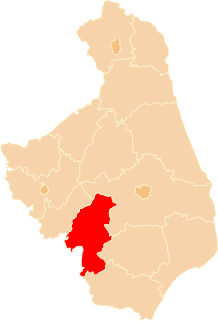
Pichari District is one of ten districts of the province La Convención in Peru.
Perki-Mazowsze is a village in the administrative district of Gmina Sokoły, within Wysokie Mazowieckie County, Podlaskie Voivodeship, in north-eastern Poland.
Mochowo-Dobrzenice is a village in the administrative district of Gmina Mochowo, within Sierpc County, Masovian Voivodeship, in east-central Poland.
El Hanchane is a town in Essaouira Province, Marrakech-Tensift-Al Haouz, Morocco. According to a 2004 census it has a population of 4,698.

Kosuge Station is a railway station on the Tobu Skytree Line in Adachi, Tokyo, Japan, operated by the private railway operator Tobu Railway.
Ravenstone Priory was a medieval monastic house in Buckinghamshire, England. It was established c.1255 and was dissolved in 1524.
Eisteinhovde is a mountain of Oppland, in southern Norway.
Al Makha District is a district of the Taiz Governorate, Yemen. As of 2003, the district had a population of 18,155 inhabitants. The capital lies at Mocha.
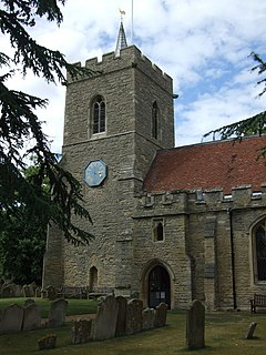
Church of St James is a Grade I listed church in Biddenham, Bedfordshire, England. It became a listed building on 13 July 1964.
Zabrega is a village in the municipality of Paraćin, Serbia. According to the 2002 census, the village has a population of 1211 people.
Prisoji is a village in Pljevlja Municipality, in northern Montenegro. According to the 2003 census, the village had a population of 51 people.
Frikeh, Idlib is a Syrian village located in Jisr al-Shughur Nahiyah in Jisr al-Shughur District, Idlib. According to the Syria Central Bureau of Statistics (CBS), Frikeh, Idlib had a population of 3261 in the 2004 census.

Rathauspassagen is a shopping centre in Berlin, Germany.
Sherrill Township is a township in Texas County, in the U.S. state of Missouri.