The city of Savannah, Province of Georgia, was laid out in 1733, in what was colonial America, around four open squares, each surrounded by four residential "tithing") blocks and four civic ("trust") blocks. The layout of a square and eight surrounding blocks was known as a "ward." The original plan was part of a larger regional plan that included gardens, farms, and "outlying villages." Once the four wards were developed in the mid-1730s, two additional wards were laid. Oglethorpe's agrarian balance was abandoned after the Georgia Trustee period. Additional squares were added during the late 18th and 19th centuries, and by 1851 there were 24 squares in the city. In the 20th century, three of the squares were demolished or altered beyond recognition, leaving 21. In 2010, one of the three "lost" squares, Ellis, was reclaimed, bringing the total to today's 22.

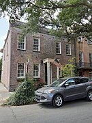
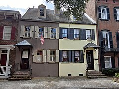
Greene Square is one of the 22 squares of Savannah, Georgia, United States. It is the easternmost square in the second row of the city's five rows of squares. The square is located on Houston Street and East President Street, and is south of Washington Square, east of Columbia Square and north of Crawford Square. The oldest buildings on the square are at 510 East York Street, 509 East President Street and 503 East President Street, each in the southwestern trust/civic block, which are believed to have been built at the same time as the square itself (1799).

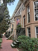
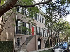
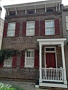
Columbia Square is one of the 22 squares of Savannah, Georgia, United States. It is located in the second row of the city's five rows of squares, on Habersham Street and East President Street. It is south of Warren Square and between Oglethorpe Square to the west and Greene Square to the east. The oldest building on the square is at 307 East President Street, today's 17 Hundred 90 Inn, which, as its name suggests, dates to the 18th century.

Reynolds Square is one of the 22 squares of Savannah, Georgia, United States. It is located in the northernmost row of the city's five rows of squares, on Abercorn Street and East St. Julian Street. It is east of Johnson Square, west of Warren Square and north of Oglethorpe Square. The oldest building on the square is The Olde Pink House, which dates to 1771.

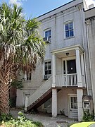
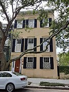
Warren Square is one of the 22 squares of Savannah, Georgia, United States. It is located in the northernmost row of the city's five rows of squares, on Habersham Street and East St. Julian Street. It is east of Reynolds Square, west of Washington Square and north of Columbia Square. The oldest building on the square is the Spencer–Woodbridge House, at 22 Habersham Street, which dates to 1790. The Lincoln Street Parking Garage occupies the entire western side of the square.
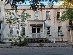
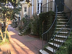
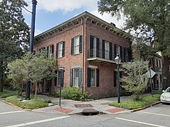
Washington Square is one of the 22 squares of Savannah, Georgia, United States. It is located in the northernmost row of the city's five rows of squares, on Houston Street and East St. Julian Street. It is east of Warren Square and north of Greene Square in the northeastern corner of the city's grid of squares, in Savannah's Old Fort neighborhood. The oldest building original to the square is 510 East St. Julian Street, which dates to 1797.

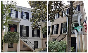
Oglethorpe Square is one of the 22 squares of Savannah, Georgia, United States. It is located in the second row of the city's five rows of squares, on Abercorn Street and East President Street, and was laid out in 1742. It is south of Reynolds Square, west of Columbia Square, north of Colonial Park Cemetery and east of Wright Square. The oldest building on the square is the Owens–Thomas House, at 124 Abercorn Street, which dates 1819.

Orleans Square is one of the 22 squares of Savannah, Georgia, United States. It is located in the middle row of the city's five rows of squares, on Barnard Street and West McDonough Street, and was laid out in 1815, shortly after the event it commemorates: General Andrew Jackson's victory at the Battle of New Orleans that January. It is south of Telfair Square, west of Chippewa Square and north of Pulaski Square. The oldest building on the square is the John Ash House, at 114–116 West Hull Street, which dates to 1817.

Chippewa Square is one of the 22 squares of Savannah, Georgia, United States. It is located in the middle row of the city's five rows of squares, on Bull Street and McDonough Street, and was laid out in 1815. It is south of Wright Square, west of Colonial Park Cemetery, north of Madison Square and east of Orleans Square. The oldest building on the square is The Savannah Theatre, at 222 Bull Street, which dates to 1818.
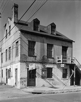
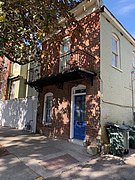
Crawford Square is one of the 22 squares of Savannah, Georgia, United States. It is located in the middle row of the city's five rows of squares, on Houston Street and East McDonough Street, and was laid out in 1841. It is south of Greene Square and east of Colonial Park Cemetery on the eastern edge of the Savannah Historic District. The oldest building on the square is at 224 Houston Street, which dates to 1850.

Pulaski Square is one of the 22 squares of Savannah, Georgia, United States. It is located in the fourth row of the city's five rows of squares, on Barnard Street and West Macon Street, and was laid out in 1837. It is south of Orleans Square, west of Madison Square and north of Chatham Square. It is known for its live oaks. The oldest buildings on the square are the Theodosius Bartow House and the Bernard Constantine House, which date to 1839.

Madison Square is one of the 22 squares of Savannah, Georgia, United States. It is located in the fourth row of the city's five rows of squares, on Bull Street and Macon Street, and was laid out in 1837. It is south of Chippewa Square, west of Lafayette Square, north of Monterey Square and east of Pulaski Square. The square is named for James Madison, fourth president of the United States. The oldest building on the square is the Sorrel–Weed House, at 6 West Harris Street, which dates to 1840.

Lafayette Square is one of the 22 squares of Savannah, Georgia, United States. It is located in the fourth row of the city's five rows of squares, on Abercorn Street and East Macon Street, and was laid out in 1837. It is south of Colonial Park Cemetery, west of Troup Square, north of Taylor Square and east of Madison Square. The square is named for Gilbert du Motier, Marquis de Lafayette, the French hero of the American Revolution who visited Savannah in 1825. The oldest building on the square is the Andrew Low Carriage House, at 329 Abercorn Street, which dates to 1849.

Chatham Square is one of the 22 squares of Savannah, Georgia, United States. It is located in the southernmost row of the city's five rows of squares, on Barnard Street and West Wayne Street, and was laid out in 1847. It is south of Pulaski Square and west of Monterey Square in the southwestern corner of the city's grid of squares. The square is named for William Pitt, 1st Earl of Chatham. Although Pitt never visited Savannah, he was an early supporter of the Georgia colony, and both Chatham Square and Chatham County are named in his honor. The oldest building on the square is the Enoch Hendry Row House, at 108–112 West Taylor Street, which dates to 1851.
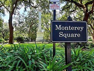
Monterey Square is one of the 22 squares of Savannah, Georgia, United States. It is located in the southernmost row of the city's five rows of squares, on Bull Street and Wayne Street, and was laid out in 1847. It is south of Madison Square, west of Taylor Square, north of Forsyth Park and east of Chatham Square. The oldest building on the square is the Herman Kuhlman Duplex, at 22–24 West Taylor Street, which dates to 1851.

Whitefield Square is one of the 22 squares of Savannah, Georgia, United States. It is located in the southernmost row of the city's five rows of squares, on Habersham Street and East Wayne Street, and was the final square laid out, in 1851. It is south of Troup Square and east of Taylor Square in the southeastern corner of Savannah's grid of squares. The oldest building on the square is at 412–414 East Taylor Street, which dates to 1855.
Moses Eastman was an American silversmith based in Savannah, Georgia. He was also the founder of, and sole benefactor in, the construction of Savannah's Unitarian Universalist Church.
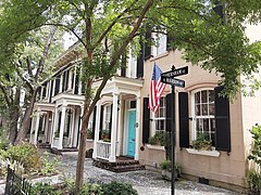
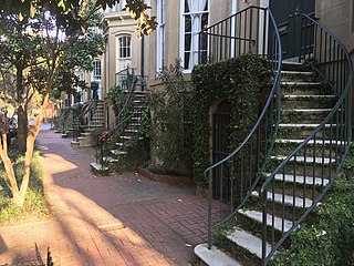
Habersham Street is a prominent street in Savannah, Georgia, United States. Located between Lincoln Street to the west and Price Street to the east, it runs for about 4.82 miles (7.76 km) from East Bay Street in the north to Stephenson Avenue in the south. The street is named for merchant and statesman James Habersham. It was known as Prendergast Street in 1760. Its northern section passes through the Savannah Historic District, a National Historic Landmark District.
Charlton Street is a prominent street in Savannah, Georgia, United States. Located between Harris Street to the north and Jones Street to the south, it runs for about 0.86 miles (1.38 km) from Purse Street in the west to East Broad Street in the east. Originally known only as Charlton Street singular, its addresses are now split between "West Charlton Street" and "East Charlton Street", the transition occurring at Bull Street in the center of the downtown area. The street is named for Thomas Charlton, fifteenth mayor of Savannah.

Harris Street is a prominent street in Savannah, Georgia, United States. Located between Liberty Street to the north and Charlton Street to the south, it runs for about 0.86 miles (1.38 km) from Purse Street in the west to East Broad Street in the east. Originally known only as Gordon Street Harris, its addresses are now split between "West Harris Street" and "East Harris Street," the transition occurring at Bull Street in the center of the downtown area. The street is named for Charles Harris, former mayor of Savannah. The street is entirely within Savannah Historic District, a National Historic Landmark District.