Britannia Beach is a small unincorporated community in the Squamish-Lillooet Regional District located approximately 55 kilometres north of Vancouver, British Columbia on the Sea-to-Sky Highway on Howe Sound. It has a population of about 300. It includes the nearby Britannia Creek, a small to mid-sized stream that flows into Howe Sound that was historically one of North America's most polluted waterways.

Courtenay is a city of about 26,000 on the east coast of Vancouver Island, in the Canadian province of British Columbia. It is the largest community and only city in the area commonly known as the Comox Valley, and the seat of the Comox Valley Regional District, which replaced the Comox-Strathcona Regional District. Courtenay is 4 km (2.5 mi) west of the town of Comox, 7 km (4.3 mi) northeast of the village of Cumberland, 5 km (3.1 mi) northwest of the unincorporated settlement of Royston, and 108 km (67 mi) northwest of Nanaimo. Along with Nanaimo and Victoria, it is home to The Canadian Scottish Regiment, a Primary Reserve infantry regiment of the Canadian Armed Forces.
Englishman River is a river in the eastern side of Vancouver Island, British Columbia, Canada. It starts on the eastern slopes of the Beaufort Range, originating from tiny Jewel Lake and flowing in an easterly direction for 40 km (25 mi), entering the Strait of Georgia at Parksville, British Columbia. It is an important watershed providing habitat for various species of salmon and community water to the residents of Parksville and surrounding area. The Englishman River watershed includes Arrowsmith Lake, Hidden Lake, Fishtail Lake, Rowbotham Lake, Healy Lake, Shelton Lake, and Rhododendron Lake.

The Regional District of Comox-Strathcona was a regional district of British Columbia, Canada, from 1967 to 2008. On February 15, 2008, the regional district was abolished and replaced by two successor regional districts, Comox Valley and Strathcona.
Anyox was a small company-owned mining town in British Columbia, Canada. Today it is a ghost town, abandoned and largely destroyed. It is located on the shores of Granby Bay in coastal Observatory Inlet, about 60 kilometres southeast of Stewart, British Columbia, and about 20 kilometres, across wilderness east of the tip of the Alaska Panhandle.

The Niut Range is 3600 km2 in area. It is a subrange of the Pacific Ranges of the Coast Mountains of British Columbia, although in some classifications it is considered part of the Chilcotin Ranges. The Niut is located in the angle of the Homathko River and its main west fork, Mosley Creek. It is isolated, island-like, by those rivers from its neighbour ranges, as both streams have their source on the Chilcotin Plateau in behind the range. Razorback Mountain is its highest peak.

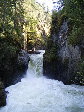
Little Qualicum Falls Provincial Park is a provincial park in British Columbia, Canada, on central Vancouver Island, that encompasses the entire southern shore of Cameron Lake. The Island Rail Corridor line to Port Alberni passes through the park.

Bowser is a community on the east coast of Vancouver Island in British Columbia, Canada. It has a population of 1,729. Approximately 66 kilometres (41 mi) north of Nanaimo, Bowser is in a region informally known as Lighthouse Country, spanning a stretch of highway that extends from Qualicum Beach in the south to Horne Lake to the west and Fanny Bay in the north and east to Denman and Hornby Islands. Bowser is in the Regional District of Nanaimo and in its Electoral Area H, one of eight in the District. The community was named after William J. Bowser, premier of British Columbia from 1915 to 1916. Bowser is served by the coast-spanning Island Highway.

Strathcona Provincial Park is the oldest provincial park in British Columbia, Canada, and the largest on Vancouver Island. Founded in 1911, the park was named for Donald Alexander Smith, 1st Baron Strathcona and Mount Royal, a wealthy philanthropist and railway pioneer. It lies within the Strathcona Regional District. The Clayoquot Sound Biosphere Reserve, established in 2000, includes three watersheds in the western area of the park.

Georges P. Vanier Secondary School is a high school in Courtenay, British Columbia, Canada. The school was named after Georges P. Vanier, one of Canada's most popular Governors General.
Franklin River in Vancouver Island, British Columbia, is located between Alberni Inlet and Barkley Sound, was named as part of the Vancouver Island Exploration Expedition of 1864. The river was named for Selim Franklin, Esquire, who was Chairman of the Exploration Committee.
Little River is a community in the Comox Valley region of Vancouver Island, British Columbia, Canada.
The K'ómoks First Nation, is the Indigenous band government of the Island Comox or K'ómoks people of Vancouver Island, British Columbia, Canada. Closely allied to the Cape Mudge and Campbell River First Nations, historically they were a Coast Salish people since integrated into Kwakwaka'wakw society. Originally part of the Laich-kwil-tach Council of Chiefs, which is a treaty society, they are now negotiating independently in the BC Treaty Process. They remain a member government of the Kwakiutl District Council.
The Puntledge River is a small river on Vancouver Island, British Columbia, Canada. It joins the Tsolum River to form the Courtenay River, which enters the Strait of Georgia at the city of Courtenay.

The Courtenay River is a short river on Vancouver Island, British Columbia, Canada, being the name of the channel from the confluence of the Puntledge and Tsolum Rivers, in the City of Courtenay, and its outlet into Comox Harbour, which is a part of the Strait of Georgia.
The Comox Land District is one of the 59 land districts of British Columbia, Canada, which are part of the cadastral divisions of British Columbia, created with rest of those on Vancouver Island via the Lands Act of the Colony of Vancouver Island. The British Columbia government's BC Names system, a subdivision of GeoBC, defines a land district as "a territorial division with legally defined boundaries for administrative purposes". All land titles and surveys use the Land District system as the primary point of reference, and entries in BC Names for placenames and geographical objects are so listed.
There are many lakes named Long Lake in British Columbia, Canada.
Waddington Harbour is a harbour at the head of Bute Inlet in the Central Coast region of British Columbia, Canada. Also issuing into the head of Bute Inlet and Waddington Harbour, just east of the mouth of the Homathko, is the Teaquahan River. Issuing directly into the inlet a few miles south on the harbour's southeast is the Southgate River, one of the major rivers of the central Pacific Ranges, which begins on the west side of the Lillooet Icecap. Its lower valley adjacent to the inlet's shores is called Pigeon Valley.

Nanaimo Lakes are a chain of four lakes composed of three natural—First, Second, and Third Lakes—and one man-made, dammed lake, Fourth Lake, on the upper Nanaimo River, on Vancouver Island in British Columbia, Canada.

The Teck Cominco smelter, also known as the Teck Cominco Lead-Zinc Smelter, Cominco Smelter, and Trail smelter located in Trail, British Columbia, Canada, is the largest integrated lead-zinc smelter of its kind in the world. It is situated approximately 10 miles (16 km) north of the border between British Columbia, Canada and Washington, in the United States, on the Columbia River. It is owned and operated by Vancouver, British Columbia-based Teck Cominco Metals Ltd—renamed Teck Resources.
