
Rio Grande do Sul is a state in the southern region of Brazil. It is the fifth-most-populous state and the ninth largest by area. Located in the southernmost part of the country, Rio Grande do Sul is bordered clockwise by Santa Catarina to the north and northeast, the Atlantic Ocean to the east, the Uruguayan departments of Rocha, Treinta y Tres, Cerro Largo, Rivera and Artigas to the south and southwest, and the Argentine provinces of Corrientes and Misiones to the west and northwest. The capital and largest city is Porto Alegre. The state has the highest life expectancy in Brazil, and the crime rate is relatively low compared to the Brazilian national average. Despite the high standard of living, unemployment is still high in the state, as of 2017. The state has 5.4% of the Brazilian population and it is responsible for 6.6% of the Brazilian GDP.
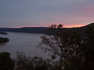
The Uruguay River is a major river in South America. It flows from north to south and forms parts of the boundaries of Brazil, Argentina, and Uruguay, separating some of the Argentine provinces of La Mesopotamia from the other two countries. It passes between the states of Santa Catarina and Rio Grande do Sul in Brazil; forms the eastern border of the provinces of Misiones, Corrientes, and Entre Ríos in Argentina; and makes up the western borders of the departments of Artigas, Salto, Paysandú, Río Negro, Soriano, and Colonia in Uruguay.
São Pedro, Portuguese for Saint Peter, may refer to the following places:
Espírito Santo is a state in southeastern Brazil.
Talian is a dialect of the Venetian language, spoken primarily in the Serra Gaúcha region in the northeast of the state of Rio Grande do Sul in Brazil. It is also spoken in other parts of Rio Grande do Sul, as well as in parts of Espirito Santo and of Santa Catarina.
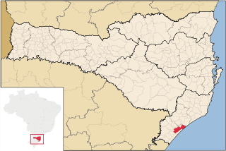
Araranguá is a city located in the southern part of Santa Catarina state, in the south of Brazil. It has 68,867 inhabitants and was settled mainly by Portuguese and Italians. Araranguá is known as "A Cidade das Avenidas" because of its wide roads.
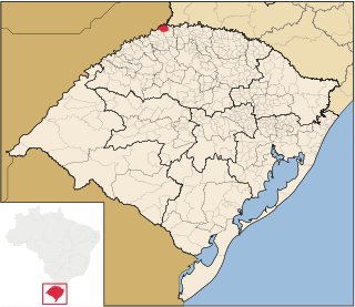
Derrubadas is a municipality of the Brazilian state of Rio Grande do Sul.

Rio Grande is a municipality (município) and one of the oldest cities in the Brazilian state of Rio Grande do Sul. It was the state capital from 1835 to 1845. It is the most important port city in the state and has one of the most important maritime ports in Brazil.

Amaral Ferrador is a municipality in the state of Rio Grande do Sul, Brazil. The population is 7,085 in an area of 506.46 km². It is situated on the Camaquã River.
The Humaitã River, also known as the Turvo River, is a river of Rio Grande do Sul state in southern Brazil. It is a tributary of the Da Prata River.
Turvo River may refer to several rivers in Brazil:

The Turvo State Park is a state park in the state of Rio Grande do Sul, Brazil. It protects the last large area of well-preserved Upper Uruguay forest in the state, which is home to several rare or endangered species. The park is best known for the dramatic Yucumã Falls on the Uruguay River, the second-widest in the world by some measures. The falls may be threatened by flooding from the planned Garabí-Panambi Hydroelectric Complex if a 2015 court ruling is overturned.

The Panambí Dam, or Roncador Dam, is a planned hydroelectric dam and generating station on the Uruguay River between Argentina and Brazil, part of the Garabí-Panambi Hydroelectric Complex. There is controversy over the environmental impact on the fast-flowing river.

Vale do Ribeira is a region in the south of the state of São Paulo and the northeast of the state of Paraná, Brazil. It contains a large part of the Ribeira de Iguape River valley, from which it takes its name, as well as the coastal Iguape-Cananéia-Paranaguá estuary lagoon complex. The region is environmentally rich, with large areas of well-preserved Atlantic Forest, but economically poor.
