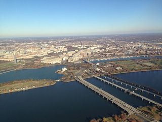
The 14th Street bridges refers to the three bridges near each other that cross the Potomac River, connecting Arlington, Virginia and Washington, D.C. Sometimes the two nearby rail bridges are included as part of the 14th Street bridge complex. A major gateway for automotive, bicycle and rail traffic, the bridge complex is named for 14th Street, which feeds automotive traffic into it on the D.C. end.

The Delaware Memorial Bridge is a dual-span suspension bridge crossing the Delaware River. The toll bridges carry Interstate 295 and U.S. Route 40 and is also the link between Delaware and New Jersey. The bridge was designed by the firm of Howard, Needles, Tammen & Bergendoff with consulting help from engineer Othmar Ammann, whose other designs include the George Washington Bridge and the Verrazzano-Narrows Bridge.

Interstate 295 (I-295) in Delaware, New Jersey, and Pennsylvania is an auxiliary Interstate Highway, designated as a bypass around Philadelphia, and a partial beltway of Trenton.
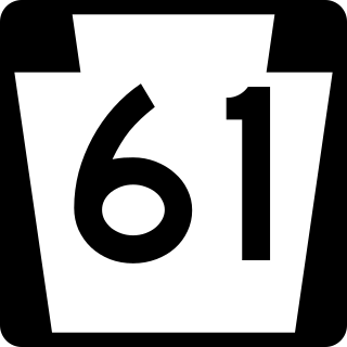
Pennsylvania Route 61 is an 81.8-mile-long (131.6 km) state highway that is located in Pennsylvania in the United States. The route is signed north-south despite running in a northwest-southeast direction from U.S. Route 222 Business in Reading to US 11/US 15/PA 147 in Shamokin Dam.

The Schuylkill Expressway, locally known as "the Schuylkill", is a freeway through southern Montgomery County and Philadelphia. It is the easternmost segment of Interstate 76 (I-76) in the U.S. state of Pennsylvania. It extends from the Valley Forge interchange of the Pennsylvania Turnpike in King of Prussia, paralleling its namesake Schuylkill River for most of the route, southeast to the Walt Whitman Bridge over the Delaware River in South Philadelphia. It serves as the primary corridor into Philadelphia from points west. Maintenance and planning for most of the highway are administered through Pennsylvania Department of Transportation (PennDOT) District 6, with the Delaware River Port Authority (DRPA) maintaining the approach to the Walt Whitman Bridge.

Pennsylvania Route 611 is a state highway in eastern Pennsylvania running 109.7 mi (176.5 km) from Interstate 95 (I-95) in the southern part of Philadelphia north to I-380 in Coolbaugh Township in the Pocono Mountains.

Interstate 95 (I-95) is a major north–south Interstate Highway that runs along the East Coast of the United States from Miami, Florida, north to the Canada–United States border at Houlton, Maine. In the state of Pennsylvania, it runs 51.00 miles (82.08 km) from the Delaware state line near Marcus Hook in Delaware County in the southeastern part of the state northeast to the Delaware River–Turnpike Toll Bridge at the New Jersey state line near Bristol in Bucks County, closely paralleling the New Jersey state line for its entire length through Pennsylvania.
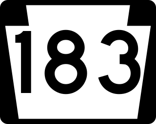
Pennsylvania Route 183 (PA 183) is a 31.7-mile-long (51.0 km) route that runs north to south in southeastern Pennsylvania. The southern terminus is at U.S. Route 422 Business in Reading in Berks County. Its northern terminus is at PA 61 near Schuylkill Haven in Schuylkill County. The road passes through developed areas near Reading before continuing north through rural areas, crossing from Berks County into Schuylkill County at Blue Mountain. PA 183 serves the communities of Bernville, Strausstown, and Cressona.

The West Philadelphia Elevated, also known as the High Line or Philadelphia High Line, is a railroad viaduct in the western part of Philadelphia, Pennsylvania. Now part of the Harrisburg Subdivision of CSX Transportation, the viaduct was built in 1903 by the Pennsylvania Railroad (PRR) to allow through freight trains to bypass rail yard, industrial sidings, and a passenger station.

U.S. Route 1 (US 1) is a major north–south U.S. Route, extending from Key West, Florida, in the south to Fort Kent, Maine, at the Canada–United States border in the north. In the U.S. state of Pennsylvania, US 1 runs for 81 miles (130 km) from the Maryland state line near Nottingham northeast to the New Jersey state line at the Delaware River in Morrisville, through the southeastern portion of the state. The route runs southwest to northeast and serves as a major arterial road through the city of Philadelphia and for many of the suburbs in the Delaware Valley metropolitan area. South of Philadelphia, the road mostly follows the alignment of the Baltimore Pike. Within Philadelphia, it mostly follows Roosevelt Boulevard. North of Philadelphia, US 1 parallels the route of the Lincoln Highway. Several portions of US 1 in Pennsylvania are freeways, including from near the Maryland state line to Kennett Square, the bypass of Media, the concurrency with Interstate 76 and the Roosevelt Expressway in Philadelphia, and between Bensalem Township and the New Jersey state line.

The Liberty Bend Bridge is the common name for the two continuous truss bridges on Route 291 over the Missouri River in Sugar Creek, Missouri in the Kansas City metropolitan area. Although the bridges cross over the Missouri River, they do not cross the county line. When the Missouri River was rerouted in 1949, it cut across the northern part of Jackson County, Missouri. This left part of the county north of the river, which is known as River Bend. The original Liberty Bend Bridge was located about two miles to the north, which then crossed over into Clay County, Missouri.

U.S. Route 13 (US 13) is a United States Numbered Highway running from Fayetteville, North Carolina, north to Morrisville, Pennsylvania. The route runs for 49.359 miles (79.436 km) through the Delaware Valley in the U.S. state of Pennsylvania. The route enters the state from Delaware in Marcus Hook, Delaware County. It continues northeast through Delaware County, passing through the city of Chester before heading through suburban areas along Chester Pike to Darby. US 13 enters the city of Philadelphia on Baltimore Avenue and runs through West Philadelphia to University City, where it turns north along several city streets before heading east across the Schuylkill River along Girard Avenue. The route turns north and heads to North Philadelphia, where it runs northeast along Hunting Park Avenue. US 13 becomes concurrent with US 1 on Roosevelt Boulevard, continuing into Northeast Philadelphia. US 13 splits southeast on a one-way pair of streets before heading northeast out of the city on Frankford Avenue. The route continues into Bucks County as Bristol Pike, heading northeast to Bristol, where it becomes a divided highway. US 13 becomes a freeway in Tullytown and continues north to its terminus at US 1 in Falls Township, near Morrisville. US 13 roughly parallels Interstate 95 (I-95) through its course in Pennsylvania.

The Falls Bridge is a steel Pratt truss bridge that spans the Schuylkill River in Fairmount Park in Philadelphia, Pennsylvania. It connects Kelly Drive at Calumet Street with Martin Luther King, Jr. Drive at Neill Drive. It replaced a wooden covered bridge at the same site.

Gray's Ferry Bridge has been the formal or informal name of several floating bridges and four permanent ones that have carried highway and rail traffic over the Schuylkill River in Philadelphia. The bridge today is a four-lane divided highway bridge, built in 1976, that carries Grays Ferry Avenue from the Grays Ferry neighborhood on the east bank, over the river and the Northeast Corridor railroad tracks, to the Southwest Philadelphia neighborhood of Kingsessing.

The Girard Avenue Bridge is an automobile and trolley bridge in Philadelphia, Pennsylvania, that carries Girard Avenue over the Schuylkill River. It connects the east and west sections of Fairmount Park, and the Brewerytown neighborhood with the Philadelphia Zoo. The current bridge is the third built on the site.

Pennsylvania Railroad, Connecting Railway Bridge is a stone arch bridge in Philadelphia, Pennsylvania, that carries Amtrak Northeast Corridor rail lines and SEPTA and NJT commuter rail lines over the Schuylkill River. It is located in Fairmount Park, just upstream from the Girard Avenue Bridge.
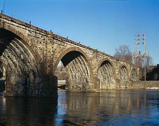
The Philadelphia and Reading Railroad, Schuylkill River Viaduct, also called the Reading Railroad Bridge and the Falls Rail Bridge, is a stone arch bridge that carries rail traffic over the Schuylkill River at Falls of Schuylkill in Philadelphia, Pennsylvania. Located in Fairmount Park, the bridge also spans Martin Luther King, Jr., Drive, and Kelly Drive. The name Philadelphia & Reading Railroad (P&R) was later shortened to Reading Company.
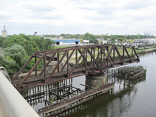
Philadelphia, Wilmington and Baltimore Railroad Bridge No. 1 was a swing steel through truss that spanned the Schuylkill River between Philadelphia, Pennsylvania's Kingsessing and Grays Ferry neighborhoods.
Ridge Pike is a major historic road in the U.S. state of Pennsylvania that opened in 1706 that originally connected Wissahickon Creek to Perkiomen Creek. Inside Philadelphia, it is called Ridge Avenue. Going westward, it traverses many eastern Pennsylvania neighborhoods in Montgomery County including Conshohocken and beyond, connecting with Germantown Pike near Collegeville and continuing to Pottstown. In Montgomery County, Ridge Pike is called Main Street in the Norristown area and again in Collegeville and Trappe, and is called High Street in the Pottstown area.

The City Avenue Bridges are twin bridges that span the Schuylkill River in Philadelphia, Pennsylvania. Although the bridges carry the eastbound and westbound lanes of City Avenue, the bridges are not signed with the U.S. Route 1 designation. The bridges directly connect the Schuylkill Expressway to Lincoln Drive, Kelly Drive, and Ridge Avenue via the Gustine Lake interchange.


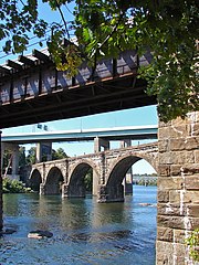 5 bridges, looking north on the Schuylkill
 Twin Bridges on the right,
