Related Research Articles

Dehradun, also known as Dehra Doon, is the winter capital and the most populous city of the Indian state of Uttarakhand. It is the administrative headquarters of the eponymous district and is governed by the Dehradun Municipal Corporation, with the Uttarakhand Legislative Assembly holding its winter sessions in the city as its winter capital. Part of the Garhwal region, and housing the headquarters of its Divisional Commissioner, Dehradun is one of the "Counter Magnets" of the National Capital Region (NCR) being developed as an alternative centre of growth to help ease the migration and population explosion in the Delhi metropolitan area and to establish a smart city in the Himalayas.

Champawat is a town and a Nagar Palika Parishad in Champawat district in the state of Uttarakhand, India. It is the administrative headquarters of Champawat district. The town was the former capital of the Kumaon Kingdom.

Unnao is an important city of Kanpur Metropolis in the Indian state of Uttar Pradesh. Unnao is located on the eastern bank of the Ganges River, and it is a satellite city of Kanpur. Administratively, Unnao city lies within the district of Unnao and is the headquarters of the Unnao Sadar subdivision. Unnao city also falls under Kanpur Metropolitan Development Authority.

Haldwani is the largest city of Kumaon. It is also the third most populous city in the Indian state of Uttarakhand. Haldwani is said to be the financial capital of Uttarakhand, having the most commercial, economic and industrial activities of the state. Haldwani is located in the Nainital District, and is one of its eight Subdivisions. The Haldwani Urban agglomeration has 656,000 people as of 2021, and is the third most populous UA in Uttarakhand, after Dehradun and Haridwar. Being situated in the immediate foothills of Kumaon Himalayas, the Kathgodam neighbourhood of Haldwani is known as the "Gateway to Kumaon".

Ranikhet is a hill station and cantonment town, near Almora Town in Almora district in the Indian state of Uttarakhand. It is the home of the Military Hospital, Kumaon Regiment (KRC) and Naga Regiment and is maintained by the Indian Army.
Gairsain is a town in Chamoli district of the Indian state of Uttarakhand near state's summer capital Bhararisain. A town and Nagar Panchayat, Gairsain is situated at the eastern edge of the vast Dudhatoli mountain range, and is located in Chamoli district almost at the centre of the state, at a distance of approximately 250 kilometres from Dehradun. It is easily accessible from both the Garhwal and the Kumaon divisions, and in a way, acts as the bridge between the two regions. It is being considered as the future Permanent capital of Uttarakhand.

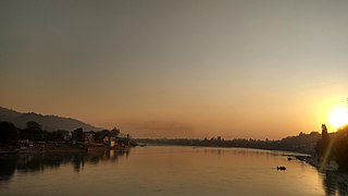
The Tons is the largest tributary of the Yamuna. It flows through Garhwal region in Uttarakhand, touching Himachal Pradesh. The Tons thrust is named after this river.
Chakrata is a cantonment town and also a sub district/tehsil, in Dehradun district in the state of Uttarakhand, India.
Dehradun district is a district in Garhwal which is a part of Uttarakhand state in northern India. The district headquarters is Dehradun, which has also served as the interim capital of Uttarakhand since its founding in 2000. The district has 6 tehsils, 6 community development blocks, 17 towns and 764 inhabited villages, and 18 unpopulated villages. As of 2011, it is the second most populous district of Uttarakhand, after Haridwar. Dehradun district also includes the prominent towns of Rishikesh, Mussoorie, Landour and Chakrata. The district stretches from the Ganges river in the east to the Yamuna river in the west, and from the Terai and Shivaliks in the south and southeast to the Great Himalaya in the northwest. During the days of British Raj, the official name of the district was Dehra Dun. In 1842, Dun was attached to Saharanpur district and placed under an officer subordinate to the Collector of the district but since 1871 it is being administered as separate district.

Pithoragarh is a Himalayan town with a Municipal corporation in Pithoragarh district in the Indian state of Uttarakhand. It is the largest hill town in Kumaon Division.

Bagli is a town and a nagar panchayat in the Malwa region of Dewas district in the state of Madhya Pradesh, India. Bagli is around 66 km (41 mi) from Dewas.
Buraswa is a village which is located 30 km from Chakrata and comes under the Tehsil of Chakrata, Dehradun, Uttarakhand, India.

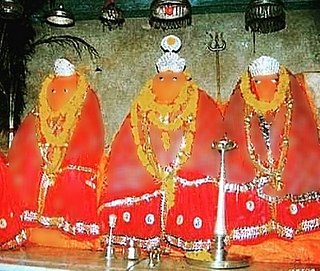
Bagnath Temple is an ancient shrine dedicated to Shiva, situated in the Bageshwar city at the confluence of Sarayu and Gomati rivers. Bagnath Temple is festooned with bells of all sizes and features impressive carvings. It is the most famous Temple in Bageshwar District. It is flooded with devotees on the occasion of Shivratri. The city of Bageshwar gets its name from this Temple.
Pakhanjur, also known as Pakhanjore, is a town, nagar panchayat, and the headquarters of the eponymous tehsil in the Kanker District of Chhattisgarh State in India. According to the 2011 Census of India, it is the second largest town in the district by population, only second to the district headquarters Kanker. It is located 120 km (75 mi) south-west of Kanker and 47 km (29 mi) west of the block headquarters Koyalibeda.
Maharana Pratap Sports College is a sports academy and a college in Raipur, Dehradun, Uttarakhand. It offers sports training in six sports, Athletics, Football, Volleyball, Boxing, Cricket and Field hockey in sixth to twelfth standard and with the curriculum of Uttarakhand Board. It was only sports college in the state until the establishment of Hari Singh Thapa Sports College at Pithoragarh.
Siddhpeeth Shri Shakumbhari Devi Temple is an important and ancient Hindu temple. It is situated in the Shivalik hills in Behat tehsil, 40 km from Saharanpur in Uttar Pradesh.
Riyuni Lekhmar is a remote village located in Garur Tehsil of Bageshwar District in Uttarakhand State of India. It is part of the Bageshwar Vidhan Sabha and Almora Lok Sabha constituency. It is situated at 1300m above mean sea level and is surrounded by Pine forests from three sides and one rivulet flowing from NE to SW direction towards southern side of village periphery. The village Panchayat is combination of three four sub villages to include Riyuni, Lekhmar, Paniyagaad and Bagotiya.
Ghat is a tehsil, or administrative division, located in the Chamoli district of the Indian state of Uttarakhand. The tehsil is located in the south central part of the district and is connected to Nandaprayag on the Badrinath Highway by a road.
Jilasu is a tehsil, or administrative division, located in the Chamoli district of the Indian state of Uttarakhand. It is situated between Nandaprayag and Karnaprayag on the river Alakananda.
References
- ↑ "Tehsil | District Dehradun | India".
- ↑ "Dehradun District Map". Maps of India.
- ↑ "60 लोगों से भरी बस नदी में गिरी". BBC News हिंदी. 4 September 2011.
- ↑ "Dehradun: अनियंत्रित होकर टौंस नदी में गिरी हिमाचल की कार, चालक का नहीं लगा कोई सुराग". Amar Ujala (in Hindi).
- ↑ "Tons | Uttarakhand Tourism". uttarakhandtourism.gov.in.
- ↑ "त्यूणी के हनोल मंदिर में जागड़ का आयोजन – डीएम ने व्यवस्थाओं को दुरुस्त करने के दिए निर्देश" . Retrieved 3 February 2024.
- ↑ Chakrata [ dead link ]