Related Research Articles

Seismology is the scientific study of earthquakes and the generation and propagation of elastic waves through the Earth or other planetary bodies. It also includes studies of earthquake environmental effects such as tsunamis as well as diverse seismic sources such as volcanic, tectonic, glacial, fluvial, oceanic microseism, atmospheric, and artificial processes such as explosions and human activities. A related field that uses geology to infer information regarding past earthquakes is paleoseismology. A recording of Earth motion as a function of time, created by a seismograph is called a seismogram. A seismologist is a scientist works in basic or applied seismology.
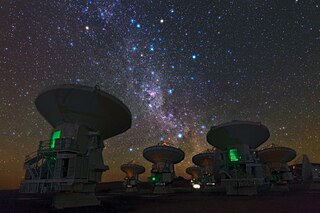
Very-long-baseline interferometry (VLBI) is a type of astronomical interferometry used in radio astronomy. In VLBI a signal from an astronomical radio source, such as a quasar, is collected at multiple radio telescopes on Earth or in space. The distance between the radio telescopes is then calculated using the time difference between the arrivals of the radio signal at different telescopes. This allows observations of an object that are made simultaneously by many radio telescopes to be combined, emulating a telescope with a size equal to the maximum separation between the telescopes.

A mantle plume is a proposed mechanism of convection within the Earth's mantle, hypothesized to explain anomalous volcanism. Because the plume head partially melts on reaching shallow depths, a plume is often invoked as the cause of volcanic hotspots, such as Hawaii or Iceland, and large igneous provinces such as the Deccan and Siberian Traps. Some such volcanic regions lie far from tectonic plate boundaries, while others represent unusually large-volume volcanism near plate boundaries.
Seismic tomography or seismotomography is a technique for imaging the subsurface of the Earth with seismic waves produced by earthquakes or explosions. P-, S-, and surface waves can be used for tomographic models of different resolutions based on seismic wavelength, wave source distance, and the seismograph array coverage. The data received at seismometers are used to solve an inverse problem, wherein the locations of reflection and refraction of the wave paths are determined. This solution can be used to create 3D images of velocity anomalies which may be interpreted as structural, thermal, or compositional variations. Geoscientists use these images to better understand core, mantle, and plate tectonic processes.
The Lamont–Doherty Earth Observatory (LDEO) is the Earth Science research center of Columbia University. It focuses on climate and earth sciences and is located on a 189-acre campus in Palisades, New York, 18 miles (29 km) north of Manhattan on the Hudson River.
IRIS was a university research consortium dedicated to exploring the Earth's interior through the collection and distribution of seismographic data. IRIS programs contributed to scholarly research, education, earthquake hazard mitigation, and the verification of a Comprehensive Nuclear-Test-Ban Treaty. Support for IRIS came from the National Science Foundation, other federal agencies, universities, and private foundations. IRIS supported five major components, the Data Management Center (DMC), the Portable Array Seismic Studies of the Continental Lithosphere (PASSCAL), the Global Seismographic Network (GSN), the Transportable Array (USARRAY), and the Education and Public Outreach Program (EPO). IRIS maintained a Corporate Office in Washington, D.C.

Magnetotellurics (MT) is an electromagnetic geophysical method for inferring the earth's subsurface electrical conductivity from measurements of natural geomagnetic and geoelectric field variation at the Earth's surface.
The EarthScope project was an National Science Foundation (NSF) funded earth science program that, from 2003-2018, used geological and geophysical techniques to explore the structure and evolution of the North American continent and to understand the processes controlling earthquakes and volcanoes. The project had three components: USArray, the Plate Boundary Observatory, and the San Andreas Fault Observatory at Depth. Organizations associated with the project included UNAVCO, the Incorporated Research Institutions for Seismology (IRIS), Stanford University, the United States Geological Survey (USGS) and National Aeronautics and Space Administration (NASA). Several international organizations also contributed to the initiative. EarthScope data are publicly accessible.

Geodynamics is a subfield of geophysics dealing with dynamics of the Earth. It applies physics, chemistry and mathematics to the understanding of how mantle convection leads to plate tectonics and geologic phenomena such as seafloor spreading, mountain building, volcanoes, earthquakes, faulting. It also attempts to probe the internal activity by measuring magnetic fields, gravity, and seismic waves, as well as the mineralogy of rocks and their isotopic composition. Methods of geodynamics are also applied to exploration of other planets.

The Ocean Observatories Initiative (OOI) is a National Science Foundation (NSF) Major Research Facility composed of a network of science-driven ocean observing platforms and sensors in the Atlantic and Pacific Oceans. This networked infrastructure measures physical, chemical, geological, and biological variables from the seafloor to the sea surface and overlying atmosphere, providing an integrated data collection system on coastal, regional and global scales. OOI's goal is to deliver data and data products for a 25-year-plus time period, enabling a better understanding of ocean environments and critical ocean issues.
The Array Network Facility component of the EarthScope USArray project was charged with ensuring all the real time seismic data collected from the Transportable Array and Flexible Arrays were transmitted, checked for quality, archived, and accessible online for researchers and the general public. The facility was part of the Scripps Institution of Oceanography at the University of California San Diego. The principal investigator of the ANF was Dr. Frank Vernon.

Paul Gordon Silver was an American seismologist. A member of the research staff at the Department of Terrestrial Magnetism of the Carnegie Institution of Washington since 1982, Paul Silver made a series of important contributions to the investigation of seismic anisotropy and to earthquake research by observing the slow redistribution of stress and strain along fault zones.
The Lviv Centre of Institute for Space Research, is a research institute in Lviv, Ukraine. It falls under the purview of the NASU and NSAU,.
UNAVCO was a non-profit university-governed consortium that facilitated geology research and education using geodesy.
Geomathematics is the application of mathematical methods to solve problems in geosciences, including geology and geophysics, and particularly geodynamics and seismology.

The lithosphere–asthenosphere boundary represents a mechanical difference between layers in Earth's inner structure. Earth's inner structure can be described both chemically and mechanically. The lithosphere–asthenosphere boundary lies between Earth's cooler, rigid lithosphere and the warmer, ductile asthenosphere. The actual depth of the boundary is still a topic of debate and study, although it is known to vary according to the environment.
Intraplate volcanism is volcanism that takes place away from the margins of tectonic plates. Most volcanic activity takes place on plate margins, and there is broad consensus among geologists that this activity is explained well by the theory of plate tectonics. However, the origins of volcanic activity within plates remains controversial.
Karen Fischer is an American seismologist known for her research on the structure of Earth's mantle, its lithosphere, and how subduction zones change over geologic history.
Anne Meltzer is a seismologist known for her research on earthquakes and the formation of mountain ranges. Her research primarily focused on the evolution of the Earth's lithosphere and the surface processes associated with faulting and deformation in the Earth's crust. Through her own personal research and collaboration with other colleagues, she strived to make advancements in the efficiency and effectiveness of monitoring earthquakes. In addition, her work aimed to effectively reduce earthquake destruction in countries that experience frequent seismic phenomena.
The Seismological Facility for the Advancement of Geoscience (SAGE) is a distributed, multi-user national facility that provides state of-the-art seismic research. It is operated by the EarthScope Consortium. Its previous operator was the Incorporated Research Institutions for Seismology (IRIS), until its merger with UNAVCO to become the EarthScope Consortium. SAGE is one of the two premier geophysical facilities in support of geoscience and geoscience education of the National Science Foundation (NSF). The other premiere geophysical facility is GAGE, the Geodetic Facility for the Advancement of Geoscience.
References
- 1 2 "USArray". Usarray.org. Retrieved 14 August 2018.
- ↑ Kerr, Richard (14 June 2013). "Geophysical Exploration Linking Deep Earth and Backyard Geology". Science. 340: 1283–1285. doi:10.1126/science.340.6138.1283. PMID 23766309.
- ↑ Meltzer, Anne; Rudnick, Roberta; Zeitler, Peter; Levander, Alan; Humphreys, Gene; Karlstrom, Karl; Ekström, Goran; Carlson, Rick; Dixon, Tim; Gurnis, Michael; Shearer, Peter; van der Hilst, Rob (November 1999). "USArray Initiative" (PDF). GSA Today. pp. 8–10.