
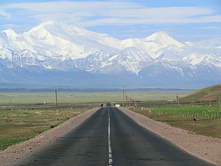
Batken is a town in southwestern Kyrgyzstan, on the southern fringe of the Fergana Valley. It is the administrative seat of Batken Region. Since 2000, it is a city of regional significance, i.e. not part of a district. However, it is still the administrative seat of Batken District. Its area is 205 square kilometres (79 sq mi), and its resident population was 27,730 in 2021. The population of the town proper was 15,805.

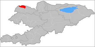
Naryn Region is the largest region (oblus) of Kyrgyzstan. It is located in the east of the country and borders with Chuy Region in the north, Issyk-Kul Region in the northeast, Xinjiang Uyghur Autonomous Region of China in the southeast, Osh Region in the southwest, and Jalal-Abad Region in the west. Its capital is Naryn. Its total area is 44,160 km2 (17,050 sq mi). The resident population of the region was 292,140 as of January 2021.

Osh Region is a region (oblast) of Kyrgyzstan. Its capital is Osh, which is not part of the region. It is bounded by (clockwise) Jalal-Abad Region, Naryn Region, China (Xinjiang), Tajikistan, Batken Region, and Uzbekistan. Its total area is 28,934 km2 (11,171 sq mi). The resident population of the region was 1,391,649 as of January 2021. The region has a sizeable Uzbek minority.
Toktogul, is a city in Jalal-Abad Region of Kyrgyzstan. Its population was 20,577 in 2021. It is the administrative seat of Toktogul District.
Kyzyl-Kyya is a city in Batken Region, in southwestern Kyrgyzstan. It is a city of regional significance, not part of a district, and consists of the town proper and the villages Karavan, Ak-Bulak and Jin-Jigen. Its area is 78 square kilometres (30 sq mi), and its resident population was 56,819 in 2021. It is situated on the southern edge of the Fergana Valley, 32 km southeast of Fergana, and 65 km southwest of Osh. The town is one of the oldest centers of the coal mining industry in Kyrgyzstan.
Suzak is a village in Jalal-Abad Region, Kyrgyzstan. Its population was 30,534 in 2021. It is the administrative seat of Suzak District.
Dostuk is a village in Naryn District of Naryn Region of Kyrgyzstan on the river Naryn (river) and highway A361 about 35 km west of Naryn. Its population was 750 in 2021. Until 2012 it was an urban-type settlement.
Sovet is a village in Kadamjay District of Batken Region of Kyrgyzstan. Its population was 1,502 in 2021. Until 2012 it was an urban-type settlement.
Nayman is a village in Nookat District, Osh Region, southwestern Kyrgyzstan. Its population was 1,811 in 2021. Until 2012 it was an urban-type settlement.
Kaynar is a village in Talas Region of Kyrgyzstan. It is part of the Kara-Buura District. Its population was 1,394 in 2009.
Kara-Köl is a city in Jalal-Abad Region of Kyrgyzstan. It is a city of regional significance, not part of a district. Its area is 1,050 square kilometres (410 sq mi), and its resident population was 26,901 in 2021. Kara-Köl consists of the town proper, the urban-type settlement Ketmen-Töbö and the village Jazy-Kechüü.

Ak-Suu is a district of Issyk-Kul Region in eastern Kyrgyzstan. The administrative center lies at the village Teploklyuchenka. Its area is 9,917 square kilometres (3,829 sq mi), and its resident population was 69,439 in 2021.

Chatkal is a district of Jalal-Abad Region in western Kyrgyzstan. The administrative seat lies at Kanysh-Kyya. Its area is 4,608 square kilometres (1,779 sq mi), and its resident population was 28,625 in 2021.

Toktogul is a district of Jalal-Abad Region in western Kyrgyzstan. The administrative seat lies at Toktogul. Its area is 7,815 square kilometres (3,017 sq mi), and its resident population was 103,310 in 2021.
Alay is a district of Osh Region in south-western Kyrgyzstan. The capital lies at Gülchö. The Alay District borders with China in the east, Tajikistan in the south, Chong-Alay District in the west, Nookat District in the north-west, Kara-Suu District and Özgön District in the north, and Kara-Kulja District in the north-east. Its area is 6,821 square kilometres (2,634 sq mi), and its resident population was 87,398 in 2021.
Manas is a district of Talas Region in north-western Kyrgyzstan. Its area is 1,198 square kilometres (463 sq mi), and its resident population was 37,505 in 2021. The administrative seat lies at Pokrovka.
Kulundu is a village in the Batken Region of Kyrgyzstan. It is part of the Leylek District. Its population was 8,250 in 2021.
Üch-Korgon, is a large village in Batken Region of Kyrgyzstan. It is part of the Kadamjay District. With the population of 14,708 (2021), it is the largest village in the region. Under Soviet rule the village was named Molotovabad.
Mikhaylovka is a village in Jalal-Abad Region of Kyrgyzstan. It is part of the Suzak District. Its population was 6,488 in 2021.
Kurgak-Köl is a village in Jalal-Abad Region of Kyrgyzstan. It is part of the Suzak District. Its population was 5,794 in 2021.
