
Eritrea is located in the Horn of Africa and is bordered on the northeast and east by the Red Sea, on the west and northwest by Sudan, on the south by Ethiopia, and on the southeast by Djibouti. The country has a high central plateau that varies from 1,800 to 3,000 meters (5,906–9,843 ft) above sea level. A coastal plain, western lowlands, and some 350 islands comprise the remainder of Eritrea's land mass.
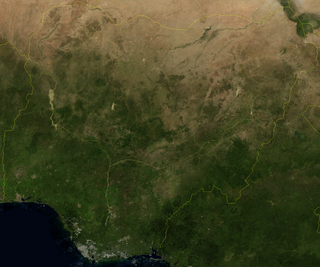
Nigeria is a country in West Africa. It shares land borders with the Republic of Benin to the west, Chad and Cameroon to the east, and Niger to the north. Its coast lies on the Gulf of Guinea in the south and it borders Lake Chad to the northeast. Notable geographical features in Nigeria include the Adamawa Plateau, Mambilla Plateau, Jos Plateau, Obudu Plateau, the Niger River, Benue River, and Niger Delta.

The Northern Mariana Islands, together with Guam to the south, compose the Mariana Islands. The southern islands are limestone, with level terraces and fringing coral reefs. The northern islands are volcanic, with active volcanoes on Anatahan, Pagan and Agrihan. The volcano on Agrihan has the highest elevation at 3,166 feet (965 m). About one-fifth of the land is arable; another tenth is pasture. The primary natural resource is fish, some of which are endangered species, which leads to conflict. Also, development has created landfills which have contaminated the groundwater on Saipan, which could lead to disease.

Tropical climate is the first of the five major climate groups in the Köppen climate classification identified with the letter A. Tropical climates are defined by a monthly average temperature of 18 °C (64.4 °F) or higher in the coolest month, featuring hot temperatures and high humidity all year-round. Annual precipitation is often abundant in tropical climates, and shows a seasonal rhythm but may have seasonal dryness to varying degrees. There are normally only two seasons in tropical climates, a wet (rainy/monsoon) season and a dry season. The annual temperature range in tropical climates is normally very small. Sunlight is intense in these climates.
Yola, meaning 'Great Plain' or 'Vast Plain Land', is a large city, capital city and administrative centre of Adamawa State, Nigeria. It is located on the Benue River, and it has a population of over 336,648 (2010). Yola is split into two parts. The old town of Yola where the Lamido resides is the traditional city and the new city of Jimeta is the administrative and commercial centre. They are generally referred to as Yola.

Benue River, previously known as the Chadda River or Tchadda, is the major tributary of the Niger River. The size of its catchment basin is 319,000 km2. Almost its entire length of approximately 1,400 kilometres (870 mi) is navigable during the summer months. As a result, it is an important transportation route in the regions through which it flows. The name Benue comes from Binuwe, meaning 'Mother of Waters’ in the Batta language.

Gombe State is a state in northeastern Nigeria, bordered to the north and northeast by the states of Borno for 93 km in the vicinity of Gongola River and Lake Dadin Kowa and Yobe in the vicinity of Gongola River for 140 km, to the south by Taraba State for 58 km, to the southeast by Adamawa State for 95 km, and to the west by Bauchi State for 277 km. Gombe is the state capital of Gombe state and it was formed from a part of Bauchi State on 1 October 1996. Of the 36 states in Nigeria, Gombe is the 21st largest in area and the 32nd most populous, with an estimated population of about 3.25 million as of 2016. The state bears a slogan "Jewel in the Savannah".
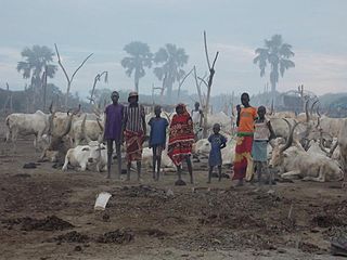
Rumbek is the capital of Lakes State in the Bahr el Ghazal region of South Sudan.

Enugu State is a state in the South-East geopolitical zone of Nigeria, bordered to the north by the states of Benue and Kogi, Ebonyi State to the east and southeast, Abia State to the south, and Anambra State to the west. The state takes its name from its capital and largest city, Enugu. The city acquired township status in 1917 and was called Enugwu-Ngwo. Due to the rapid expansion towards areas owned by other indigenous communities, it was renamed Enugu in 1928.

Nasarawa State is a state in the North Central region of Nigeria, bordered to the east by the states of Taraba and Plateau, to the north by Kaduna State, to the south by the states of Benue and Kogi, and to the west by the Federal Capital Territory. Named for the historic Nasarawa Emirate, the state was formed from the west of Plateau State on 1 October 1996. The state has thirteen local government areas and its capital is Lafia, located in the east of the state, while a key economic centre of the state is the Karu Urban Area—suburbs of Abuja—along the western border with the FCT.
Karachi has a semi-arid climate, formerly a hot desert climate, albeit a moderate version of this climate, influenced by monsoons. Karachi has a tropical climate, despite being located slightly above the Tropic of Cancer. It is situated in the monsoon region of Pakistan. It is located on the coast bordering the Arabian Sea, and as a result, has a relatively mild climate. However, in more recent years, rainfall has become more abundant. For this reason, the city may be classed as semi-arid (BSh), since it has a mild climate with a short but defined wet season, along with a lengthy dry season.

Wau is a city in northwestern South Sudan, on the western bank of the Jur River, that serves as capital for Western Bahr el Ghazal. It lies approximately 650 kilometres (400 mi) northwest of the capital Juba. A culturally, ethnically and linguistically diverse urban center and trading hub, Wau is also the former headquarters of Western Bahr el Ghazal.

Gboko is a Local Government Area in Benue state, North-central Nigeria. It is headquartered in the town of Gboko.

Climate classifications are systems that categorize the world's climates. A climate classification may correlate closely with a biome classification, as climate is a major influence on life in a region. One of the most used is the Köppen climate classification scheme first developed in 1884.
Mallapur is also known as Mallapuram before (2000's) is a neighbourhood in Hyderabad in the Indian state of Telangana. It falls under Uppal mandal of Medchal-Malkajgiri district. It is administered as Ward No. 5 of Greater Hyderabad Municipal Corporation.
Nkanu East is a Local Government Area of Enugu State, Nigeria. Its headquarter is located in the town of Amagunze.

Keffi Local Government Area and also is a traditional or commercial town in Nasarawa north central Nigeria Its headquarters are in the town of Keffi. Keffi is 50 kilometers from Abuja. Nasarawa State university is located in Keffi sitting along Keffi-Akwanga express way.

The Dadin Kowa Dam is located in Yamaltu Deba local government area of Gombe State in the North east part of Nigeria. Dadin Kowa is 41.6 kilometers from Gombe metropolis. The dam is located about 37 kilometers to the east of the town Gombe and 5 km from the Dadin Kowa village, and provides drinking water for the town. The dam was completed by the federal government in 1984, with the goal of providing irrigation and electricity for the planned Gongola sugar plantation project.
The Otin River is a river in Osun State, Nigeria. It is impounded by the Eko-Ende Dam.
The Winter of 1985–1986 in Great Britain and Ireland contained two periods of notably cold weather. November 1985 brought an early start to winter with the month being the coldest in the Central England region since 1925, with an average temperature of 4.1 °C (39.4 °F). However, December was milder than average and January close to average before February became the coldest month of any kind since January 1963 with an average temperature of −1.1 °C (30.0 °F). March and April were also below average, especially April which was the coldest since 1922 with an average temperature of just 5.8 °C (42.4 °F).
