Related Research Articles

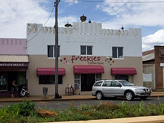
Coonabarabran is a town in Warrumbungle Shire that sits on the divide between the Central West and North West Slopes regions of New South Wales, Australia. At the 2021 census, the town had a population of 2,387, and as of 2021, the population of Coonabarabran and its surrounding area is 3,477. Local and district residents refer to the town as 'Coona'. Coonabarabran is the gateway to the Warrumbungle National Park, Siding Spring Observatory and the Pilliga Forest.

Oxley Highway is a rural highway in New South Wales, Australia, linking Nevertire, Gilgandra, Coonabarabran, Tamworth, and Walcha to Port Macquarie, on the coast of the Tasman Sea. It was named to commemorate John Oxley, the first European to explore much of inland New South Wales in 1818.

Binnaway is a small town located on the Castlereagh River in central western New South Wales near the larger centre of Coonabarabran, which is about 35 kilometres to the north. In 2021, the town had a population of 399 people. The road linking these two towns closely follows the meandering Castlereagh River. There are many pleasant areas to stop beside the road and on the river banks to have a picnic. Binnaway is also located near the similarly sized small town of Mendooran. Following local government amalgamation, the town is now located in the Warrumbungle Shire Council area which is headquartered at Coonabarabran.

The Warrumbungle Shire is a local government area in the central western region of New South Wales, Australia. The Shire is traversed by the Newell Highway. The Warrumbungle mountain range and Warrumbungles National Park are major tourist attractions for the Shire. Its seat is located in Coonabarabran, a town in the southwest.

The Gwabegar railway line is a railway line in the Central West and North West Slopes of New South Wales, Australia, which passes through the towns of Mudgee, Gulgong, Dunedoo, Coonabarabran and terminates at Gwabegar.

Baradine County is one of the 141 cadastral divisions of New South Wales. It is bounded in the north by the Namoi River, and includes the land south to Coonabarabran, which is on its southern edge. This includes land on both sides of the Baradine Creek and the town of Baradine.

Gowen County is one of the 141 cadastral divisions of New South Wales. It is located to the east of the Castlereagh River in the area to the east of Gilgandra, to Coonabarabran in the north-east. This includes land on both sides of the Newell Highway.
Baradine is a small town in north western New South Wales, Australia. At the 2021 census, Baradine had a population of 593.
Kenebri is a locality in northern New South Wales, Australia.
Napier is a locality in the Riverina district of New South Wales, Australia and also a civil parish of Buccleuch County, New South Wales.
Murrawal is a location on the now closed Gwabegar railway line in north-western New South Wales, Australia. A loop and loading bank station was located there between 1917 and 1972.
Piambra is rural locality of Warrumbungle Shire Council and a civil parish of Napier County.
The Coonabarabran Shire was a local government area in the Orana region of New South Wales, Australia. The Shire was proclaimed on 7 March 1906 with the enactment of the Local Government (Shires) Act 1905 and was centred on the town of Coonabarabran, but also covered a wide area extending to smaller towns, such as Baradine and Binnaway. On 25 August 2004, the Shire voluntarily amalgamated with the adjoining Coolah Shire to form the Warrumbungle Shire.

Napier is a rural locality of Warrumbungle Shire Council and a civil parish of Napier County New South Wales. and is at 31°35′54″S149°46′04″E.
Biamble is a civil parish of Napier County, New South Wales, that is located at 31°43′54″S 149°19′04″E. The civil parish is roughly equivalent to the rural locality of Neilrex in Warrumbungle Shire Council.
Moorangoorang is a rural locality and a civil parish of County of Napier in the central western part of New South Wales, Australia. The parish has three railway stations, Mooren, Borah and Pimbra.
Bungabah is a civil parish of Napier County in New South Wales.
Toorawandi is a civil parish of Napier County in New South Wales.
Binnaway Parish is a civil Parish of Napier County, New South Wales, located on the Castlereagh River in central western New South Wales.

Hightown is a suburban area of Wrexham, in Wrexham County Borough, Wales.
References
- ↑ Map of Napier County
- ↑ Ulamambri station NSWrail.net, accessed 9 April 2010.