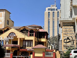
Arusha Urban District is one of the seven districts of the Arusha Region of Tanzania, and it contains the regional and economic capital; the city of Arusha. It is bordered to the south, west and north by Arusha Rural District and to east by Meru District. As of 1994, Arusha District was the wealthiest district in Tanzania with TSh.91,024/=.As of 2002, the population of the Arusha District was 282,712. According to the 2012 Tanzania National Census, the population of Arusha Urban District was 416,442.
Bangata is an administrative ward in the Arusha Rural District of the Arusha Region of Tanzania. According to the 2012 census, the ward has a total population of 9,136.
Bwawani is an administrative ward in the Arusha Rural District of the Arusha Region of Tanzania. According to the 2012 census, the ward has a total population of 11,117.
Kimnyaki is an administrative ward in the Arusha Rural District of the Arusha Region of Tanzania. The name "Kimnyaki" means we are lucky in Maasai. According to the 2012 census, the ward has a total population of 3,487.
Kiranyi is an administrative ward in the Arusha Rural District of the Arusha Region of Tanzania. According to the 2012 census, the ward has a total population of 25,469.
Mlangarini is an administrative ward in the Arumeru district of the Arusha Region of Tanzania. According to the 2012 census, the ward has a total population of 12,983.
Oljoro is an administrative ward in the Arusha Rural District of the Arusha Region of Tanzania. The ward is home to Mungu Crater which is 1,030 meters deep. According to the 2002 census, the ward has a total population of 7,896
Olkokola is an administrative ward in the Arusha Rural District of the Arusha Region of Tanzania. According to the 2012 census, the ward has a total population of 24,728.
Oltrumet is an administrative ward in the Arusha District of the Arusha Region of Tanzania. The name of the ward is from a Maasai word meaning a place of grazing. According to the 2012 census, the ward has a total population of 10,226.
Engutoto is an administrative ward in the Arusha District of the Arusha Region of Tanzania. Meaning the hidden place in Maasai. According to the 2012 census, the ward has a total population of 7,426.
Gelai Lumbwa is an administrative ward in the Longido District district of the Arusha Region of Tanzania. According to the 2012 census, the ward has a total population of 6,198.
Kansay is an administrative ward in the Karatu district of the Arusha Region of Tanzania. According to the 2012 census, the ward has a total population of 14,198.
Daraja Mbili is an administrative ward in the Arusha District of the Arusha Region of Tanzania. According to the 2012 census, the ward has a total population of 19,491.
Kaloleni is an administrative ward in the Arusha District of the Arusha Region of Tanzania. According to the 2012 census, the ward has a total population of 9,591.
Kimandolu is an administrative ward in the Arusha District of the Arusha Region of Tanzania. It is roughly 6 km from the centre of Arusha town and lies between the Old Moshi Road and the Arusha-Himo highway, which leads directly to Moshi and Kilimanjaro International Airport. There are various charitable NGOs currently working in the area with schools, healthcare and sports, such as Art In Tanzania. The local representative is Jackson Lemunga.
Lemara is an administrative ward in the Arusha District of the Arusha Region of Tanzania. According to the 2012 census, the ward has a total population of 19,564.
Oloirien is an administrative ward in the Arusha District of the Arusha Region of Tanzania. According to the 2012 census, the ward has a total population of 18,679. 47% of the population are males and 53% are female.
Sokon I is an administrative ward in the Arusha District of the Arusha Region of Tanzania. According to the 2012 census, the ward has a total population of 73,331.
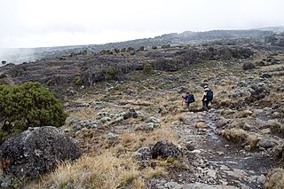
Siha is one of the seven administrative districts of Kilimanjaro Region in Tanzania. The district covers approximately 1,217 square kilometres (470 sq mi). It is bordered to the west by Meru District in Arusha Region and to the northeast by Rombo District and the southeast Hai District. The western part of Mount Kilimanjaro is located within the district's boundaries.
Endamaghang is an administrative ward in the Karatu District of the Arusha Region of Tanzania. According to the 2012 census, the ward has a total population of 24,996.
