Unterroth

Last updated
Unterroth
Unterroth Pfarrkirche.jpg
Church of Saints Gordianus and Epimachus
Wappen Unterroth.svg
Coat of arms
Location of Unterroth within Neu-Ulm district
Unterroth in NU.svg
Germany adm location map.svg
Red pog.svg
Unterroth
Bavaria location map.svg
Red pog.svg
Unterroth
Coordinates: 48°12′N10°10′E / 48.200°N 10.167°E / 48.200; 10.167 Coordinates: 48°12′N10°10′E / 48.200°N 10.167°E / 48.200; 10.167
Country Germany
State Bavaria
Admin. region Schwaben
District Neu-Ulm
Government
   Mayor (202026) Norbert Poppele [1]
Area
  Total15.37 km2 (5.93 sq mi)
Elevation
524 m (1,719 ft)
Population
 (2020-12-31) [2]
  Total1,142
  Density74/km2 (190/sq mi)
Time zone UTC+01:00 (CET)
  Summer (DST) UTC+02:00 (CEST)
Postal codes
89299
Dialling codes 07343
Vehicle registration NU
Website www.vg-buch.de

Unterroth is a municipality in the district of Neu-Ulm in Bavaria in Germany.

Related Research Articles

Vilshofen an der Donau Place in Bavaria, Germany

Vilshofen an der Donau is a town in the German district of Passau.

Aurach, Germany Place in Bavaria, Germany

Aurach is a municipality in the district of Ansbach in Bavaria in Germany.

Bruckberg, Middle Franconia Place in Bavaria, Germany

Bruckberg is a municipality in the district of Ansbach in Bavaria in Germany.

Diebach Place in Bavaria, Germany

Diebach is a municipality in the district of Ansbach in Bavaria in Germany.

Dombühl Place in Bavaria, Germany

Dombühl is a municipality in the district of Ansbach in Bavaria in Germany.

Wettringen, Bavaria Place in Bavaria, Germany

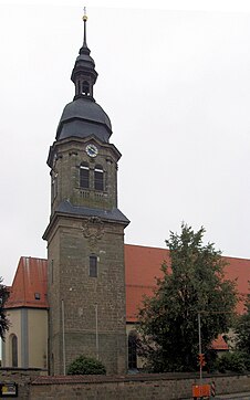
Wettringen is a municipality in the district of Ansbach in Bavaria in Germany.

Westendorf (Schmutter) Place in Bavaria, Germany

Westendorf is a municipality in the district of Augsburg in Bavaria in Germany. It lies on the river Schmutter.

Bischofswiesen Place in Bavaria, Germany

Bischofswiesen is a municipality in the district of Berchtesgadener Land in Bavaria in Germany.

Wald, Upper Palatinate Place in Bavaria, Germany

Wald is a municipality in the district of Cham in Bavaria in Germany.

Heroldsbach Place in Bavaria, Germany

Heroldsbach is a municipality in the district of Forchheim in Bavaria in Germany.

Kirchendemenreuth Place in Bavaria, Germany

Kirchendemenreuth is a municipality in the district of Neustadt an der Waldnaab in Bavaria, Germany. It includes the village (Dorf) of Steinreuth.

Leuchtenberg Place in Bavaria, Germany

Leuchtenberg is a municipality in the district of Neustadt an der Waldnaab in Bavaria, Germany, essentially a suburb of nearby Weiden in der Oberpfalz, and a larger historical region in the Holy Roman Empire governed by the Landgraves of Leuchtenberg.

Beratzhausen Place in Bavaria, Germany

Beratzhausen is a market town and municipality in the district of Regensburg in Bavaria in Germany.

Schierling Place in Bavaria, Germany

Schierling is a municipality in the district of Regensburg in Bavaria in Germany.

Altenmarkt an der Alz Place in Bavaria, Germany

Altenmarkt an der Alz is a municipality in the district of Traunstein in Bavaria, Germany.

Pfaffenhausen Place in Bavaria, Germany

Pfaffenhausen is a municipality in the district of Unterallgäu in Bavaria, Germany. The town is seat of a municipal association with Breitenbrunn, Swabia, Oberrieden, Bavaria and Salgen.

Ehingen, Swabia Place in Bavaria, Germany

Ehingen is a municipality in the district of Augsburg in Bavaria in Germany.

Rammingen, Bavaria Place in Bavaria, Germany

Rammingen is a municipality in the district of Unterallgäu in Bavaria, Germany. The town has a municipal association with Türkheim.

Oberpleichfeld Place in Bavaria, Germany

Oberpleichfeld is a municipality in the district of Würzburg in Bavaria, Germany.

Uettingen Place in Bavaria, Germany

Uettingen is a municipality in the district of Würzburg in Bavaria, Germany.

References

  1. Liste der ersten Bürgermeister/Oberbürgermeister in kreisangehörigen Gemeinden, Bayerisches Landesamt für Statistik, 15 July 2021.
  2. "Tabellenblatt "Daten 2", Statistischer Bericht A1200C 202041 Einwohnerzahlen der Gemeinden, Kreise und Regierungsbezirke". Bayerisches Landesamt für Statistik und Datenverarbeitung (in German). June 2021.