
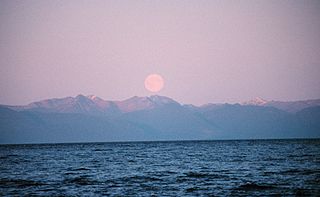
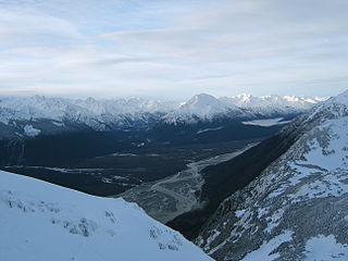
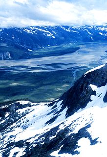
Southeast Alaska, colloquially referred to as the Alaska Panhandle or Alaskan Panhandle, is the southeastern portion of the U.S. state of Alaska, bordered to the east by the northern half of the Canadian province of British Columbia. The majority of Southeast Alaska's area is part of the Tongass National Forest, the United States' largest national forest. In many places, the international border runs along the crest of the Boundary Ranges of the Coast Mountains. The region is noted for its scenery and mild, rainy climate.
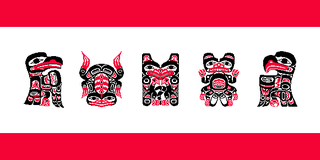
The Tlingit are indigenous peoples of the Pacific Northwest Coast of North America. Their language is the Tlingit language, in which the name means "People of the Tides". The Russian name Koloshi or the related German name Koulischen may be encountered referring to the people in older historical literature, such as Shelikhov's 1796 map of Russian America.

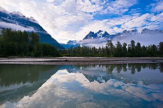
The City and Borough of Wrangell is a borough in Alaska, United States. As of the 2010 census the population was 2,369, up from 2,308 in 2000.

The Copper River or Ahtna River, Ahtna Athabascan ‘Atna’tuu, "river of the Ahtnas", Tlingit Eeḵhéeni, "river of copper", is a 290-mile (470 km) river in south-central Alaska in the United States. It drains a large region of the Wrangell Mountains and Chugach Mountains into the Gulf of Alaska. It is known for its extensive delta ecosystem, as well as for its prolific runs of wild salmon, which are among the most highly prized stocks in the world. The river is the tenth largest in the United States, as ranked by average discharge volume at its mouth.

The Stikine River is a river, historically also the Stickeen River, approximately 610 kilometres (380 mi) long, in northwestern British Columbia in Canada and in southeast Alaska in the United States.

Revillagigedo Island is an island in the Alexander Archipelago in Ketchikan Gateway Borough of the southeastern region of the U.S. state of Alaska. Running about 89 km (50 mi) north-south and 48 km (35 mi) east-west, it is 2,754.835 km² (1,063.65 mi²) in area, making it the 12th largest island in the United States and the 167th largest island in the world. Its center is located near 55°38′03″N131°17′51″W.
Chatham Strait, or Shee ya xhaak in the Tlingit language, is a narrow passage of the Alexander Archipelago in the southeastern region of the U.S. state of Alaska. It separates Chichagof Island and Baranof Island to its west from Admiralty Island and Kuiu Island on its east.

The Chilkoot River is a river in Southeast Alaska, United States, that extends about 20 miles (32 km) from its source and covers a watershed area of 100 square miles (260 km2). The source of the river is in the Takshanuk Mountains to the west and the Freebee glacier and unnamed mountains to the east. From its source, the upper reach of the river extends approximately 16 miles (26 km) to the point where it enters Chilkoot Lake. From the downstream end of the lake, the lower reach of the river flows for about 1.5 miles (2.4 km) until it enters the Chilkoot Inlet, a branch at the northern end of the Lynn Canal.
The Chilkat River is a river in British Columbia and southeastern Alaska that flows southward from the Coast Range to the Chilkat Inlet and ultimately Lynn Canal. It is about 80 kilometres (50 mi) long. It begins at Chilkat Glacier, in Alaska, flows west and south in British Columbia for 27 kilometres (17 mi), enters Alaska and continues southwest for another 60 kilometres (37 mi). It reaches the ocean at the abandoned area of Wells, Alaska and deposits into a long delta area.

The Chinook salmon is the largest species of Pacific salmon as well as the largest in the genus Oncorhynchus. Its common name is derived from the Chinookan peoples. Other vernacular names for the species include king salmon, Quinnat salmon, Tsumen , spring salmon, chrome hog, Blackmouth, and Tyee salmon. The scientific species name is based on the Russian common name chavycha (чавыча).

The Salmon River is a braided stream that flows through Hyder, Alaska, and empties into the Portland Canal. It is fed by meltwater from the Salmon Glacier, which is located within British Columbia approximately 13 miles north of its confluence into the Canal and is road-accessible from the town of Stewart, British Columbia. The river crosses the Canada–United States border at 56°02′00″N130°02′00″W.
The Taku River is a river running from British Columbia, Canada, to the northwestern coast of North America, at Juneau, Alaska. The river basin spreads across 27,500 square kilometres (10,600 sq mi). The Taku is a very productive salmon river and its drainage basin is primarily wilderness.
The Tsetsaut were an Athabaskan-speaking group whose territory was around the head of the Portland Canal, straddling what is now the boundary between the US state of Alaska and the Canadian province of British Columbia. The name T'set'sa'ut, meaning "those of the Interior", was used by the Nisga'a and Gitxsan in reference to their origin as migrants into the region from somewhere farther inland; their use of the term is not to the Tsetsaut alone but also can refer to the Tahltan and the Sekani.

New Eddystone Rock an Alaskan island located in Behm Canal, about 40 miles (64 km) east of Ketchikan. It is a pillar of basalt.

The Tatshenshini River is a river in the Canadian boreal forest, in the southwestern Yukon and the northwestern corner of British Columbia. It originates in British Columbia, near Haines Highway. It flows north into Yukon, then it turns west and south before it returns into British Columbia, where it flows through the Tatshenshini-Alsek Provincial Wilderness Park. There it joins the Alsek River, which then flows into the Pacific Ocean in Alaska, United States. It is popular for wilderness rafting trips.
Behm Canal is a natural channel in the Alexander Archipelago, in the southeastern part of the U.S. state of Alaska.
The Craig River is a river located in Alaska, United States and British Columbia, Canada, also formerly known as the South Fork of the Iskut River, as it is the main south tributary of the lower Iskut. The Craig has a tributary in Alaska, the South Fork Craig River. The river's origin in Alaska is located near 56°27′00″N131°25′00″W and crosses into British Columbia at 56°29′30″N131°17′30″W.
Rivers Without Borders is a nonprofit organization fiscally sponsored by the Tides Center in the United States. Rivers Without Borders works as a project of Tides Canada Initiatives in Canada. Tides Canada's mission is to provide uncommon solutions for the common good by leading and supporting actions that foster a healthy environment and just Canadian society.
The Stikine Gold Rush was a minor but important gold rush in the Stikine Country of northwestern British Columbia, Canada. The rush's discoverer was Alexander "Buck" Choquette, who staked a claim at Choquette Bar in 1861, just downstream from the confluence of the Stikine and Anuk Rivers, at approximately 56°48′N131°46′W. Choquette was the son-in-law of the Tlingit chief Chief Shakes, who presided over the region at the mouth of the river, the site of the former Fort Stikine and today's city of Wrangell, Alaska, and had also explored the Nass and several other rivers.
The name Unuk is derived from the Tlingit name for the area, Joonáxh (Place of Dreams).
