Upper Mississippi water resource region

Last updated

The Upper Mississippi water resource region is one of 21 major geographic areas, or regions, in the first level of classification used by the United States Geological Survey to divide and sub-divide the United States into successively smaller hydrologic units. These geographic areas contain either the drainage area of a major river, or the combined drainage areas of a series of rivers. [1] [2]

Contents

The Upper Mississippi region, which is listed with a 2-digit hydrologic unit code (HUC) of 07, has an approximate size of 189,968 square miles (492,010 square kilometers ), and consists of 14 subregions, which are listed with the 4-digit HUCs 0701 through 0711. In a 1975 report, the region was described as "rich in water - surface water is plentiful, and ground water is a large, important, and manageable resource." [3]

This region includes the drainage of the Mississippi River Basin above the confluence with the Ohio River, excluding the Missouri River Basin. Includes parts of Illinois, Indiana, Iowa, Michigan, Minnesota, Missouri, South Dakota, and Wisconsin. [4]

The Upper Mississippi region, with its 14 4-digit subregion hydrologic unit boundaries. HUC07.jpg
The Upper Mississippi region, with its 14 4-digit subregion hydrologic unit boundaries.

List of water resource subregions

Subregion HUC [5] Subregion Name [5] Subregion Description [4] Subregion Location [5] Subregion Size (mi2) [5] Subregion Map
0701 Mississippi Headwaters Subregion The Mississippi River Basin above the confluence with the St. Croix River Basin, excluding the Minnesota River Basin.Located in Minnesota.20,200 sq mi (52,000 km2)
HUC0701 HUC0701.jpg
HUC0701
0702 Minnesota Subregion The Minnesota River Basin.Located in Iowa, Minnesota, and South Dakota.16,800 sq mi (44,000 km2)
HUC0702 HUC0702.jpg
HUC0702
0703 St. Croix Subregion The St. Croix River Basin.Located in Minnesota and Wisconsin.7,750 sq mi (20,100 km2)
HUC0703 HUC0703.jpg
HUC0703
0704 Upper Mississippi–Black–Root Subregion 
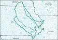
The Mississippi River Basin below the confluence with the St. Croix River Basin to and including the Root River Basin west of the Mississippi River and the La Crosse River Basin east of the Mississippi River, excluding the Chippewa River Basin.Located in Iowa, Minnesota, and Wisconsin.10,700 sq mi (28,000 km2)
HUC0704 HUC0704.jpg
HUC0704
0705 Chippewa Subregion The Chippewa River Basin.Located in Michigan and Wisconsin.9,570 sq mi (24,800 km2)
HUC0705 HUC0705.jpg
HUC0705
0706 Upper Mississippi–Maquoketa–Plum Subregion 
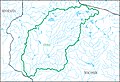
The Mississippi River Basin below the Root River Basin west of the Mississippi River and the La Crosse River Basin east of the Mississippi River to Lock and Dam 13, excluding the Wisconsin River Basin.
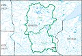
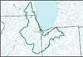
Located in Illinois, Iowa, Minnesota, and Wisconsin.8,610 sq mi (22,300 km2)
HUC0706 HUC0706.jpg
HUC0706
0707 Wisconsin Subregion The Wisconsin River Basin.Located in Michigan and Wisconsin.11,900 sq mi (31,000 km2)
HUC0707 HUC0707.jpg
HUC0707
0708 Upper Mississippi–Iowa–Skunk–Wapsipinicon Subregion Mississippi River Basin below Lock and Dam 13 to the confluence with the Des Moines River Basin, excluding the Rock River Basin.Located in Illinois, Iowa, and Michigan.22,800 sq mi (59,000 km2)
HUC0708 HUC0708.jpg
HUC0708
0709 Rock Subregion The Rock River Basin.Located in Illinois and Wisconsin.10,900 sq mi (28,000 km2)
HUC0709 HUC0709.jpg
HUC0709
0710 Des Moines Subregion The Des Moines River Basin.Located in Iowa, Minnesota, and Missouri.14,400 sq mi (37,000 km2)
HUC0710 HUC0710.jpg
HUC0710
0711 Upper Mississippi–Salt Subregion 
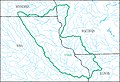
The Mississippi River Basin below the confluence with the Des Moines River Basin to the confluence with the Missouri River Basin, excluding the Illinois River Basin.Located in Illinois, Iowa, and Missouri.9,970 sq mi (25,800 km2)
HUC0711 HUC0711.jpg
HUC0711
0712 Upper Illinois Subregion The Illinois River Basin above the confluence of and including the Fox River Basin.Located in Illinois, Indiana, Michigan, and Wisconsin.10,900 sq mi (28,000 km2)
HUC0712 HUC0712.jpg
HUC0712
0713 Lower Illinois Subregion The Illinois River Basin below the confluence of the Fox River Basin.Located in Illinois.17,700 sq mi (46,000 km2)
HUC0713 HUC0713.jpg
HUC0713
0714 Upper Mississippi–Kaskaskia–Meramec Subregion The Mississippi River Basin below the confluence with and excluding the Missouri River Basin to the confluence with the Ohio River.Located in Illinois and Missouri.11,200 sq mi (29,000 km2)
HUC0714 HUC0714.jpg
HUC0714

See also

Related Research Articles

<span class="mw-page-title-main">South Atlantic–Gulf water resource region</span> Drainage region

The South Atlantic–Gulf water resource region is one of 21 major geographic areas, or regions, in the first level of classification used by the United States Geological Survey to divide and sub-divide the United States into successively smaller hydrologic units. These geographic areas contain either the drainage area of a major river, or the combined drainage areas of a series of rivers.

<span class="mw-page-title-main">Lower Mississippi water resource region</span>

The Lower Mississippi water resource region is one of 21 major geographic areas, or regions, in the first level of classification used by the United States Geological Survey to divide and sub-divide the United States into successively smaller hydrologic units. These geographic areas contain either the drainage area of a major river, or the combined drainage areas of a series of rivers.

<span class="mw-page-title-main">Missouri water resource region</span>

The Missouri water resource region is one of 21 major geographic areas, or regions, in the first level of classification used by the United States Geological Survey to divide and sub-divide the United States into successively smaller hydrologic units. These geographic areas contain either the drainage area of a major river, or the combined drainage areas of a series of rivers.

<span class="mw-page-title-main">Ohio water resource region</span>

The Ohio water resource region is one of 21 major geographic areas, or regions, in the first level of classification used by the United States Geological Survey to divide and sub-divide the United States into successively smaller hydrologic units. These geographic areas contain either the drainage area of a major river, or the combined drainage areas of a series of rivers.

<span class="mw-page-title-main">Tennessee water resource region</span>

The Tennessee water resource region is one of 21 major geographic areas, or regions, in the first level of classification used by the United States Geological Survey to divide and sub-divide the United States into successively smaller hydrologic units. These geographic areas contain either the drainage area of a major river, or the combined drainage areas of a series of rivers.

<span class="mw-page-title-main">Rio Grande water resource region</span>

The Rio Grande water resource region is one of 21 major geographic areas, or regions, in the first level of classification used by the United States Geological Survey to divide and sub-divide the United States into successively smaller hydrologic units. These geographic areas contain either the drainage area of a major river, or the combined drainage areas of a series of rivers.

<span class="mw-page-title-main">Upper Colorado water resource region</span> Major geographic area

The Upper Colorado water resource region is one of 21 major geographic areas, or regions, in the first level of classification used by the United States Geological Survey to divide and sub-divide the United States into successively smaller hydrologic units. These geographic areas contain either the drainage area of a major river, or the combined drainage areas of a series of rivers.

<span class="mw-page-title-main">Lower Colorado water resource region</span> Major geographic area

The Lower Colorado water resource region is one of 21 major geographic areas, or regions, in the first level of classification used by the United States Geological Survey to divide and sub-divide the United States into successively smaller hydrologic units. These geographic areas contain either the drainage area of a major river, or the combined drainage areas of a series of rivers.

<span class="mw-page-title-main">Great Basin water resource region</span>

The Great Basin water resource region is one of 21 major geographic areas, or regions, in the first level of classification used by the United States Geological Survey to divide and sub-divide the United States into successively smaller hydrologic units. These geographic areas contain either the drainage area of a major river, or the combined drainage areas of a series of rivers.

<span class="mw-page-title-main">Pacific Northwest water resource region</span>

The Pacific Northwest water resource region is one of 21 major geographic areas, or regions, in the first level of classification used by the United States Geological Survey to divide and sub-divide the United States into successively smaller hydrologic units. These geographic areas contain either the drainage area of a major river, or the combined drainage areas of a series of rivers.

<span class="mw-page-title-main">California water resource region</span> Surface water, first-level USGS hydrologic system subdivision

The California water resource region is one of 21 major geographic areas, or regions, in the first level of classification used by the United States Geological Survey in the United States hydrologic unit system, which is used to divide and sub-divide the United States into successively smaller hydrologic units. These geographic areas contain either the drainage area of a major river, or the combined drainage areas of a series of rivers.

<span class="mw-page-title-main">Alaska water resource region</span>

The Alaska water resource region is one of 21 major geographic areas, or regions, in the first level of classification used by the United States Geological Survey to divide and sub-divide the United States into successively smaller hydrologic units. These geographic areas contain either the drainage area of a major river, or the combined drainage areas of a series of rivers.

<span class="mw-page-title-main">Hawaii water resource region</span>

The Hawaii water resource region is one of 21 major geographic areas, or regions, in the first level of classification used by the United States Geological Survey to divide and sub-divide the United States into successively smaller hydrologic units. These geographic areas contain either the drainage area of a major river, or the combined drainage areas of a series of rivers.

<span class="mw-page-title-main">Caribbean water resource region</span>

The Caribbean water resource region is one of 21 major geographic areas, or regions, in the first level of classification used by the United States Geological Survey to divide and sub-divide the United States into successively smaller hydrologic units. These geographic areas contain either the drainage area of a major river, or the combined drainage areas of a series of rivers.

<span class="mw-page-title-main">Souris–Red–Rainy water resource region</span>

The Souris–Red–Rainy region is one of 21 major geographic areas, or regions, in the first level of classification used by the United States Geological Survey to divide and sub-divide the United States into successively smaller hydrologic units. These geographic areas contain either the drainage area of a major river, or the combined drainage areas of a series of rivers.

<span class="mw-page-title-main">Texas–Gulf water resource region</span>

The Texas–Gulf water resource region is one of 21 major geographic areas, or regions, in the first level of classification used by the United States Geological Survey to divide and sub-divide the United States into successively smaller hydrologic units. These geographic areas contain either the drainage area of a major river, or the combined drainage areas of a series of rivers.

<span class="mw-page-title-main">Arkansas–White–Red water resource region</span>

The Arkansas–White–Red water resource region is one of 21 major geographic areas, or regions, in the first level of classification used by the United States Geological Survey to divide and sub-divide the United States into successively smaller hydrologic units. These geographic areas contain either the drainage area of a major river, or the combined drainage areas of a series of rivers.

<span class="mw-page-title-main">Hydrologic unit system (United States)</span> Watershed tracking system

In order to advantage hydrologists, ecologists, and water-resource managers in the study of "water, its properties and laws, and its distribution over the earth's surface" in the United States, the United States Geological Survey created a hierarchical system of hydrologic units.

<span class="mw-page-title-main">Northern Mojave–Mono Lake water resource subregion</span> Second-level USGS hydrologic unit system subdivision

Northern Mojave–Mono Lake water resource subregion is one of 10 water resource subregions within the California water resource region and is one of 222 water resource subregions in the federally organized United States hydrologic unit system.

<span class="mw-page-title-main">Laguna–San Diego Coastal water resource basin</span> Third-level USGS hydrologic unit system subdivision

Laguna–San Diego Coastal water resource basin is one of three hydrologic basins within the Southern California Coastal water resource subregion and is one of approximately 2,200 water resource basins in the United States hydrologic unit system.

References

  1. "Science in Your Watershed - Locate Your Watershed". USGS . Retrieved 2016-10-12.PD-icon.svg This article incorporates text from this source, which is in the public domain .
  2. "Hydrologic Unit Maps". USGS . Retrieved 2016-10-12.PD-icon.svg This article incorporates text from this source, which is in the public domain .
  3. Bloyd, R. M. (1975). Summary appraisals of the nation's ground-water resources – Upper Mississippi region (PDF) (Report). Washington, D.C.: U.S. Geological Survey. doi:10.3133/pp813b . Retrieved 2023-09-13.
  4. 1 2 "Boundary Descriptions and Names of Regions, Subregions, Accounting Units and Cataloging Units". USGS . Retrieved 2016-10-12.PD-icon.svg This article incorporates text from this source, which is in the public domain .
  5. 1 2 3 4 McManamay RA, Bevelhimer MS, Kao SC, Yaxing W, Martinez-Gonzalez M, Samu N (2013). "National Hydropower Asset Assessment Environmental Attribution". USGS-Oak Ridge National Laboratory . Retrieved 2016-10-12.PD-icon.svg This article incorporates text from this source, which is in the public domain .