Azángaro Province is a province of the Puno Region in Peru.
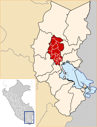
San Anton District is one of fifteen districts of the Azángaro Province in Peru.

Millo is a mountain in the Vilcanota mountain range in the Andes of Peru, about 5,500 metres (18,045 ft) high. It is situated in the Cusco Region, Canchis Province, Checacupe District, and in the Puno Region, Carabaya Province, Corani District. Millo lies northwest of the large glaciated area of Quelccaya and west of Unollocsina.
Yuraq Apachita is a mountain in the Andes of Peru, about 4,423.9 metres (14,514 ft) high. It is situated in the Puno Region, Lampa Province, Pucará District, southwest of Pucará.
Yurac Apacheta is a mountain in the Andes of Peru, about 4,200 metres (13,780 ft) high. It is situated in the Arequipa Region, Arequipa Province, Yura District, and in the Caylloma Province, Huanca District.
Rit'i Apachita is a 5,029-metre-high (16,499 ft) mountain in the Apolobamba mountain range in Bolivia. It is situated in the La Paz Department, Franz Tamayo Province, Pelechuco Municipality, north-west of Pelechuco. Rit'i Apachita lies northeast of the mountain Sural (Soral) and southeast of the mountain Apachita Pura Pura.
Punta Yavre or Punta Yayre is a mountain in the northeast of the Apolobamba mountain range on the border of Bolivia and Peru. It is about 4,600 metres (15,092 ft) high. On the Bolivian side it is located in the La Paz Department, Franz Tamayo Province, Pelechuco Municipality, and on the Peruvian side it lies in the Puno Region, Putina Province, Sina District. Punta Yavre is situated northwest and northeast of the mountains Chawpi Urqu and Kulli Pata.
Huancane Apacheta is a mountain in the Vilcanota mountain range in the Andes of Peru, about 5,200 metres (17,060 ft) high. It is located in the Cusco Region, Canchis Province, Checacupe District, and in the Puno Region, Carabaya Province, Corani District. Huancane Apacheta lies between the mountain Otoroncane in the northeast and Tutallipina and Sayrecucho in the southwest.
Wira Apachita is a mountain in the Andes of Peru, about 5,100 metres (16,732 ft) high. It is located in the Puno Region, Lampa Province, Palca District. Wira Apachita is situated northeast of the lake Sayt'uqucha and the mountain Yanawara.
Wiluyu is a mountain in the Andes of southern Peru, about 4,600 metres (15,092 ft) high. It is located in the Puno Region, Puno Province, Tiquillaca District. It lies between two rivers named Wanuni (Huanuni) and Uqi Jaqhi (Oqueaque), southwest of the mountain K'ara K'arani and southeast of Pura Purani.
Hatun Qurini is a mountain in the Peruvian Andes, about 5,000 metres (16,404 ft) high. It is situated in the Puno Region, Azángaro Province, San José District. Hatun Qurini lies northwest of the mountain Surupana.
Yuraq Apachita is a mountain in the Peruvian Andes, about 4,800 metres (15,748 ft) high. It is located in the Puno Region, Azángaro Province, San Antón District. Yuraq Apachita lies southwest of the mountain Ichhu Muruq'u and northeast of Hatun Anta. It is situated at the river Tawqani (Taucane).
Ch'iyar Jaqhi is a mountain in the Peruvian Andes, about 4,600 metres (15,092 ft) high. It is located in the Puno Region, Azángaro Province, on the border of the districts Potoni and San Antón. Ch'iyar Jaqhi lies northwest of the mountain Uqi Apachita and east of Ichhu Muruq'u.
Taruja Pincha or Taruka Pincha is a mountain in the Peruvian Andes, about 4,800 metres (15,748 ft) high. It is located in the Puno Region, Azángaro Province, on the border of the districts Muñani and Potoni.
Ojecunca is a mountain in the Vilcanota mountain range in the Andes of Peru, about 5,000 metres (16,404 ft) high. It is located in the Cusco Region, Canchis Province, in the districts of Checacupe and San Pablo. Ojecunca lies southwest of Jampatune and Pomanota. The Pumanuta River, an important tributary of the Vilcanota River, flows along its southern slope.
Yuraq Apachita is a mountain in the Wansu mountain range in the Andes of Peru, about 5,000 metres (16,404 ft) high. It is situated in the Arequipa Region, La Unión Province, Huaynacotas District. Yuraq Apachita lies southeast of Puka Willka.
Machu Apachita is a mountain in the Andes of Peru, about 4,800 m (15,700 ft) high. It is located in the Cusco Region, Quispicanchi Province, on the border of the districts of Camanti and Marcapata. It is situated southeast of Wisk'achani.
Chaka Apachita is a 5,136-metre-high (16,850 ft) mountain in the Andes of Peru. It is situated in the Moquegua Region, Mariscal Nieto Province, Carumas District. It lies northwest of Qiwña Milluku and southeast of Qina Qinani.
Incapachata is a mountain in the north of the Barroso mountain range in the Andes of southern Peru, about 5,000 m (16,000 ft) high. It is situated in the Tacna Region, Tarata Province, Tarata District. It lies northeast of Vilaucarane and south of Antajave.
Uqi Uqi is a mountain in the Cordillera Central in the Andes of Peru which reaches a height of approximately 5,000 metres (16,404 ft). It is located in the Lima Region, Yauyos Province, Laraos District. Uqi Uqi lies northeast of Wamp'una and T'uruyuq.
