Navarre, officially the Chartered Community of Navarre, is a landlocked foral autonomous community and province in northern Spain, bordering the Basque Autonomous Community, La Rioja, and Aragon in Spain and Nouvelle-Aquitaine in France. The capital city is Pamplona. The present-day province makes up the majority of the territory of the medieval Kingdom of Navarre, a long-standing Pyrenean kingdom that occupied lands on both sides of the western Pyrenees, with its northernmost part, Lower Navarre, located in the southwest corner of France.

Berguedà is an inland comarca (county) in Catalonia, Spain, lying partly in the Pyrenees and Pre-Pyrenees, and partly in the Catalan Central Depression.
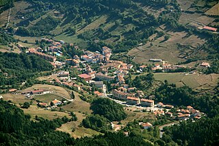
Zegama, popularly known as "The shadow of Aizkorri", is a town and municipality in the Goierri region of the province of Gipuzkoa, in the autonomous community of the Basque Country, northern Spain.
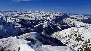
The Cantabrian Mountains or Cantabrian Range are one of the main systems of mountain ranges in Spain. They stretch for over 300 km (180 miles) across northern Spain, from the western limit of the Pyrenees to the Galician Massif in Galicia, along the coast of the Cantabrian Sea. Their easternmost end meets the Sistema Ibérico.

Abadiño is a town located in the province of Biscay, in the autonomous community of Basque Country, in the north of Spain, about 35 km from the provincial capital of Bilbao. The area of the municipality is about 36 km2 (13.9 sq mi) and according to the 2014 census, the population is 7504. The original name of the town was Abadiano Celayeta.

Ergoiena is a municipality located in the province and autonomous community of Navarre, northern Spain. The Basque municipality numbers three villages, Lizarraga, Unanu and Dorrao. It bounds with the range Urbasa on the west and south, and with Andia on the east.

Mirafuentes is a town and municipality located in the province and autonomous community of Navarre, northern Spain.
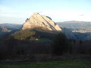
Urkiola is a mountain range of the Basque mountains in Biscay near Durango, in the western Basque Country, Spain. The highest mountain in the range is Anboto. The range runs from west to east and forms the water divide between the Atlantic and the Mediterranean basins.

The Basque Mountains are a mountain range situated in the northern Iberian Peninsula. Geographically the range is considered as the eastern section of the larger Cantabrian Range. The range runs through the Basque Autonomous Community and western Navarre.

Aizkorri or Aitzgorri is a massif, the highest one of the Basque Autonomous Community (Spain) with 1,551 m AMSL at its highest point. The massif is formed by a crest of limestone summits aligned north-west to south-east all in a row at the south of the province of Gipuzkoa, namely Artzanburu, Andreaitz, Arbelaitz (1,513 m), Iraule (1,511 m), Aitxuri, Aketegi (1,549 m) and Aizkorri (1,528 m). Despite its slightly lower height, this summit is the most popular one. The Aizkorri massif is one of the most conspicuous geological formations on the Basque Mountains range.

Beriain is a 1,493 metres high peak part of the Basque Mountains range, located in the Andia range of western Navarre, Spain. Its sharp profile is an iconic image in the Burunda and Barranca valleys that link Vitoria-Gasteiz and Pamplona. The peak is located at the center of the traditional Basque Country provinces.
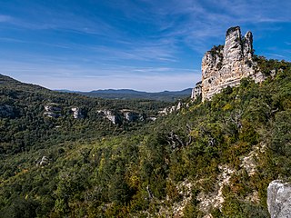
The Aralar Range is a mountain range in the Basque Mountains of Southern Basque Country. The part of the range lying in Gipuzkoa was established as a conservation area called Aralar Natural Park in 1994. In addition to its natural features, scenic beauty, recreational use and habitation, the range is home to a rich corpus of Basque mythology milestones and legends.

The Andia Range is a mountain range of western Navarre, Spain, part of the Basque Mountains. Its highest point is the 1,493-metre-high Beriain.

The Codés Range is a mountain range of western Navarre, Spain, part of the Basque Mountains. Its highest point is the 1,418-metre-high Ioar, located between Santa Cruz de Campezo and Aguilar de Codés. The Codés Range is the westernmost mountain range in Navarre, located right at the limit of Álava Province.

The physical geography of the Basque Country is very diverse despite the small size of the region. The territory hosts a blend of green and brown to yellowish tones, featuring hilly terrain altogether. The Basque Country spreads from the rough coastal landscape to the semi-desert of the Bardenas on the south-eastern fringes of Navarre.
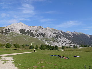
The Aizkorri-Aratz Natural Park is the second-largest natural park in the Basque Country. Straddling the Cantabrian-Mediterranean watershed, it is named Aizkorri and Aratz, the two most notable mountains in the park. Declared a natural park in 2006, the area contains limestone mountains and as well as dense beech forests.
The Villarreal Offensive was an offensive of the Spanish Civil War which lasted from 30 November to 24 December 1936. Eusko Gudarostea's 4,300 men fought 600 men of the insurgent forces.
The Izki Natural Park is in Álava, Basque Country, Spain. The park encompasses the valley of the Izki river, which is mostly covered by Quercus pyrenaica forests. Korres is the only settlement within the park.
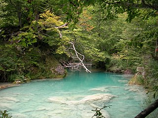
Urederra is the natural exit of the aquifer created in the rock massif karst of Urbasa, Navarre. The river rises in The Natural Park of Urbasa-Andía, near the village Baquedano. It is 19 km long and flows into the Ega River, which is a tributary of the Ebro. The first emerge is produced in a 713 metres high clift in the southern ledge of the rock massif and makes a more than 100 metres waterfall which with the passing of the years has modelled a rocky and karstic landscape.
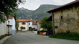
Ilarduia is a village located in the municipality of Asparrena, between the mountain of Albeniz and the mountain range of Urbasa, in the bank of the river Zirauntza. This is a flat area also considered to be placed in a natural passage formed by the mountains of Altzaina (North) and the mountain range of Entzia (South) in the vicinity of Burunda's lands in Navarre.

