
The Pyrenees are a mountain range straddling the border of France and Spain. They extend nearly 500 km (310 mi) from their union with the Cantabrian Mountains to Cap de Creus on the Mediterranean coast, reaching a maximum altitude of 3,404 metres (11,168 ft) at the peak of Aneto.
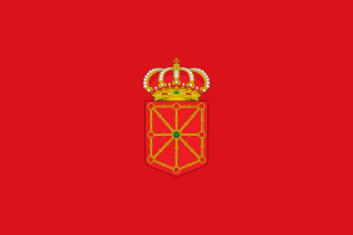
Navarre, officially the Chartered Community of Navarre, is a landlocked foral autonomous community and province in northern Spain, bordering the Basque Autonomous Community, La Rioja, and Aragon in Spain and New Aquitaine in France. The capital city is Pamplona. The present-day province makes up the majority of the territory of the medieval Kingdom of Navarre, a long-standing Pyrenean kingdom that occupied lands on both sides of the western Pyrenees, with its northernmost part, Lower Navarre, located in the southwest corner of France.
Hautes-Pyrénées is a department in the region of Occitania, southwestern France. The department is bordered by Pyrénées-Atlantiques to the west, Gers to the north, Haute-Garonne to the east, as well by the Spanish province of Huesca in the autonomous community of Aragon to the south. In 2019, its population was 229,567; its prefecture is Tarbes. It is named after the Pyrenees mountain range.

Pyrénées-Atlantiques is a department located in the region of Nouvelle-Aquitaine in the southwest corner of metropolitan France. Named after the Pyrenees mountain range and the Atlantic Ocean, it covers the French Basque Country and the Béarn. It is divided in three arrondissements and its prefecture is Pau. In 2019, it had a population of 682,621.

Aneto is the highest mountain in the Pyrenees and in Aragon, Spain's third-highest mountain, reaching a height of 3,404 metres. It is in the Spanish province of Huesca, the northernmost of three Aragonese provinces, 6 kilometres south of the France–Spain border. It forms the southernmost part of the Maladeta massif.

The Pre-Pyrenees are the foothills of the Pyrenees.

The Battle of Roncevaux Pass in 778 saw a large force of Basques ambush a part of Charlemagne's army in Roncevaux Pass, a high mountain pass in the Pyrenees on the present border between France and Spain, after his invasion of the Iberian Peninsula.

Roncesvalles Pass, Ronceval Pass or Roncevaux Pass is a high mountain pass in the Pyrenees near the border between France and Spain. The pass itself is entirely in Spain.

The Kingdom of Navarre, originally the Kingdom of Pamplona occupied lands on both sides of the western Pyrenees, with its northernmost areas originally reaching the Atlantic Ocean, between present-day Spain and France.

Roncesvalles is a small village and municipality in Navarre, northern Spain. It is situated on the small river Urrobi at an altitude of some 900 metres (3,000 ft) in the Pyrenees, about 4 kilometres (2.5 mi) from the French border as the crow flies, or 21 kilometres (13 mi) by road.

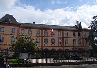
Saint-Jean-Pied-de-Port is a commune in the Pyrénées-Atlantiques department in south-western France. It is close to Ostabat in the Pyrenean foothills. The town is also the old capital of the traditional Basque province of Lower Navarre. Saint-Jean-Pied-de-Port is also a starting point for the French Way Camino Francés, the most popular option for travelling the Camino de Santiago. It is a member of Les Plus Beaux Villages de France Association.

Luzaide is a town in Navarre, northern Spain, located on the French border and just a few kilometers from the road frontier in the French village of Arnéguy.

Sare is a village and a commune in the Pyrénées-Atlantiques department in south-western France on the border with Spain. It is part of the traditional Basque province of Labourd. It is a member of Les Plus Beaux Villages de France Association.

Anhaux is a commune in the Pyrénées-Atlantiques department in the Nouvelle-Aquitaine region of south-western France. It is part of the former province of Lower Navarre.

The Haute Randonnée Pyrénéenne (HRP) is a high-level long-distance trail in the Pyrenees joining the Atlantic and Mediterranean. It approximately follows the French and Spanish border and passes through Andorra.

The Duchy of Gascony or Duchy of Vasconia was a duchy located in present-day southwestern France and northeastern Spain, an area encompassing the modern region of Gascony. The Duchy of Gascony, then known as Wasconia, was originally a Frankish march formed to hold sway over the Basques. However, the duchy went through different periods, from its early years with its distinctively Basque element to the merger in personal union with the Duchy of Aquitaine to the later period as a dependency of the Plantagenet kings of England.

The Port de Larrau is a mountain pass on the France – Spain border in the western Pyrenees between the department of Pyrénées-Atlantiques, France and Navarre, Spain. The climb from the French side was used in the 2007 Tour de France.

The Battle of Orbaizeta was fought from 15 to 17 October 1794 during the War of the Pyrenees, between the French Army of the western Pyrenees led by Bon-Adrien Jeannot de Moncey and Spanish forces under the command of Pedro Téllez-Girón, 9th Duke of Osuna. Part of the wider French Revolutionary Wars, this engagement was fought over a wide area to the northwest and northeast of Pamplona in Navarre and ended in a French victory. The Spanish defenders gave up territory to the north of Pamplona, including a number of strategic locations.
During the Battle of Roncevaux Pass a combined Basque-Qasawi Muslim army defeated a Carolingian military expedition in 824. The battle took place only 46 years after the first Battle of Roncevaux Pass (778) in a confrontation showing similar features: a Basque force engaging from the mountains, a northbound expedition led by the Franks, and the same geographical setting.

The Caixa de Rotllan is a dolmen in Arles-sur-Tech, Pyrénées-Orientales, southern France, dating back to the Neolithic period, during the second half of 3rd millennium BC.

