
State Route 68 (SR-68) is a state highway in the U.S. state of Utah. It is a major thoroughfare throughout the Wasatch Front as it runs north–south for 70.8 miles (113.9 km), linking US-6 near Elberta to US-89 in Woods Cross. The route intersects several major freeways and highways in the Salt Lake City metropolitan area including I-215, I-80, and I-15. The route is more commonly referred to as Redwood Road, after the street it is routed along throughout Salt Lake County. The highway is also routed for a short distance along 500 South and 200 West in Bountiful and Camp Williams Road in Utah County. The route is a surface street for its entire length.

Interstate 80 Business is an unofficial business loop of Interstate 80 (I-80) that is 2.26 miles (3.64 km) long and serves as the main street for the US cities of West Wendover, Nevada, and Wendover, Utah, along a roadway named Wendover Boulevard. Wendover Boulevard was originally part of US Route 40 (US 40), which connected California to New Jersey via Nevada and Utah. A portion of the Nevada segment is concurrent with US 93 Alternate, and the entire portion in Utah is coterminous with Utah State Route 58 (SR-58). The Nevada Department of Transportation (NDOT) applied for the business loop designation in the early 1980s, but the designation has never been approved; nevertheless, signs are posted in both states. Between July 1976 and 1993, I-80 Bus was concurrent with Nevada State Route 224 (SR 224) in Nevada.

State Route 265 is a west–east thoroughfare completely within Utah County in northern Utah that cuts through Orem and Provo. Utah Valley University and Brigham Young University are in close proximity to SR-265. The entirety of the route is named University Parkway.

Interstate 84 (I-84) is a part of the Interstate Highway System that links Portland, Oregon, to I-80 near Echo, Utah. The 117.38-mile-long (188.90 km) segment in the US state of Utah is the shortest of any of the three states the western I-84 passes through and contains the eastern terminus of the highway. I-84 enters Box Elder County near Snowville before becoming concurrent with I-15 in Tremonton. The concurrent highways travel south through Brigham City and Ogden and separate near Ogden-Hinckley Airport. Turing east along the Davis County border, I-84 intersects US Route 89 (US-89) and enters Weber Canyon as well as Morgan County. While in Morgan County, I-84 passes the Devil's Gate-Weber Hydroelectric Power Plant and Devil's Slide rock formation. Past Morgan, the highway crosses into Summit County, past the Thousand Mile Tree before reaching its eastern terminus at I-80 near Echo.

Interstate 15 (I-15) runs north–south in the U.S. state of Utah through the southwestern and central portions of the state, passing through most of the state's population centers, including St. George and those comprising the Wasatch Front: Provo–Orem, Salt Lake City, and Ogden–Clearfield. It is Utah's primary and only north–south interstate highway, as the vast majority of the state's population lives along its corridor; the Logan metropolitan area is the state's only Metropolitan Statistical Area through which I-15 does not pass. In 1998, the Utah State Legislature designated Utah's entire portion of the road as the Veterans Memorial Highway.

State Route 161 (SR-161) is a 3.084-mile (4.963 km) long state highway, designated as a rural major connector, completely within Millard County in central Utah. The highway connects Interstate 70 (I-70) to I-15 while providing service to historic Cove Fort. The route was once part of U.S. Route 91 (US-91), but was renumbered to SR-161 in the 1970s, in parallel with the construction of I-70.
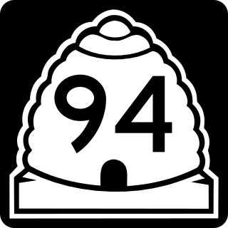
State Route 94 (SR-94), located entirely within Grand County, is a 0.958-mile-long (1.542 km) minor collector state highway in the U.S. state of Utah. The highway serves as a spur route into Thompson Springs. The highway was formed in 1969, at the same time Interstate 70 (I-70) was constructed through the area.

Legacy Parkway is an 11.5-mile-long (18.5 km) four-lane controlled-access parkway located almost completely within Davis County in the northern part of the U.S. state of Utah. The parkway travels north from Interstate 215 (I-215) in northwestern Salt Lake City to an interchange named the Wasatch Weave in Farmington with two intermediate interchanges providing access to Woods Cross and Centerville. Wetlands of the nearby Great Salt Lake and nature preserves border the western side of the parkway while the eastern side roughly parallels Union Pacific and Utah Transit Authority rail lines and I-15. On average, between 20,000 and 23,000 vehicles use the parkway daily.
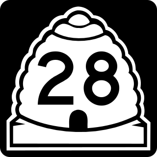
State Route 28 (SR-28) is a state highway in central Utah running for 43.612 miles (70.187 km) in Sanpete and Juab counties from Gunnison to Nephi. It serves as a connection from the Wasatch Front to the Sevier Valley.

State Route 266 is a west–east thoroughfare completely within Salt Lake County in northern Utah that connects both sides of the I-215 beltway. It is known as 4500 South and 4700 South along the route.

State Route 129 (SR-129) is a state highway in northern Utah County, Utah, United States. The route spans (mostly) north-south for 7.27 miles (11.70 km) to connect U.S. Route 89 (US-89) on the Lindon-Pleasant Grove line with SR-92 in Highland. The majority of the route runs along North County Boulevard.
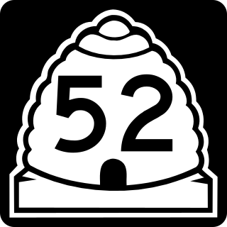
State Route 52 (SR-52) is a state highway in the U.S. state of Utah, connecting I-15 with US-189 along Orem's 800 North.

State Route 151 (SR-151), sometimes known as the South Jordan Parkway, is a state highway in the U.S. state of Utah connecting SR-154 in South Jordan to Interstate 15 (I-15) in Sandy. The route spans 4.24 miles (6.82 km) in southern Salt Lake County.

State Route 103 (SR-103) is a 0.225-mile-long (362 m) urban minor arterial state highway in the U.S. state of Utah. It branches off from SR-126 in downtown Clearfield and extends east to Interstate 15 (I-15), with the roadway continuing to the Falcon Hill National Aerospace Research Park, just outside Hill Air Force Base. The entire route is located in Davis County and was formed in 1965 coinciding with the construction of I-15.
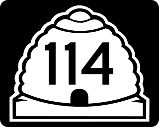
State Route 114 (SR-114) is a state highway in the US state of Utah that spans 10.79 miles (17.36 km) in Utah County. The route forms a loop around US-89 and roughly parallels the coast of Utah Lake as it passes through the west side of Provo, Lindon and Orem, eventually terminating in Pleasant Grove. The highway consists of a portion of Center Street and all of Geneva Road. The highway was formed in 1931, the southern terminus initially extending into the east side of Provo. In 1965, the route was truncated to its present state.

State Route 200 (SR-200) is a 1.565-mile-long (2.519 km) state highway in the U.S. state of Utah. It serves to connect Lewiston's Center Street (SR-61) to the Idaho border. The roadway continues north past the state line into the city of Preston, Idaho.

State Route 145 (SR-145), a majority of which is also known as Pioneer Crossing, is a 6.862-mile-long (11.043 km) west–east thoroughfare completely within Utah County in northern Utah that cuts through Saratoga Springs, Lehi, American Fork, and portions of unincorporated Utah County. The portion between Interstate 15 (I-15) and U.S. Route 89 (US-89) has been under state jurisdiction since 1978, while the roadway between SR-68 and I-15 opened in 2010. The road were extended from SR-68 to SR-73 in 2014. The road runs mostly parallel to and south of SR-73, which also connects to SR-68 and I-15. The original portion of the route between I-15 and US-89 is designated as Main Street in American Fork's street grid.
Utah State Route 156 (SR-156) is a state highway in the U.S. state of Utah. Spanning just 1.38 miles (2.22 km), it connects the city of Spanish Fork, via Main Street, with Interstate 15 on the north side of town.
State Route 135 (SR-135) is a short divided state highway in northern Utah County, Utah, United States. The route spans east–west for 0.726 miles (1.168 km) to connect the far northeastern part of Lindon and Interstate 15 (I-15) with SR-129 in the southeastern part of Pleasant Grove. The majority of the route runs along Pleasant Grove Boulevard.
State Route 179, also known as the Midvalley Highway, is a highway in the U.S. state of Utah. It runs through the northern part of the Tooele Valley, located in eastern Tooele County.

