
Van Buren County is a county located in the U.S. state of Arkansas. As of the 2020 census, the population was 15,796. The county seat is Clinton. The county was formed on November 11, 1833, and named for Martin Van Buren, President of the United States, who was Vice President at the time of the county's formation. Van Buren County was a dry county until November 3, 2020, as the county residents voted to make it a wet county.
Stone County is located in the Ozark Mountains in the U.S. state of Arkansas. The county is named for rugged, rocky area terrain of the Ozarks. Created as Arkansas's 74th county on April 21, 1873, Stone County has two incorporated cities: Mountain View, the county seat and most populous city, and Fifty-Six. The county is also the site of numerous unincorporated communities and ghost towns.

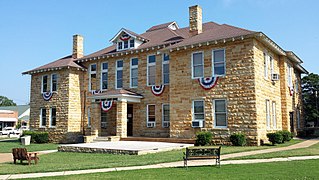
Van Buren is the second-largest city in the Fort Smith, Arkansas–Oklahoma Metropolitan Statistical Area and the county seat of Crawford County, Arkansas, United States. The city is located directly northeast of Fort Smith at the Interstate 40 – Interstate 540 junction. The city was incorporated in 1845 and as of the 2020 census had a population of 23,218, ranking it as the state's 21st largest city.

Conway is a city in the U.S. state of Arkansas and the county seat of Faulkner County, located in the state's most populous Metropolitan Statistical Area, Central Arkansas. Although considered a suburb of Little Rock, Conway is unusual in that the majority of its residents do not commute out of the city to work. The city also serves as a regional shopping, educational, work, healthcare, sports, and cultural hub for Faulkner County and surrounding areas. Conway's growth can be attributed to its jobs in technology and higher education; among its largest employers being Acxiom, the University of Central Arkansas, Hendrix College, Insight Enterprises, and many technology start-up companies. Conway is home to three post-secondary educational institutions, earning it the nickname "The City of Colleges".

Fort Smith is the third-most populous city in Arkansas and one of the two county seats of Sebastian County. As of the 2020 census, the population was 89,142. It is the principal city of the Fort Smith, Arkansas–Oklahoma Metropolitan Statistical Area, a region of 298,592 residents that encompasses the Arkansas counties of Crawford, Franklin, and Sebastian, and the Oklahoma counties of LeFlore and Sequoyah.

The Boston Mountains is a Level III ecoregion designated by the Environmental Protection Agency (EPA) in the U.S. states of Arkansas and Oklahoma. Part of the Ozarks, the Boston Mountains are a deeply dissected plateau. The ecoregion is steeper than the adjacent Springfield Plateau to the north, and bordered on the south by the Arkansas Valley. The Oklahoma portion of the range is locally referred to as the Cookson Hills. There are several theories of how the mountains were named, though apparently none are related to the Massachusetts city.

The Battle of Pea Ridge, also known as the Battle of Elkhorn Tavern, took place in the American Civil War near Leetown, northeast of Fayetteville, Arkansas. Federal forces, led by Brig. Gen. Samuel R. Curtis, moved south from central Missouri, driving Confederate forces into northwestern Arkansas.
Scotland is an unincorporated community in southwestern Van Buren County, Arkansas, United States, near the head of the South Fork of the Little Red River. In April 2010, a tornado struck this community which resulted in extreme damage.

David Kevin Van Horn is an American baseball coach and former infielder, who is the current head baseball coach of the Arkansas Razorbacks.

The Fort Smith Metropolitan Statistical Area, as defined by the United States Census Bureau, is a five-county area including three Arkansas counties and two Oklahoma counties, and anchored by the city of Fort Smith, Arkansas. The total MSA population in 2000 was 273,170 people, estimated by the Bureau to have grown to 289,693 people by 2007.
Van Buren High School is a comprehensive public high school serving students in grades 10 through 12 in Van Buren, Arkansas, United States. It is the sole high school administered by the Van Buren School District.

Area code 501 is a telephone area code in the North American Numbering Plan (NANP) for central Arkansas, including Little Rock and most of its suburbs. The numbering plan area (NPA) comprises most communities in Cleburne, Conway, Faulkner, Garland, Hot Spring, Lonoke, Perry, Pulaski, Saline, White and Van Buren counties.
Dora is an unincorporated community and census-designated place (CDP) in Crawford County in the western part of the U.S. state of Arkansas. It is located approximately three miles west of Van Buren on the Arkansas-Oklahoma border along Interstate 40. The community is part of the Fort Smith, Arkansas-Oklahoma Metropolitan Statistical Area. Dora shares its ZIP code (72956) and other municipal services with Van Buren.
Alread is an unincorporated community in Van Buren County, Arkansas, United States.

U.S. Route 64 is a U.S. highway running from Teec Nos Pos, Arizona east to Nags Head, North Carolina. In the U.S. state of Arkansas, the route runs 246.35 miles (396.46 km) from the Oklahoma border in Fort Smith east to the Tennessee border in Memphis. The route passes through several cities and towns, including Fort Smith, Clarksville, Russellville, Conway, Searcy, and West Memphis. US 64 runs parallel to Interstate 40 until Conway, when I-40 takes a more southerly route.

Bee Branch is an unincorporated community and census-designated place (CDP) in Van Buren County, Arkansas, United States. It was first listed as a CDP in the 2020 census with a population of 293.
Lost Corner is an unincorporated community in Pope County, Arkansas, United States. The community changed its name from Okay to avoid confusion with a community in Howard County with the same name. Lost Corner was selected because of the backwoods location of the community.
Marshallese Americans are Americans of Marshallese descent or Marshallese people naturalized in the United States. According to the 2010 census, 22,434 people of Marshallese origin lived in the United States at that time, though that number has likely grown significantly over the last decade. A recent estimate puts the number at approximately 30,000 in 2018. The United States has the highest concentration of Marshallese people outside the Marshall Islands. Most of these Marshallese people live in Hawaii and Arkansas, with significant populations in Washington, California, Oklahoma and Oregon.
Ross Van Ness is an unincorporated community in Chicot County, Arkansas, United States.
Eudora School District was a school district based in Eudora, Arkansas. Its schools were G. C. Johns Lower Elementary School, G. C. Johns Upper Elementary School, and Eudora High School.

