
Vanali | |
|---|---|
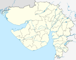  Vanali  Vanali | |
| Coordinates: 21°54′44″N71°36′50″E / 21.912153°N 71.613934°E | |
| Country |  India India |
| State |  Gujarat Gujarat |
| District | Botad |
| Region |  Saurashtra Saurashtra |
| Government | |
| • Type | Gram Panchayat |
| • Body | Vanali Gram Panchayat |
| Area | |
• Total | 7.54 km2 (2.91 sq mi) |
| Elevation | 59 m (194 ft) |
| Population (2011) | |
• Total | 1,633 |
| • Density | 217/km2 (561/sq mi) |
| Demonym | Vanalian |
| Languages | |
| • Official | Gujarati, Sanskrit, English, Hindi |
| • Spoken | Gujarati |
| Time zone | UTC+5:30 (IST) |
| Postal Index Number | 364 750 |
| Telephone code | +91 02847 |
| Vehicle registration | GJ-32 |
| Website | botad |
Vanali is a medium size village located in Gadhda division of Botad district, [1] Saurashtra, India with 279 families residing. [2]

