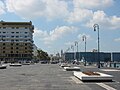
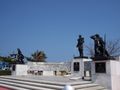
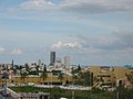
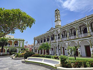
Boca del Río is a city and municipality located in the center of the Mexican state of Veracruz. The small city of Boca del Río serves as the seat of the municipality. The municipality lies just south of the municipality of Veracruz, and contains a part of the city and city and port of Veracruz. It is a port in its own right, as well as the metropolitan area's center for business travel and upscale hotels and restaurants. The city contains two museums, one dedicated to Agustín Lara and the other a military ship that has been converted into a museum. However, the municipality's main feature is the World Trade Center Veracruz, which hosts business meetings, conferences and conventions.
El Llano is a municipality in the Mexican state of Aguascalientes. It stands at 21°55′N101°58′W.

San Francisco de los Romo is a municipality and city in the Mexican state of Aguascalientes. The city of San Francisco de los Romo serves as the municipal seat for the surrounding municipality of San Francisco de los Romo.

Mexicali Municipality is a municipality in the Mexican state of Baja California. Its municipal seat is located in the city of Mexicali. As of 2020, the municipality had a total population of 1,049,792. The municipality has an area of 13,700 km2 (5,300 sq mi). This includes many smaller outlying communities as well as the city of Mexicali. Also, the islands of Baja California located in the Gulf of California are part of the municipality, among them the mudflat islands at the mouth of the Colorado River, Isla Ángel de la Guarda and the islands of the San Lorenzo Marine Archipelago National Park. Mexicali is the northernmost municipality of Latin America.

Tecate is a municipality in the Mexican state of Baja California. Its municipal seat is located in the city of Tecate. According to the 2020 census, it had a population of 108,440 inhabitants. The municipality has an area of 3,079.0 km².

Playas de Rosarito Municipality is located in the northwestern part of the Mexican state of Baja California comprising part of the Tijuana metropolitan area. It lies just south of the city of Tijuana. Its municipal seat is the city of Rosarito. According to the 2020 census, the municipality had a population of 126,890 inhabitants. Its area is 513.32 km2.

The Municipality of Pachuca de Soto, or Municipality of Pachuca, is one of the Municipalities of the state of Hidalgo, located in east-central Mexico.
Antón Lizardo is a fishing town located 23 km (14 mi) in the Mexican state of Veracruz. It is located south of the port city of Veracruz, near Boca del Río, in the municipality of Alvarado.

Acapetahua is a town and municipality in the Mexican state of Chiapas, in southern Mexico. As of 2010, the municipality had a total population of 27,580, up from 14,189 in 2005.

Pabellón de Arteaga is municipality in the Mexican state of Aguascalientes. It stands at 22°09′N102°16′W in the central part of the state. The city of Pabellón de Arteaga serves as its municipal seat. The municipality had a population of 41,862 and an area of 199.33 km². Its largest other town is named Emiliano Zapata.
Jesús María is a municipality in the Mexican state of Aguascalientes. It stands at 21°58′N102°21′W. As of 2010, the municipality had a total population of 99,590.

Tepezalá is a municipality and town in the Mexican state of Aguascalientes. The town of Tepezalá serves as the municipal seat for the surrounding municipality of Tepezalá.
San Juan del Río, Durango is a city and seat of the municipality of San Juan del Río, in the state of Durango, north-western Mexico. As of 2010, the town had a population of 2,912.
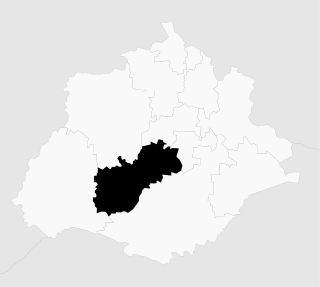
Alvarado is a municipality in the Mexican state of Veracruz. The municipality is part of the state's Papaloapan Region and its municipal seat is established at the homonymous city of Alvarado.
Lerdo de Tejada is a municipality in the Mexican state of Veracruz, located 207 kilometres (129 mi) southeast of the state capital Xalapa. It is named after Sebastián Lerdo de Tejada, the 27th President of Mexico.
Comapa is a municipality in the Mexican state of Veracruz, located about 40 kilometres (25 mi) south of the state capital Xalapa.
Naranjal is a municipality in the Mexican state of Veracruz, located 10 kilometres (6.2 mi) south of the city of Córdoba.

Citlaltépetl is a municipality in the Mexican state of Veracruz, located 223 kilometres (139 mi) northwest of the state capital of Xalapa and 99 kilometres (62 mi) south of the city of Tampico, Tamaulipas.

Tomatlán is a municipality in the Mexican state of Veracruz, located 58 kilometres (36 mi) south of the state capital of Xalapa.
Xoxocotla is a municipality in the Mexican state of Veracruz, located 103 kilometres (64 mi) south of the state capital Xalapa.