Vermilion River (Lac Seul)

Last updated
Vermilion River
Country Canada
Province Ontario
Region Northwestern Ontario
District Kenora
Part of Hudson Bay drainage basin
SourceHighstone Lake
 - elevation366 m (1,201 ft)
 - coordinates 50°23′38″N91°32′27″W / 50.39389°N 91.54083°W / 50.39389; -91.54083
Mouth Lac Seul
 - elevation357 m (1,171 ft)
 - coordinates 50°25′05″N91°50′11″W / 50.41806°N 91.83639°W / 50.41806; -91.83639 Coordinates: 50°25′05″N91°50′11″W / 50.41806°N 91.83639°W / 50.41806; -91.83639
Length30 km (19 mi)
Canada Ontario location map 2.svg
Red pog.svg
Location of the mouth of the Vermilion River in Ontario

The Vermilion River is a river in the Hudson Bay drainage basin in Kenora District in Northwestern Ontario, Canada. The river begins at Highstone Lake and reaches its mouth at Brechin Bay on Lac Seul, about 35 kilometres (22 mi) north of the town of Sioux Lookout, which flows via the English River, Winnipeg River and Nelson River to Hudson Bay.

River Natural flowing watercourse

A river is a natural flowing watercourse, usually freshwater, flowing towards an ocean, sea, lake or another river. In some cases a river flows into the ground and becomes dry at the end of its course without reaching another body of water. Small rivers can be referred to using names such as stream, creek, brook, rivulet, and rill. There are no official definitions for the generic term river as applied to geographic features, although in some countries or communities a stream is defined by its size. Many names for small rivers are specific to geographic location; examples are "run" in some parts of the United States, "burn" in Scotland and northeast England, and "beck" in northern England. Sometimes a river is defined as being larger than a creek, but not always: the language is vague.

Hudson Bay A large body of saltwater in northeastern Canada

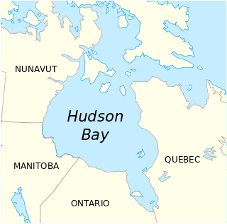
Hudson Bay is a large body of saltwater in northeastern Canada with a surface area of 1,230,000 km2 (470,000 sq mi). It drains a very large area, about 3,861,400 km2 (1,490,900 sq mi), that includes parts of southeastern Nunavut, Saskatchewan, most of Manitoba, Ontario, Quebec and indirectly through smaller passages of water to parts of North Dakota, South Dakota, Minnesota, and Montana. Hudson Bay's southern arm is called James Bay.

Drainage basin Area of land where precipitation collects and drains off into a common outlet

A drainage basin is any area of land where precipitation collects and drains off into a common outlet, such as into a river, bay, or other body of water. The drainage basin includes all the surface water from rain runoff, snowmelt, and nearby streams that run downslope towards the shared outlet, as well as the groundwater underneath the earth's surface. Drainage basins connect into other drainage basins at lower elevations in a hierarchical pattern, with smaller sub-drainage basins, which in turn drain into another common outlet.

Contents

Tributaries

See also

Related Research Articles

Batchawana River river in Canada

The Batchawana River is a river in Algoma and Sudbury Districts of Ontario, Canada, which empties into Batchawana Bay on Lake Superior north of Sault Ste. Marie, Ontario. The name "Batchawana" is derived from an Ojibwe word meaning "turbulent waters".

English River (Ontario) river in Canada

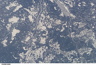
The English River is a river in Kenora District and Thunder Bay District in Northwestern Ontario, Canada. It flows through Lac Seul to join the Winnipeg River as a right tributary. The river is in the Hudson Bay drainage basin, is 615 kilometres (382 mi) long and has a drainage basin of 52,300 square kilometres (20,200 sq mi). There are several hydroelectric plants on this river.
Kenogami River river in Canada

The Kenogami River is a river in the James Bay drainage basin in Thunder Bay and Cochrane districts in Northern Ontario, Canada, which flows north from Long Lake near Longlac to empty into the Albany River. The river is 320 kilometres (199 mi) in length and its name means "long water" in the Cree language. A portion of the river's headwaters have been diverted into the Lake Superior drainage basin.

Wabigoon River river in Canada

The Wabigoon River is a river in Kenora District in northwestern Ontario, Canada. It flows from Raleigh Lake past Dryden, Ontario on Wabigoon Lake to join the English River. The name "Wabigoon" comes from the Ojibwe waabigon, "marigold", or waabi-miigwan, "white feather".

Fawn River (Ontario) river in Canada

The Fawn River is a river in the north of the Unorganized Part of Kenora District in Northwestern Ontario, Canada. It is in the Hudson Bay drainage basin and is a right tributary of the Severn River.
Hayes River river in Manitoba, Canada

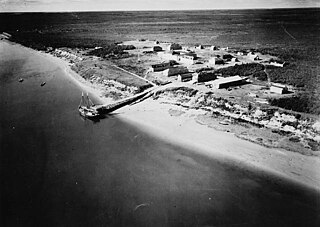
The Hayes River is a river in Northern Region, Manitoba, Canada that flows from Molson Lake to Hudson Bay at York Factory. It was an historically important river in the development of Canada, and is today a Canadian Heritage River and the longest naturally flowing river in Manitoba.

Berens River river in Manitoba and Ontario, Canada

The Berens River is a river in the Provinces of Manitoba and Ontario, Canada. It flows west from an unnamed lake in Kenora District, Ontario and discharges its waters into Lake Winnipeg near the village and First Nation of Berens River, Manitoba. The river has a number of lakes along its course, and many rapids.

Firesteel River (Ontario) river in Ontario, Canada

The Firesteel River is a river in Thunder Bay District, northwestern Ontario, Canada in the Hudson Bay drainage basin. It flows from Trap Lake, 3 kilometres (1.9 mi) east of the Canadian National Railway location of George and 19 kilometres (12 mi) north of the community of Upsala, southwest under the Canadian National Railway, the Canadian Pacific Railway mainline and Ontario Highway 17 to its mouth at the Seine River, 28 kilometres (17 mi) west of Upsala.

Frederick House River river in Canada

The Frederick House River is a river in the James Bay and Moose River drainage basins in Cochrane District in northeastern Ontario, Canada. It flows 100 kilometres (62 mi) from Night Hawk Lake in the city of Timmins to its mouth at the Abitibi River in Cochrane, Unorganized, North Part. Both the river and the associated Hudson's Bay Company Frederick House post (1785–1821) are named for Prince Frederick, Duke of York and Albany, son of George III of the United Kingdom,

Whitefish River (Berens River tributary) river in Kenora District in northwestern Ontario, Canada

The Whitefish River is a river in Kenora District in northwestern Ontario, Canada. It is in the Hudson Bay and Nelson River drainage basins and is a tributary of the Berens River.

Echoing River river in Canada

The Echoing River is a river in the Hudson Bay drainage basin in Manitoba and Ontario, Canada. Its flows from its source at Echoing Lake in Unorganized part of Kenora District, Northwestern Ontario to its mouth at the Gods River in Northern Manitoba. The Gods River flows via the Hayes River to Hudson Bay.

Vermilion River (Sudbury District) river in Sudbury District, Ontario, Canada

The Vermilion River is a river in the Lake Huron drainage basin in Sudbury District and Greater Sudbury in Northeastern Ontario, Canada.

Cedar River (Ontario) river in Canada

The Cedar River is a river in the Hudson Bay drainage basin in the Unorganized Part of Kenora District in northwestern Ontario in Canada. The river is a left tributary of the English River.

Blanche River (Lake Timiskaming) river in Canada

The Blanche River is a river in the Saint Lawrence River drainage basin in Timiskaming District in northeastern Ontario, Canada. The river is a tributary of Lake Timiskaming and its name is from the French for the colour "white".
Kapuskasing River river in Northeastern Ontario, Canada

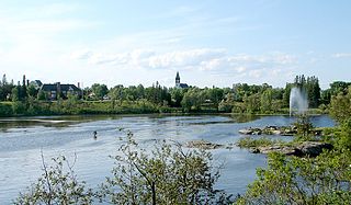
The Kapuskasing River is a river in the James Bay drainage basin in Cochrane District and Algoma District in northeastern Ontario, Canada. The river is a left tributary of the Mattagami River.

Ivanhoe River river in Cochrane and Sudbury Districts, Ontario, Canada

The Ivanhoe River is a river in Cochrane District and Sudbury District in Northeastern Ontario, Canada. The river is in the James Bay drainage basin and is a left tributary of the Groundhog River.

Black River (Kenora District)

The Black River is a river in the municipality of Sioux Narrows-Nestor Falls, Kenora District in Northwestern Ontario, Canada. It is part of the Hudson Bay drainage basin, and is a tributary of the Lake of the Woods.

Onaping River watercourse in Canada

The Onaping River is a river in Greater Sudbury and Sudbury District in Northeastern Ontario, Canada. It is in the Great Lakes Basin and is a right tributary of the Vermilion River.

Michaud River watercourse in Canada

The Michaud River is a river in Sudbury District in Northeastern Ontario, Canada. It is in the Great Lakes Basin and is a left tributary of the Onaping River.

Rostoul River river in Kenora District, Ontario, Canada

The Rostoul River is a river in the Unorganized Part of Kenora District in Northwestern Ontario, Canada. It is in the Hudson Bay drainage basin, is a left tributary of the Gammon River, and is within Woodland Caribou Provincial Park.

References

The Department of Natural Resources, operating under the FIP applied title Natural Resources Canada (NRCan), is the ministry of the government of Canada responsible for natural resources, energy, minerals and metals, forests, earth sciences, mapping and remote sensing. It was created in 1995 by amalgamating the now-defunct Departments of Energy, Mines and Resources and Forestry. Natural Resources Canada (NRCan) works to ensure the responsible development of Canada's natural resources, including energy, forests, minerals and metals. NRCan also uses its expertise in earth sciences to build and maintain an up-to-date knowledge base of our landmass and resources. To promote internal collaboration, NRCan has implemented a departmental wide wiki based on MediaWiki. Natural Resources Canada also collaborates with American and Mexican government scientists, along with the Commission for Environmental Cooperation, to produce the North American Environmental Atlas, which is used to depict and track environmental issues for a continental perspective.

The Atlas of Canada is an online atlas published by Natural Resources Canada that has information on every city, town, village, and hamlet in Canada. It was originally a print atlas, with its first edition being published in 1906 by geographer James White and a team of 20 cartographers. Much of the geospatial data used in the atlas is available for download and commercial re-use from the Atlas of Canada site or from GeoGratis. Information used to develop the atlas is used in conjunction with information from Mexico and the United States to produce collaborative continental-scale tools such as the North American Environmental Atlas.