Verona, Nebraska

Last updated

Verona, Nebraska
Verona, NE.jpg
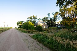
Road 315 in Verona, July 2017
USA Nebraska location map.svg
Red pog.svg
Verona
Location within the state of Nebraska
Coordinates: 40°33′13″N97°57′58″W / 40.55361°N 97.96611°W / 40.55361; -97.96611
Country United States
State Nebraska
County Clay
Elevation
1,772 ft (540 m)
Time zone UTC-6 (Central (CST))
  Summer (DST) UTC-5 (CDT)
ZIP codes
68933
FIPS code 31-24055
GNIS feature ID834374

Verona is an unincorporated community in Clay County, Nebraska, United States. [1]

Contents

History

Verona was named in 1884 for the Veronica family of pioneer settlers. [2] A post office was established in Verona in 1887, and remained in operation until it was discontinued in 1954. [3]

See also

Flag of Nebraska.svg  Nebraskaportal

Related Research Articles

<span class="mw-page-title-main">Adams County, Nebraska</span> County in Nebraska, United States

Adams County is a county located in the U.S. state of Nebraska. As of the 2020 United States Census, the population was 31,205. Its county seat is Hastings. The county was formed in 1867 and organized in 1871. It is named for John Adams, the second President of the United States.

<span class="mw-page-title-main">Clay County, Nebraska</span> County in Nebraska, United States

Clay County is a county in the U.S. state of Nebraska. As of the 2020 United States Census, the population was 6,104. Its county seat is Clay Center. The county was formed in 1855, and was organized in 1871. It was named for Henry Clay, a member of the United States Senate from Kentucky, who went on to become United States Secretary of State.

<span class="mw-page-title-main">Clay County, South Dakota</span> County in South Dakota, United States

Clay County is a county in the U.S. state of South Dakota. As of the 2020 census, the population was 14,967. The county seat is Vermillion, which is also home to the University of South Dakota. The county is named for Henry Clay, American statesman, US Senator from Kentucky, and United States Secretary of State in the 19th century.

<span class="mw-page-title-main">Franklin County, Nebraska</span> County in Nebraska, United States

Franklin County is a county in the U.S. state of Nebraska. As of the 2020 census, the population was 2,889. Its county seat is Franklin. The county was formed in 1867 and organized in 1871. It was named for Benjamin Franklin.

<span class="mw-page-title-main">Cedar County, Nebraska</span> County in Nebraska, United States

Cedar County is a county in the U.S. state of Nebraska. As of the 2020 United States Census, the population was 8,380. The county seat is Hartington. The county was formed in 1857, and was named for the Cedar tree groves in the area.

<span class="mw-page-title-main">Shelton, Nebraska</span> Village in Nebraska, United States

Shelton is a village in Buffalo and Hall counties, Nebraska, United States. It is part of the Kearney, Nebraska Micropolitan Statistical Area. The population was 1,059 at the 2010 census. It is located west of Grand Island along both the Union Pacific Railroad and U.S. Route 30. Nebraska Link 10-D connects Shelton with Interstate 80.

<span class="mw-page-title-main">Crete, Nebraska</span> City in Saline County, Nebraska, United States

Crete is a city in and the most populous municipality of Saline County, Nebraska, United States. The population was 7,099 at the 2020 census. The city is home to Doane University.

<span class="mw-page-title-main">Westerville, Nebraska</span> Census-designated place in Nebraska, United States

Westerville is an unincorporated community and census-designated place in Custer County, Nebraska, United States. It is located at the intersection of U.S. Route 183 and Nebraska Highway 70. As of the 2010 census it had a population of 39.

<span class="mw-page-title-main">Breslau, Nebraska</span> Unincorporated Community in Nebraska, United States

Breslau is an unincorporated community in Pierce County, Nebraska, United States. It is located on U.S. Route 20, approximately equidistant from Plainview and Osmond, at the corner of 541st Avenue.

<span class="mw-page-title-main">Inland, Nebraska</span> Census-designated place in Clay County, Nebraska, United States

Inland is a census-designated place in northwestern Clay County, Nebraska, United States. As of the 2010 census it had a population of 62. Although Inland is unincorporated, it has a post office, with the ZIP code of 68954.

<span class="mw-page-title-main">Poole, Nebraska</span> Census-designated place in Nebraska, United States

Poole is a census-designated place (CDP) in Buffalo County, Nebraska, United States. It is part of the Kearney, Nebraska Micropolitan Statistical Area. The population of the CDP was 19 at the 2010 census.

<span class="mw-page-title-main">Holland, Nebraska</span> Unincorporated community in Nebraska, United States

Holland is an unincorporated community in Lancaster County, Nebraska, United States.

<span class="mw-page-title-main">Kramer, Nebraska</span> Unincorporated community in Nebraska, United States

Kramer is an unincorporated rural village in Lancaster County, Nebraska, United States. There is a grainary there, a restaurant, and a community hall, and no other businesses or services. The population was 26 at the 2020 census.

<span class="mw-page-title-main">Prairie Home, Nebraska</span> Unincorporated community and Census designated place in Nebraska, United States

Prairie Home is an unincorporated community in Lancaster County, Nebraska, United States.

<span class="mw-page-title-main">Princeton, Nebraska</span> Unincorporated Community and Census designated place in Nebraska, United States

Princeton is an unincorporated community in Lancaster County, Nebraska, United States.

Eldorado is an unincorporated community in Clay County, Nebraska, United States.

Oliver is an unincorporated community in Kimball County, Nebraska, United States.

<span class="mw-page-title-main">Agnew, Nebraska</span> Unincorporated community and Census designated place in Nebraska, United States

Agnew is an unincorporated community in Lancaster County, Nebraska, United States.

<span class="mw-page-title-main">Berks, Nebraska</span> Unincorporated community in Lancaster and Saline counties in Nebraska, United States

Berks is an Unincorporated community in Lancaster and Saline counties in Nebraska, United States. The community is located approximately three miles (4.8 km) northeast of Crete on the BNSF Railroad Line and north of Nebraska Highway 33.

References

  1. U.S. Geological Survey Geographic Names Information System: Verona, Nebraska
  2. Fitzpatrick, Lillian L. (1960). Nebraska Place-Names. University of Nebraska Press. p. 43. A 1925 edition is available for download at University of Nebraska—Lincoln Digital Commons.
  3. "Clay County". Jim Forte Postal History. Retrieved August 25, 2014.

Commons-logo.svg Media related to Verona, Nebraska at Wikimedia Commons