
Vertically integrated liquid (VIL) is an estimate of the total mass of precipitation in the clouds. The measurement is obtained by observing the reflectivity of the air which is obtained with weather radar. [1]
Vertically integrated liquid (VIL) is an estimate of the total mass of precipitation in the clouds. The measurement is obtained by observing the reflectivity of the air which is obtained with weather radar. [1]
Reflectivity (Z) in dBZ represents the intensity of radar echoes returning from a clouds. According to the wavelengths used in weather radars, only precipitation can be noted (drizzle, rain, snow, hail), not the cloud droplets nor water vapor, so Z is proportional to the rain rate. Using the sum in the vertical of Z, one can find the total mass of water equivalent in and below the precipitating cloud and that is what is VIL.
From the studies of Marshall and Palmer on the drop size distribution of rain drops, it is possible to find VIL: [2] [3] [4]
Where :
To note, the unit kg/m2 multiplied by water density (1 kg/liter) gives the surface accumulation in millimeters of rain: 1 kg/m2 = 1 mm.
The VIL measurement is usually used in determining the size of prospective hail, [3] the potential amount of rain under a thunderstorm, and the potential downdraft strength when combined with the height of the echo tops.[ citation needed ] VIL can be used to triage storms based on their severe potential. It is sometimes still used to assess storms for their potential severity. [5]
When VIL values are high for longer periods of time, the storm may be a supercell.[ citation needed ]
Multicells usually have alternating VIL values. Multicells can have high VIL values on one radar picture, yet much smaller values in the next radar picture.[ citation needed ]
When VIL values quickly fall, it might mean that a downburst is imminent. This is the result of the updraft within the cell weakening, thereby losing its ability to hold the copious amounts of moisture (including hail) within the storm's structure. Downbursts of this type are referred to as 'wet microbursts' by the National Weather Service for two reasons: (1) they contain heavy rainfall and (usually) hail; (2) they have damaging winds of greater than 58 mph (50 kn ; 93 km/h ). Microbursts are classified as being 'a swath of damaging winds not exceeding 2.5 miles (4.0 km ) in diameter'. [6]
Thus, wet microbursts have been sometimes mistaken for a tornado by the general public, as the damage can be quick, hard hitting, and as important or more than an EF-1 tornado. [7] An algorithm has been developed by S. Stewart, a meteorologist for the US National Weather Service, to estimate the potential maximum gust with a descending downdraft using VIL and the Echotop on radar: [8]

Cumulonimbus is a dense, towering vertical cloud, typically forming from water vapor condensing in the lower troposphere that builds upward carried by powerful buoyant air currents. Above the lower portions of the cumulonimbus the water vapor becomes ice crystals, such as snow and graupel, the interaction of which can lead to hail and to lightning formation, respectively. When occurring as a thunderstorm these clouds may be referred to as thunderheads. Cumulonimbus can form alone, in clusters, or along squall lines. These clouds are capable of producing lightning and other dangerous severe weather, such as tornadoes, hazardous winds, and large hailstones. Cumulonimbus progress from overdeveloped cumulus congestus clouds and may further develop as part of a supercell. Cumulonimbus is abbreviated Cb.

A thunderstorm, also known as an electrical storm or a lightning storm, is a storm characterized by the presence of lightning and its acoustic effect on the Earth's atmosphere, known as thunder. Relatively weak thunderstorms are sometimes called thundershowers. Thunderstorms occur in a type of cloud known as a cumulonimbus. They are usually accompanied by strong winds and often produce heavy rain and sometimes snow, sleet, or hail, but some thunderstorms produce little precipitation or no precipitation at all. Thunderstorms may line up in a series or become a rainband, known as a squall line. Strong or severe thunderstorms include some of the most dangerous weather phenomena, including large hail, strong winds, and tornadoes. Some of the most persistent severe thunderstorms, known as supercells, rotate as do cyclones. While most thunderstorms move with the mean wind flow through the layer of the troposphere that they occupy, vertical wind shear sometimes causes a deviation in their course at a right angle to the wind shear direction.

A supercell is a thunderstorm characterized by the presence of a mesocyclone; a deep, persistently rotating updraft. Due to this, these storms are sometimes referred to as rotating thunderstorms. Of the four classifications of thunderstorms, supercells are the overall least common and have the potential to be the most severe. Supercells are often isolated from other thunderstorms, and can dominate the local weather up to 32 kilometres (20 mi) away. They tend to last 2–4 hours.

A squall line, or more accurately a quasi-linear convective system (QLCS), is a line of thunderstorms, often forming along or ahead of a cold front. In the early 20th century, the term was used as a synonym for cold front. Linear thunderstorm structures often contain heavy precipitation, hail, frequent lightning, strong straight-line winds, and occasionally tornadoes or waterspouts. Particularly strong straight-line winds can occur where the linear structure forms into the shape of a bow echo. Tornadoes can occur along waves within a line echo wave pattern (LEWP), where mesoscale low-pressure areas are present. Some bow echoes can grow to become derechos as they move swiftly across a large area. On the back edge of the rainband associated with mature squall lines, a wake low can be present, on very rare occasions associated with a heat burst.

In meteorology, a downburst is a strong downward and outward gushing wind system that emanates from a point source above and blows radially, that is, in straight lines in all directions from the area of impact at surface level. Capable of producing damaging winds, it may sometimes be confused with a tornado, where high-velocity winds circle a central area, and air moves inward and upward. These usually last for seconds to minutes. Downbursts are particularly strong downdrafts within thunderstorms.

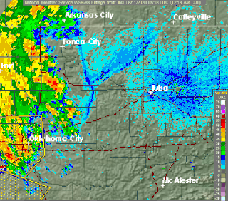
Weather radar, also called weather surveillance radar (WSR) and Doppler weather radar, is a type of radar used to locate precipitation, calculate its motion, and estimate its type. Modern weather radars are mostly pulse-Doppler radars, capable of detecting the motion of rain droplets in addition to the intensity of the precipitation. Both types of data can be analyzed to determine the structure of storms and their potential to cause severe weather.

In meteorology, convective available potential energy, is the integrated amount of work that the upward (positive) buoyancy force would perform on a given mass of air if it rose vertically through the entire atmosphere. Positive CAPE will cause the air parcel to rise, while negative CAPE will cause the air parcel to sink. Nonzero CAPE is an indicator of atmospheric instability in any given atmospheric sounding, a necessary condition for the development of cumulus and cumulonimbus clouds with attendant severe weather hazards.

An outflow boundary, also known as a gust front, is a storm-scale or mesoscale boundary separating thunderstorm-cooled air (outflow) from the surrounding air; similar in effect to a cold front, with passage marked by a wind shift and usually a drop in temperature and a related pressure jump. Outflow boundaries can persist for 24 hours or more after the thunderstorms that generated them dissipate, and can travel hundreds of kilometers from their area of origin. New thunderstorms often develop along outflow boundaries, especially near the point of intersection with another boundary. Outflow boundaries can be seen either as fine lines on weather radar imagery or else as arcs of low clouds on weather satellite imagery. From the ground, outflow boundaries can be co-located with the appearance of roll clouds and shelf clouds.

In meteorology, an updraft is a small-scale current of rising air, often within a cloud.
The Canton, Illinois Tornadoes of 1975 was a destructive summer tornado event which occurred as part of a significant severe thunderstorm outbreak concentrated from eastern Iowa across northern and central Illinois on the afternoon and evening of July 23, 1975.

An air-mass thunderstorm, also called an "ordinary", "single cell", "isolated" or "garden variety" thunderstorm, is a thunderstorm that is generally weak and usually not severe. These storms form in environments where at least some amount of Convective Available Potential Energy (CAPE) is present, but with very low levels of wind shear and helicity. The lifting source, which is a crucial factor in thunderstorm development, is usually the result of uneven heating of the surface, though they can be induced by weather fronts and other low-level boundaries associated with wind convergence. The energy needed for these storms to form comes in the form of insolation, or solar radiation. Air-mass thunderstorms do not move quickly, last no longer than an hour, and have the threats of lightning, as well as showery light, moderate, or heavy rainfall. Heavy rainfall can interfere with microwave transmissions within the atmosphere.

Severe weather is any dangerous meteorological phenomenon with the potential to cause damage, serious social disruption, or loss of human life. Types of severe weather phenomena vary, depending on the latitude, altitude, topography, and atmospheric conditions. High winds, hail, excessive precipitation, and wildfires are forms and effects of severe weather, as are thunderstorms, downbursts, tornadoes, waterspouts, tropical cyclones, and extratropical cyclones. Regional and seasonal severe weather phenomena include blizzards (snowstorms), ice storms, and duststorms.
Outflow, in meteorology, is air that flows outwards from a storm system. It is associated with ridging, or anticyclonic flow. In the low levels of the troposphere, outflow radiates from thunderstorms in the form of a wedge of rain-cooled air, which is visible as a thin rope-like cloud on weather satellite imagery or a fine line on weather radar imagery. For observers on the ground, a thunderstorm outflow boundary often approaches in otherwise clear skies as a low, thick cloud that brings with it a gust front.

Atmospheric convection is the result of a parcel-environment instability in the atmosphere. Different lapse rates within dry and moist air masses lead to instability. Mixing of air during the day expands the height of the planetary boundary layer, leading to increased winds, cumulus cloud development, and decreased surface dew points. Convection involving moist air masses leads to thunderstorm development, which is often responsible for severe weather throughout the world. Special threats from thunderstorms include hail, downbursts, and tornadoes.
Convective storm detection is the meteorological observation, and short-term prediction, of deep moist convection (DMC). DMC describes atmospheric conditions producing single or clusters of large vertical extension clouds ranging from cumulus congestus to cumulonimbus, the latter producing thunderstorms associated with lightning and thunder. Those two types of clouds can produce severe weather at the surface and aloft.

GRLevelX is a suite of data processing and display programs developed by Gibson Ridge Software, LLC (GRS), to view weather radar data. It went on the market in March 2005. It comes in three versions, all of which ingest raw data: GRLevel2 and GRLevel2 Analyst Edition for viewing Level II data of the National Weather Service (NWS), and GRLevel3 for viewing Level III data. All programs are capable of rendering dual polarization data.
The following is a glossary of tornado terms. It includes scientific as well as selected informal terminology.

A precipitation shaft is a weather phenomenon, visible from the ground at large distances from the storm system, as a dark vertical shaft of heavy rain, hail, or snow, generally localized over a relatively small area.

This glossary of meteorology is a list of terms and concepts relevant to meteorology and atmospheric science, their sub-disciplines, and related fields.
Project NIMROD was a meteorological field study of severe thunderstorms and their damaging winds conducted by the National Center for Atmospheric Research (NCAR). It took place in the Greater Chicago area from May 15 to June 30, 1978. Data collected was from single cell thunderstorms as well as mesoscale convective systems, such as bow echoes. Using Doppler weather radars and damage clues on the ground, the team studied mesocyclones, downbursts and gust fronts. NIMROD was the first time that microbursts, very localized strong downdrafts under thunderstorms, were detected; this helped improve airport and public safety by the development of systems like the Terminal Doppler Weather Radar and the Low-level windshear alert system.

