Veteran Hall Remains

Last updated

Veteran Hall Remains
Veteran Hall, Prospect (11182876874).jpg
Veteran Hall, 1913
Location Great Western Highway, Prospect, City of Blacktown, New South Wales, Australia
Coordinates 33°48′39″S150°54′59″E / 33.8109°S 150.9165°E / -33.8109; 150.9165 Coordinates: 33°48′39″S150°54′59″E / 33.8109°S 150.9165°E / -33.8109; 150.9165
Built18211821
Owner Sydney Water
Official nameVeteran Hall - House Remains
Typestate heritage (archaeological-terrestrial)
Designated18 November 1999
Reference no.1351
TypeHomestead Complex
CategoryFarming and Grazing
BuildersWilliam Lawson
Australia New South Wales relief location map.png
Red pog.svg
Location of Veteran Hall Remains in New South Wales

The Veteran Hall Remains are the heritage-listed archaeological remains of the former Veteran Hall house at Great Western Highway, Prospect, City of Blacktown, New South Wales, Australia. Veteran Hall was built in 1821 by William Lawson. The property is owned by Sydney Water. It was added to the New South Wales State Heritage Register on 18 November 1999. [1]

Contents

History

Aboriginal & European settler history

The area of Prospect Reservoir is an area of known Aboriginal occupation, with favourable camping locations along the Eastern Creek and Prospect Creek catchments, and in elevated landscapes to the south. There is also evidence to suggest that the occupation of these lands continued after European contact, through discovery of intermingled glass and stone flakes in archaeological surveys of the place. The area was settled by Europeans by 1789. [1]

Prospect Hill, Sydney's largest body of igneous rock, lies centrally in the Cumberland Plain and dominates the landscape of the area. Very early after first settlement, on 26 April 1788, an exploration party heading west led by Governor Phillip, climbed Prospect Hill. An account by Phillip states that the exploration party saw from Prospect Hill, "for the first time since we landed Carmathen [sic] Hills (Blue Mountains) as likewise the hills to the southward". Phillip's "Bellevue" (Prospect Hill) acquired considerable significance for the new settlers. Prospect Hill provided a point from which distances could be meaningfully calculated, and became a major reference point for other early explorers. When Watkin Tench made another official journey to the west in 1789, he began his journey with reference to Prospect Hill, which commanded a view of the great chain of mountains to the west. A runaway convict, George Bruce, used Prospect Hill as a hideaway from soldiers in the mid-1790s. [1]

During the initial struggling years of European settlement in NSW, Governor Phillip began to settle time-expired convicts on the land as farmers, after the success of James Ruse at Rose Hill. On 18 July 1791 Phillip placed a number of men on the eastern and southern slopes of Prospect Hill, as the soils weathered from the basalt cap were richer than the sandstone derived soils of the Cumberland Plain. The grants, mostly 30 acres, encircled Prospect Hill. The settlers included William Butler, James Castle, Samuel Griffiths, John Herbert, George Lisk, Joseph Morley, John Nicols, William Parish and Edward Pugh. [1]

The arrival of the first settlers prompted the first organised Aboriginal resistance to the spread of settlement, with the commencement of a violent frontier conflict in which Pemulwuy and his Bidjigal clan played a central role. On 1 May 1801 Governor King took drastic action, issuing a public order requiring that Aboriginal people around Parramatta, Prospect Hill and Georges River should be "driven back from the settlers" habitations by firing at them'. King's edicts appear to have encouraged a shoot-on-sight attitude whenever any Aboriginal men, women or children appeared. [1]

With the death of Pemulwuy, the main resistance leader, in 1802, Aboriginal resistance gradually diminished near Parramatta, although outer areas were still subject to armed hostilities. Prompted by suggestions to the Reverend Marsden by local Prospect Aboriginal groups that a conference should take place "with a view of opening the way to reconciliation", Marsden promptly organised a meeting near Prospect Hill. At the meeting, held on 3 May 1805, local Aboriginal representatives discussed with Marsden ways of ending the restrictions and indiscriminate reprisals inflicted on them by soldiers and settlers in response to atrocities committed by other Aboriginal clans. The meeting was significant because a group of Aboriginal women and a young free settler at Prospect named John Kennedy acted as intermediaries. The conference led to the end of the conflict for the Aboriginal clans around Parramatta and Prospect. This conference at Prospect on Friday 3 May 1805 is a landmark in Aboriginal/European relations. Macquarie's "Native Feasts" held at Parramatta from 1814 followed the precedent set in 1805. The Sydney Gazette report of the meeting is notable for the absence of the sneering tone that characterised its earlier coverage of Aboriginal matters. [1]

From its commencement in 1791 with the early settlement of the area, agricultural use of the land continued at Prospect Hill. Much of the land appears to have been cleared by the 1820s and pastoral use of the land was well established by then. When Governor Macquarie paid a visit to the area in 1810, he was favourably impressed by the comfortable conditions that had been created. [1]

Veteran Hall: Home of William Lawson

The explorer William Lawson (1774-1850) was granted 500 acres on the western slopes of the west ridge of Prospect Hill in 1810. The grant was made by the illegal government that followed the overthrow of Governor Bligh in 1808, but was later confirmed by Governor Macquarie. Lawson erected Veteran Hall in about 1821, so named because he had a commission in the NSW Veterans Company. It either replaced or was an enlargement of Lawson's first house, which was built on the same site around 1810. It was a large, single-storey building in typical Colonial Georgian style, approximately 65 squares in size, which expanded to a size of approximately 110 squares including verandahs. Veteran Hall and the original house that it replaced were owned and occupied by William Lawson between 1810 and 1850. [1]

The property was resumed during the 1880s for the construction of Prospect Reservoir, and Veteran Hall became the residence and local office of the Water Board's Engineer-In-Charge of Headworks, Albert Francis Jacob (a son of New South Wales politician Archibald Jacob), from 1888 until 1912, when the position was moved to Potts Hill. The homestead was then leased with the surrounding paddocks to the Commonwealth military authorities until 1915 as a remount depot. The building then became vacant and was demolished in 1929. Several of the decorative fittings and architectural details, such as the quoins, were donated to the Vaucluse House Trust and some of Lawson's descendants. William Lawson, a key figure in Australian history, died at Veteran Hall in 1850, and was buried at nearby St.Bartholomew's Church. [1] The foundations of Veteran Hall are still visible just off William Lawson Drive, Prospect.

Grey Stanes: Home of Nelson Lawson

Nelson Lawson, third son of explorer William Lawson (1774-1850), married Honoria Mary Dickinson and in 1837 built Grey Stanes as their future family home on the crest of the eastern ridge of Prospect Hill. William Lawson had purchased the 75 acre grant from William Cummings at about the same time, in 1810, as he was granted 500 acres on the western slopes of the west ridge of Prospect Hill. Cummings, an ensign of the New South Wales Corps, had been granted the land in 1799. In 1836 William Lawson transferred the 75 acre grant to his third son, Nelson Simmonds Lawson.

Grey Stanes was built on the original crest of the east ridge of Prospect Hill which has now been quarried away. The site is in the suburb of Pemulwuy. It is close to the present One Tree Hill, the "one tree" being a Moreton Bay fig tree, which still survives, having been planted in the paddock or garden of Grey Stanes.

Grey Stanes was approached by a long drive lined with an avenue of English trees - elms (Ulmus procera), hawthorns (Crataegus sp.), holly (Ilex aquifolium), and woodbine (Clematis sp.) mingling with jacarandas (Jacaranda mimosifolia). It had a wide, semi-circular front verandah supported by 4 pillars. The foundations were of stone, the roof of slate, and the doors and architraves of heavy red cedar. It was richly furnished with articles of the best quality available and was the scene of many glittering soirées attended by the elite of the colony. Honoria Lawson died in 1845, Nelson remarried a year later, but died in 1849 and the property reverted to his father. Grey Stanes was demolished in the 1940s. [2] [1]

Modifications and dates

Description

The homestead site is marked by wall footings and scattered sandstock bricks. An avenue of mature Araucaria cunninghamii (hoop pines) and Araucaria bidwillii (Bunya Pines) leads to the house site. [1]

Other established plantings in the vicinity include wild or African olive (Olea europaea var.cuspidata), and a former Pyracantha (firethorn) hedge. A Macartney rose (Rosa bracteata) is in the homestead garden. The same species of rose is also found in the King family farm garden at St. Marys. [3] [1]

Ancillary elements associated with the house site include cellars (filled) and a well discovered near the Prospect Hill Reservoir access road. [1]

A memorial cairn constructed of bricks from the house and erected in 1970, and several explanatory signs attached to an old style timber post and rail fence now also indicate the presence of the house site. The bronze plaque provided by the Macquarie Historical Society reads as follows, "This cairn marks the site of Veteran Hall, the home of explorer William Lawson and commemorates his life and achievements. Erected 1970". Recent works near the access road to Prospect Hill reservoir have uncovered a 25.5 metre well approximately 182 metres from the site of Veteran Hall. It is 2 metres across, lined with sandstock bricks and contains 7.5 metre deep water. [1]

Heritage listing

The Veteran Hall archaeological remains are associated with the explorer and statesman, William Lawson, who built the first substantial house on the site. The remains can potentially provide insights into settlement in the area and 19th century pastoralism, due to their intactness. The site has the potential to yield information about the second occupants of the site, the Metropolitan Water Supply Board, who occupied the site during the early phases of the Upper Nepean Scheme until the early years of the 20th century, when the Military took it over. The remains make a positive contribution to the landscape and relate harmoniously to the visual catchment of the Prospect Reservoir curtilage. [1]

Veteran Hall House Remains was listed on the New South Wales State Heritage Register on 18 November 1999 having satisfied the following criteria. [1]

The place is important in demonstrating the course, or pattern, of cultural or natural history in New South Wales.

Veteran Hall and its surrounds are associated with the explorer and statesman, William Lawson, who built the first substantial house on the site. The historical landscape around the house remains, including plantings, fences and access road provide important insight into the former landscape of the historical property. [1]

The place is important in demonstrating aesthetic characteristics and/or a high degree of creative or technical achievement in New South Wales.

The remains make a positive contribution to the landscape and relate harmoniously to the visual catchment of the Prospect Reservoir curtilage. [1]

The place has potential to yield information that will contribute to an understanding of the cultural or natural history of New South Wales.

The remains of the house, outbuildings and well can provide archaeological evidence relating to the living and working conditions on the property, when it was a large pastoral establishment, through to its later occupation by the MWS&DB; and final military use. [1]

The place possesses uncommon, rare or endangered aspects of the cultural or natural history of New South Wales.

The archaeological remains of the house provide a rare opportunity to investigate the house and landholdings of a prominent and important historical figure. [1]

See also

Related Research Articles

<span class="mw-page-title-main">William Lawson (explorer)</span> English born Australian explorer and politician (1774–1850)

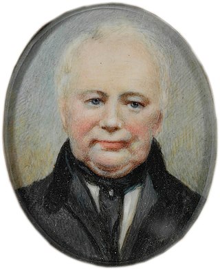
William Lawson, MLC was a British soldier, explorer, land owner, grazier and politician who migrated to Sydney, New South Wales in 1800. Along with Gregory Blaxland and William Wentworth, he pioneered the first successful crossing of the Blue Mountains by British colonists.

<span class="mw-page-title-main">Georges Hall</span> Suburb of Sydney, New South Wales, Australia

Georges Hall, a suburb of local government area City of Canterbury-Bankstown, is located 24 kilometres south-west of the Sydney central business district in the state of New South Wales, Australia, and is part of the South-western Sydney region.

<span class="mw-page-title-main">Rooty Hill historic site</span> Historic site in New South Wales, Australia

Rooty Hill is a heritage-listed historic site and now parkland at Eastern Road, Rooty Hill, City of Blacktown, New South Wales, Australia. It was built from 1802 to 1828. It is also known as The Rooty Hill and Morreau Reserve. The property is owned by the Presbyterian Church (NSW) Property Trust. It was added to the New South Wales State Heritage Register on 13 June 2007.

<span class="mw-page-title-main">Prospect, New South Wales</span> Suburb of Sydney, New South Wales, Australia

Prospect is a suburb of Sydney, in the state of New South Wales, Australia. Prospect is located 32 kilometres west of the Sydney central business district in the local government area of the City of Blacktown and is part of the Greater Western Sydney region. One of the oldest suburbs in Sydney, Prospect takes its name from the prominent nearby landmark of Prospect Hill - from the top of which people could get a prospect of the surrounding countryside.

<span class="mw-page-title-main">Greystanes, New South Wales</span> Suburb of Greater Western Sydney, New South Wales, Australia

Greystanes is a suburb in Greater Western Sydney, New South Wales, Australia. Greystanes is located 25 kilometres west of the Sydney central business district in the local government area of Cumberland Council. Founded in the late 1790s, Greystanes is one of the oldest suburbs in Sydney.

<span class="mw-page-title-main">Pemulwuy, New South Wales</span> Suburb of Greater Western Sydney, New South Wales, Australia

Pemulwuy is a suburb in Greater Western Sydney, in the state of New South Wales, Australia. Pemulwuy is located 30 kilometres west of the Sydney central business district in the local government area of the Cumberland Council. Pemulwuy is home to the highest point between the Blue Mountains and Sydney, the summit of Prospect Hill.

<span class="mw-page-title-main">Prospect Hill (New South Wales)</span>

Prospect Hill is a heritage-listed hill in Pemulwuy and Prospect in the greater western region of Sydney, New South Wales, Australia. Situated about 30 kilometres west of central Sydney, the hill is Sydney's largest body of igneous rock and is higher than the ridges of the Cumberland Plain around it, with its present-day highest point being 117 metres high, although before its summit was quarried away it rose to a height of 131 metres above sea level.

<span class="mw-page-title-main">Former Great Western Road Alignment, Prospect</span> Historic road in New South Wales, Australia

Former Great Western Road Alignment, Prospect is a heritage-listed stretch of road, now divided into four separately-named sections of road and partially divided by the M4 Western Motorway at, Prospect, City of Blacktown, Sydney, New South Wales, Australia. The road was initiated by Governor Lachlan Macquarie, likely surveyed by George Evans and built from 1815 to 1818 by William Cox. It is also known as The Western Road, The Great Western Road, The Old Western Road and The Great Western Highway. The property is owned by Blacktown City Council. It was added to the New South Wales State Heritage Register on 27 June 2014.

<span class="mw-page-title-main">Blacktown Native Institution Site</span> Historic site in New South Wales, Australia

The Blacktown Native Institution Site is the heritage-listed site of a former residential school for Aboriginal and Māori children at Richmond Road, Oakhurst, City of Blacktown, New South Wales, Australia. It was built from 1822. The site has also been known as Parramatta Native Institute, Black Town Institute, The Blacktown Site, Lloydhurst, BNI, Epping Estate, Epping Forest Estate and Native Institution Centre. The property is owned by Blacktown City Council, Department of Planning and Infrastructure and Landcom. It was added to the New South Wales State Heritage Register on 18 November 2011.

<span class="mw-page-title-main">Prospect Post Office</span> Historic site in New South Wales, Australia

Prospect Post Office is a heritage-listed former post office and shop at 23 Tarlington Place, Prospect, City of Blacktown, New South Wales, Australia. It was designed by James Watts and built by Watts from 1880 to 1890. The property is owned by the City of Blacktown. It was added to the New South Wales State Heritage Register on 2 April 1999.

<span class="mw-page-title-main">Royal Cricketers Arms Inn</span> Historic site in New South Wales, Australia

Royal Cricketers Arms Inn is a heritage-listed Australian pub at 385 Reservoir Road, Prospect, City of Blacktown, New South Wales, Australia. It was designed by James Manning and built by James Manning. It is also known as Cricketers Arms Inn. It was added to the New South Wales State Heritage Register on 2 April 1999.

<span class="mw-page-title-main">St Bartholomew's Anglican Church and Cemetery, Prospect</span> Church in New South Wales, Australia

St Bartholomew's Anglican Church and Cemetery is a heritage-listed former Anglican church and cemetery at Ponds Road, Prospect, City of Blacktown, New South Wales, Australia. It was designed by Henry Robertson and built from 1838 to 1840 by James Atkinson. It was added to the New South Wales State Heritage Register on 2 April 1999. Since 1975, the site has been leased to the Council of the City of Blacktown.

<span class="mw-page-title-main">Bungarribee Homestead Site</span> Historic site in New South Wales, Australia

The Bungarribee Homestead Site is a heritage-listed archaeological site at the location of the former Bungarribee Homestead. The site is located at Doonside Road, Doonside, City of Blacktown, Sydney New South Wales, Australia. It was added to the New South Wales State Heritage Register on 8 December 2000.

<span class="mw-page-title-main">Prospect Reservoir Valve House</span> Historic site in New South Wales, Australia

The Prospect Reservoir Valve House is a heritage-listed waterworks located at East of Reservoir, Prospect in the City of Blacktown local government area of New South Wales, Australia. Situated on the grounds of Prospect Nature Reserve, it was designed and built by The Metropolitan Board of Water Supply and Sewerage. The property is owned by Sydney Water and Water NSW, agencies of the Government of New South Wales. It was added to the New South Wales State Heritage Register on 18 November 1999.

<span class="mw-page-title-main">Brush Farm</span> Historic site in New South Wales, Australia

Brush Farm is a heritage-listed former farm, residence and vineyard and now tourist attraction, community facility, exhibition venue and meeting venue at Marsden Road, Eastwood of the City of Ryde local government area of New South Wales, Australia. It was built from 1794 to 1894. It is also known as Home for Boys, Eastwood Home for Mothers and Babies and Brush Farm Home for Mentally Deficient Children, and Brush Farm Girls' Home. The property is owned by City of Ryde. It was added to the New South Wales State Heritage Register on 2 April 1999.

<span class="mw-page-title-main">Jarvisfield, Picton</span> Historic site in New South Wales, Australia

Jarvisfield is a heritage-listed former pastoral property and now golf course at Old Hume Highway, Picton, Wollondilly Shire, New South Wales, Australia. It was designed by William Weaver, architect-engineer, and built from 1815 to 1864. It is also known as Wilton. The property is owned by the Wollondilly Shire Council. It was added to the New South Wales State Heritage Register on 2 April 1999.

<span class="mw-page-title-main">Mountain View, Richmond</span> Historic site in New South Wales, Australia

Mountain View is a heritage-listed residence at 22 Inalls Lane, Richmond, City of Hawkesbury, New South Wales, Australia. It was built from 1804 to 1870 by Lewis Jones and James Vincent. It is also known as Dight's Farm. It was added to the New South Wales State Heritage Register on 2 April 1999.

<span class="mw-page-title-main">Macquarie Field House</span> Historic site in New South Wales, Australia

Macquarie Field House is a heritage-listed former farm, private school and homestead and now residence at Quarter Sessions Road, Macquarie Fields, City of Campbelltown, New South Wales, Australia. It was designed by James Meehan, James Hume and built from 1810 to 1843 by James Meehan ; Mr Burns. It is also known as Macquarie Field House and the Meehan remains; Macquariefield, Macquarie Fields and Macquarie Field. The property is privately owned. It was added to the New South Wales State Heritage Register on 2 April 1999.

<i>Varroville</i> (homestead) Historic site in New South Wales, Australia

Varroville is a heritage-listed former farm and now rural residence at 196 St Andrews Road, Varroville in the City of Campbelltown local government area of New South Wales, Australia. It was designed by Weaver and Kemp and built from 1810 to 1859. It is also known as Varro Ville and Varra Ville. The property is privately owned. It was added to the New South Wales State Heritage Register on 2 April 1999.

Parramatta Archaeological Site is a heritage-listed urban facility at 45 Macquarie Street, Parramatta, City of Parramatta, New South Wales, Australia. It is also known as Archaeological Site and Associated Artefacts and V by Crown; 45 Macquarie Street; Wheatsheaf Hotel & Convict Hut Archaeological Site; Foundry/Blacksmithy; Industrial Archaeological Site. The property is privately owned. The site was added to the New South Wales State Heritage Register on 5 July 2019.

References

  1. 1 2 3 4 5 6 7 8 9 10 11 12 13 14 15 16 17 18 19 20 21 22 23 24 "Veteran Hall - House Remains". New South Wales State Heritage Register . Department of Planning and Environment. H01351. Retrieved 2 June 2018. CC-BY icon.svg Text is licensed by State of New South Wales (Department of Planning and Environment) under CC-BY 4.0 licence .
  2. Pollon, 1988, 116, amended Read, S.,2006
  3. Kaiser-Glass, pers.comm., 25/11/2015

Bibliography

Attribution

CC BY icon-80x15.png This Wikipedia article was originally based on Veteran Hall - House Remains , entry number 01351 in the New South Wales State Heritage Register published by the State of New South Wales (Department of Planning and Environment) 2018 under CC-BY 4.0 licence , accessed on 2 June 2018.

Commons-logo.svg Media related to Veteran Hall Remains at Wikimedia Commons