Karaikudi is the largest city in Sivaganga district in the Indian state of Tamil Nadu. Karaikudi Urban Agglomoration is the 21st largest urban area of Tamil Nadu based on 2011 census data. It is part of the area commonly referred to as "Chettinad" and has been declared a City Municipal Corporation by the Government of Tamil Nadu, on account of the palatial houses built with limestone called Kaarai veedu. For this reason, the place is sometimes called Kaarai Nagar locally. The newly formed Karaikudi Municipal Corporation spreads about 94.31 km2 (36.41 sq mi) which undergoes major developments as part of Government Schemes.

Omalur is a panchayat town and headquarters of Omalur taluk in the Salem District in the Indian state of Tamil Nadu. It is situated on the National Highway 7 between 11° 73333" latitude and 78° 06667" longitude. It has a population of about 13,600. Agriculture, leather and handloom textiles are the major businesses.

Ilaiyangudi is a town in Sivaganga district, Tamil Nadu state, India. It is the center of government for the surrounding tehsils. The town has a predominant Tamil Rowthers population. The Tamil Muslim community was traditionally engaged in Business. Bazaar(Kadai Theru) is the central business district.
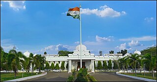
Ramanathapuram, also known as Ramnad, is a city and a municipality in Ramanathapuram district in the Indian state of Tamil Nadu. It is the administrative headquarters of Ramanathapuram district and the second largest town in Ramanathapuram district.
Annavasal is a panchayat town in Pudukkottai district in the state of Tamil Nadu, India. Which is a part of Tiruchirapalli District before 14 January 1974 and merged with Pudukkottai district 14 January 1974. Annavasal is famous for jallikatu conduct at the month of February and weekly market
Arimalam is a Town Panchayath in the district of Pudukkottai, in the state of Tamil Nadu, India. As of 2011 Census, the town had a population of 19,948.
Mallur is a village or town council (panchayat) in the Salem district, which is located in the Indian state of Tamil Nadu.

Manamadurai is a Municipality Town in Sivaganga district in the Indian state of Tamil Nadu. Manamadurai falls under Manamadurai Legislative assembly. It is a river based settlement town. River Vaigai makes its way through the town bifurcating it into two parts.
Mohanur is a taluk in the Namakkal district of the Indian state of Tamil Nadu. The Mohanur Panchayat Union includes Mohanur Town, Pettapalayam, Manappalli, Rasipalayam, Kumaripalayam, Sengappalli, Ediyar, Peramandampalayam, Ariyur, Aniyapuram, and Valayapatti. It is linked to Tiruchirappalli, Salem, Erode, and Karur districts by road.

Nattarasankottai is a village in Sivaganga district in the Indian state of Tamil Nadu.
Sankarapuram is a census town panchayat of Sivaganga district in the southern Indian state of Tamil Nadu. This census town is located in southwestern Karaikudi on national highway NH536. Currently the town panchayat has 15 wards with two villages consisting of Sakkottai and Sankarapuram, administered by village officers.
Sankar Nagar or Thalaiyuthu is a panchayat town in Tirunelveli district in the Indian state of Tamil Nadu. It is located about 8 km north of Tirunelveli on the way to Madurai on highway NH 44. The town is popularly called as Sankar Nagar because of the Sankar Cement factory which initiated settlement in the area.
Villukuri is a small village in Kanyakumari district, Tamil Nadu, India.

Tiruppattur, also spelt Tiruppathur or Thiruppathur, is a Taluk, Town Panchayat in Sivaganga district in the India state of Tamil Nadu. This town is located 22 km from Karaikudi and 27 km from Sivaganga. It is famous for Thiruthalinathar Temple, a Padal petra sthaalam, the sixth of 14 in the Pandyan region.
Kottaipattinam is a village panchayat located in the Pudukkottai district of Tamil Nadu state, India. The latitude 9.97908 and longitude 79.198595 are the geocoordinate of the Kottaipattinam. The Kottaipattinam Population is 13454. Male is 6668. Female is 6786.
Singampunari is a revenue block in the Sivaganga district of Tamil Nadu, India. It has a total of 30 panchayat villages.
Pudur is a small town in Ilayangudi Taluk, Sivagangai District of Tamil Nadu, India. It is located on State Highway 28 connecting Karaikudi and Ilayangudi.
Kallal is a village in Sivaganga District of Tamil Nadu in India. Kallal block Panchayat is one of the 12 block Panchayat coming under Sivaganga District administration of Tamil Nadu state in India. Kallal is well connected by both Road transport and Rail network. Both state owned TNSTC and Private Omni Bus services are operated from Kallal to different parts of Tamil Nadu state.
Samanthamalai is a panchayat in Veppanapalli Taluk in Krishnagiri district of Tamil Nadu, India. The place were part of Adi Karnataka or Samanta Kula have settled. It is located in 8 kilometres (5.0 mi) north of District headquarters Krishnagiri,14 kilometres (8.7 mi) from Veppanapalli. 268 km from State capital Chennai. and 87 kilometres (54 mi) from Bangalore. Its Pincode is 635115.
Kethureddipatti is a Village Panchayat in Dharmapuri district of Tamil Nadu, India. It is located at 30 km (19 mi) from Dharmapuri town. It comes under Pappireddipatti taluk and Kadathur Block. It belongs to Pappireddipatti State Legislative Assembly Constituency and Dharmapuri Loksabha Constituency. It consists of nine panchayat wards. As per the 2011 Census, the total population of this village is 4,808.

