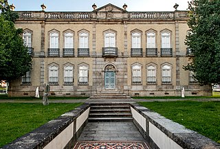
Camarate is a former civil parish in the municipality of Loures, Lisbon District, Portugal. In 2013, the parish merged into the new parish Camarate, Unhos e Apelação. With a population of 23,000 inhabitants in 2001, the parish of Camarate extends into an area of 5.52 km².

São Pedro is one of the five urban civil parishes of the municipality of Angra do Heroísmo on the island of Terceira in the Portuguese archipelago of the Azores. The population in 2011 was 3,460, in an area of 3.66 square kilometres (1.41 sq mi). The parish has a median elevation of 7 metres (23 ft).

Feteiras is a civil parish in the municipality of Ponta Delgada in the Portuguese archipelago of the Azores. It is situated in the western part of the island of São Miguel, on the south coast. The population in 2011 was 1,571, in an area of 23.53 square kilometres (9.08 sq mi).

Maia is a civil parish in the municipality of Ribeira Grande in the Portuguese archipelago of the Azores. The population in 2011 was 1,900, in an area of 21.97 km². Maia is the largest parish by area in Ribeira Grande.

Água de Alto is a civil parish in the municipality of Vila Franca do Campo on the island of São Miguel in the Portuguese archipelago of the Azores. The population in 2011 was 1,788, in an area of 18.41 km2.

Ponta Garça is a civil parish in the municipality of Vila Franca do Campo in the Portuguese archipelago of the Azores. The population in 2011 was 3,547, in an area of 29.35 km2. It is the largest parish in Vila Franca do Campo.
Ribeira das Tainhas is a civil parish in the municipality of Vila Franca do Campo in the Portuguese archipelago of the Azores. The population in 2011 was 703, in an area of 9.59 km2.

Água Retorta is a civil parish in the municipality of Povoação, on the island of São Miguel in the Portuguese archipelago of the Azores. The population in 2011 was 489, in an area of 12.55 km2. Situated along the southeast coast, it is the smallest and most eastern parish in the municipality.

Vila Franca de Xira is a city and municipality in the Lisbon District in Portugal. The population in 2021 was 137,659, in an area of 318.19 km2.

Paredes is a city and a municipality in Porto District, in northern Portugal. The population in 2021 was 84,354, in an area of 156.76 square kilometres (60.53 sq mi).

Azambuja is a municipality in the Portuguese district of Lisbon, in the historical region of Ribatejo. The population in 2011 was 21,814, in an area of 262.66 km2. Since 2002, it was integrated into the NUTS III statistical subregion of Lezíria do Tejo.

Galveias is a civil parish in the municipality of Ponte de Sor, in the Portuguese northern Alentejo, district of Portalegre. The population in 2011 was 1,061, in an area of 79.83 km2. The small parish developed under the patronage of Order of Aviz, endowments from the Marquês Ratão family.
Póvoa de Santa Iria e Forte da Casa is a freguesia in the municipality of Vila Franca de Xira, Portugal. It was formed in 2013 by the merger of the former freguesias of Póvoa de Santa Iria and Forte da Casa. The population in 2021 was 40,905, in an area of 9.16 km².
Abraveses is a Freguesia in the municipality (concelho) of Viseu, in the Portuguese central subregion of Dão-Lafões. The population in 2011 was 8,539, in an area of 12.23 km². Abraveses lies 3 kilometres (1.9 mi) north of the centre of the city of Viseu, intimately linked to the historic settlement, and located along an extensive connection between Viseu-Castro Daire and Viseu-São Pedro do Sul.
Castanheira do Ribatejo e Cachoeiras is a civil parish in the municipality of Vila Franca de Xira, Portugal. It was formed in 2013 by the merger of the former parishes Castanheira do Ribatejo and Cachoeiras. The population in 2011 was 8,266, in an area of 26.78 km2.

Forte da Casa is a town and former civil parish in the municipality of Vila Franca de Xira, Portugal. Since 2013, it is part of the civil parish Póvoa de Santa Iria e Forte da Casa. Its population in 2011 was 11,056 in an area of 3.96 km2.

Alhandra, São João dos Montes e Calhandriz is a civil parish in the municipality of Vila Franca de Xira, Portugal. It was formed in 2013 by the merger of the former parishes Alhandra, São João dos Montes and Calhandriz. The population in 2011 was 12,866, in an area of 27.54 km2.
Alverca do Ribatejo e Sobralinho is a civil parish in the municipality of Vila Franca de Xira, Portugal. It was formed in 2013 by the merger of the former parishes Alverca do Ribatejo and Sobralinho. The population in 2011 was 36,120, in an area of 23.92 km2.

Póvoa de Santa Iria is a city and former freguesia in the municipality of Vila Franca de Xira, Portugal. Since 2013, it is part of the freguesia Póvoa de Santa Iria e Forte da Casa. Its population in 2011 was 29,348.

The 2014 Portugal legionellosis outbreak was an outbreak of legionellosis in multiple cities of the Lisbon district in Portugal, caused by the release of Legionella bacteria from the cooling towers of a fertilizer plant in Forte da Casa, Vila Franca de Xira. It began on 7 November 2014 and affected mostly people in Póvoa de Santa Iria, Forte da Casa and Vialonga, in the municipality of Vila Franca de Xira. Paulo Macedo, the Portuguese Health Minister, declared the outbreak extinct on 21 November. The outbreak resulted in 375 cases and 12 casualties.


