
Sint-Martens-Lierde is a village which is part of the municipality of Lierde. It is located in the Denderstreek and in the Flemish Ardennes, the hilly southern part of the Belgian province of East Flanders.

Hemelveerdegem is a village and borough which makes up part of the municipality of Lierde in the Denderstreek in the Belgian province of East Flanders. The village and estate were ruled from 1752 by the armigerous Boelare family.

Sint-Maria-Lierde is a village which makes up part of the municipality of Lierde. It is located in the Denderstreek and in the Flemish Ardennes, the hilly southern part of the Belgian province of East Flanders.
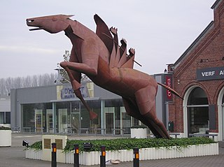
Grembergen is a town in the municipality of Dendermonde in the Denderstreek in the province of East Flanders in Belgium. It is often confused with the municipality of Grimbergen in the province of Flemish Brabant.

Nederbrakel is a town in the municipality of Brakel. It is located in the Denderstreek and in the Flemish Ardennes, the hilly southern part of the province of East Flanders, Belgium. With 5,972 residents as of 2000, it forms the largest individual part of the municipality. Nederbrakel is located near the language border.
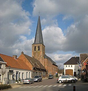
Michelbeke is a village in the municipality of Brakel, Belgium. It is located in the Denderstreek and in the Flemish Ardennes, the hilly southern part of the province of East Flanders, Belgium. It was itself a municipality until the fusion of the municipalities on 1 January 1971.
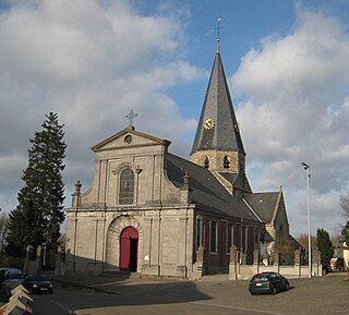
Sint-Maria-Oudenhove is a village in the Denderstreek and in the Flemish Ardennes, the hilly southern part of the province of East Flanders, Belgium.

Beerlegem is a village belonging to the municipality of Zwalm. It is located in the Flemish Ardennes, the hilly southern part of the province of East Flanders, Belgium. Until 1970, it was an independent municipality.
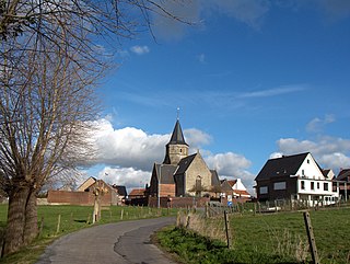
Godveerdegem is a village belonging to the municipality of Zottegem. It is located on the Molenbeek-Ter Erpenbeek in the Denderstreek and in the Flemish Ardennes, the hilly southern part of the province of East Flanders, Belgium.
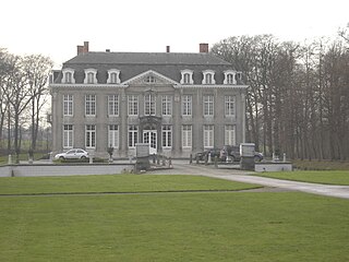
Leeuwergem is a village belonging to the municipality of Zottegem. It is located on the Molenbeek, in the Denderstreek and Flemish Ardennes, which is part of the hilly southern part of the East Flanders province, Belgium.

Maarke-Kerkem is a village in the Flemish Ardennes, the hilly southern part of the province of East Flanders, Belgium. It is formed by two hamlets, Maarke and Kerkem, and is incorporated in the municipality of Maarkedal. It is hosting the Saint Vincent Chapel, which was first erected around 1100.

Erwetegem is a village and deelgemeente (sub-municipality) belonging to the municipality of Zottegem. It is located in the Denderstreek and in the Flemish Ardennes, the hilly southern part of the province of East Flanders, Belgium. Erwetegem used to an independent municipality until 1970.

Broechem is a part of the municipality of Ranst in Antwerp Province, Flemish Region, Belgium. The village is located on the highest point of the region.
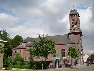
Vinderhoute is a village in the municipality of Lievegem in the province of East Flanders in Belgium. It is located in the Flemish Valley about 6 kilometres (3.7 mi) north-west of Ghent.

Hansbeke is a village and deelgemeente (sub-municipality) in the municipality of Deinze in the Belgian province of East Flanders. The village is located about 13 kilometres (8.1 mi) west of Ghent.

Bellem is a village and deelgemeente (sub-municipality) in the municipality of Aalter in the Belgian province of East Flanders. The village was originally called Bethlehem. Bellem is located about 16 kilometres (9.9 mi) west of Ghent.

Rutten is a village in the Tongeren municipality of the Limburg province in the Flemish Community of Belgium. The village is located in the Haspengouw region, and was a separate municipality until its merger into Tongeren in 1977.
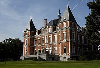
Petegem-aan-de-Schelde is a village and former municipality in the Wortegem-Petegem municipality in the Belgian province of East Flanders. The village officially changed its name from Petegem into Petegem-aan-de-Schelde in order to distinguish itself from Petegem-aan-de-Leie. In 1971, the municipality merged into Wortegem-Petegem.

Zegelsem is a village in the municipality of Brakel in the province of East Flanders, Belgium. Zegelsem is an agricultural community in the Flemish Ardennes. It is located about 26 kilometres (16 mi) south of Ghent.
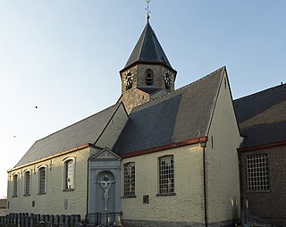
Ouwegem is a village and deelgemeente (sub-municipality) in the municipality of Kruisem in the province of East Flanders in Belgium. The village is located on the edge of the Flemish Ardennes and about 17 kilometres (11 mi) south-west of Ghent.


