
Bridal Veil Falls Provincial Park is a BC Park located on the Trans-Canada Highway just east of Rosedale, British Columbia, Canada, part of the City of Chilliwack. The community of Bridal Falls is located adjacent to the falls and park as well as the interchange between the Trans-Canada and BC Highway 9 and has a variety of highway-based tourism services. Access to the falls requires a short hike from the parking lot and well groomed trails, taking most groups 15-25 minutes.
Butler Ridge Provincial Park is a provincial park in British Columbia, Canada. Located on the northern shore of the Peach Reach arm of Williston Lake, 20 km northwest of Hudson's Hope, the park covers an area of 6,694 ha. Within the Peace Foothills ecosection, it includes three biogeoclimatic zones: the Engelmann Spruce-Subalpine Fir, the Sub-Boreal Spruce, and the Black and White Boreal Spruce zones. This cold and moist area is used as winter ranges by caribou, Stone's sheep, moose, and elk. It is recognized by the province and the Treaty 8 Tribal Association as an area that has traditionally been used by First Nations people. The park is used for fishing, hunting, trapping, hiking, and wildlife/nature viewing, cross-country skiing. There is a boat launch for Williston Lake, and motorized recreation.

Tā Chʼilā Provincial Park, formerly Boya Lake Provincial Park, is a provincial park located in the Stikine Region of British Columbia, Canada. The park located 120 km north-by-northwest of the community of Dease Lake near BC Highway 37. Boya Lake is named for Charlie Boya, a First Nations man from the area.
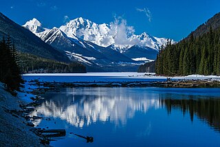
Duffey Lake Provincial Park is a provincial park in British Columbia, Canada, located at the lake of the same name, which lies along BC Highway 99 just east of the summit of Cayoosh Pass. The lake's inflow and outflow are Cayoosh Creek. The park's highest point is Mount Rohr at the westernmost boundary.
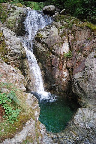
Davis Lake Provincial Park is a 185 acres (0.75 km2) park in British Columbia, Canada, established as a protected provincial park in October 1963. It is located east of the southern end of Stave Lake, northeast of Mission, British Columbia, approximately 18 km north on Sylvester Rd from BC Highway 7. There are campgrounds and beaches at the south end of the lake, access is walk-in only via a 1 km unmaintained gravel road.

Darke Lake Provincial Park is a provincial park in British Columbia, Canada located west of Okanagan Lake, southwest of the town of Peachland in that province's Okanagan region. The park is approximately 1,470 hectares in size and was established in 1968 as a provincial park Darke Lake, also mapped historically as Fish Lake, is northwest of Summerland and is named after Silas Robert Darke, an early settler in the 1890s. In 1941 Howard Clark bought Fish Lake from Clyde Stewart. He was a hunting and fishing guide that ran the camp, as well as raised four children with his wife Hazel. The children were Betty, Roger, Dale & Audrey. In 1959 he sold it to Jake and Betty Enns.
Edge Hills Provincial Park is a provincial park in British Columbia, Canada, located west of the town of Clinton. The Edge Hills flank the wall of the Fraser Canyon north of Moran Canyon and form a small fore-range between the river and the higher Marble Range just east. Access to the Edge Hills is via the Jesmond Road, which cuts north off the Pavilion Mountain Road at Kelly Lake. A spur road from the Jesmond Road west goes to an overlook atop the Edge Hills, known as Cougar Point.
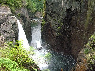
Elk Falls Provincial Park is a provincial park in British Columbia, Canada. It is 1,807 hectares in size and is located at the east end of John Hart Lake on the northwest side of the city of Campbell River, on Vancouver Island.
Eneas Lakes Provincial Park is a provincial park in British Columbia, Canada, located west of the town of Peachland, to the south of Peachland Creek. The park is approximately 1036 ha. in size and was established in 1968. The Eneas Lakes lie at the head of Finlay Creek.
Kekuli Bay Provincial Park, formerly Kalamalka West Provincial Park, is a provincial park in British Columbia, Canada, located on the west shore of Kalamalka Lake on BC Highway 97 south of Vernon. The lake is popular for waterskiing and boating, and the park includes a boat launch, as well as a campground with a view of the lake. The park was established in 1990. Its size is about 57 hectares.
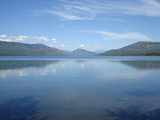
Kinaskan Lake Provincial Park is a provincial park in British Columbia, Canada, located at the south end of Kinaskan Lake along the Stewart-Cassiar Highway near Mowdade Lake and southeast of Mount Edziza. At the south end of the park, the Iskut River, of which the lake is an expansion, spills over 12.2-metre Cascade Falls. The park is approximately 800 ha. in size.
Purden Lake Provincial Park is a provincial park in British Columbia, Canada. It is located east of Prince George. It encompasses the north and east sides of Purden Lake. It was established in August 1971 and covers 2,521 hectares. In 2018, Purden became the first accessible park in British Columbia, adding wheelchair ramps and specialist playground equipment.
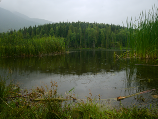
Seeley Lake Provincial Park is a provincial park in British Columbia, Canada, located within the asserted traditional territory of the Gitxsan First Nation, south of the confluence of the Skeena and Bulkley Rivers.
Syringa Park is a provincial park on the east shore of Lower Arrow Lake in the West Kootenay region of southeastern British Columbia. At the foot of the Norns Range, Tulip Creek passes through the centre, and Syringa Creek is closer to the southeastern boundary. The park is about 19 kilometres (12 mi) west of Castlegar via Broadwater Rd.
Steelhead Provincial Park is a provincial park in the Thompson Country region of south central British Columbia, Canada. The facility is at the west end of Kamloops Lake near the town of Savona. On BC Highway 1, the locality is by road about 38 kilometres (24 mi) east of Cache Creek and 45 kilometres (28 mi) west of Kamloops.

Summit Lake Provincial Park is a Class C provincial park located southeast of the community of Summit Lake in the Central Kootenay region of British Columbia, Canada.
Tyhee Lake Provincial Park is a provincial park in British Columbia, Canada, located near the town of Smithers in the Bulkley Valley.

Castle Towers Mountain is a triple summit mountain on the east side of Garibaldi Lake in southwestern British Columbia, Canada. The first ascent party from the BC Mountaineering Club named the mountain after its appearance in August 1911.

Lac du Bois Grasslands Protected Area is a protected area located north of Kamloops in British Columbia, Canada. The protected area was established by BC Parks on 30 April 1996 to protect a unique mixed forest-grassland ecosystem overlooking the North and South forks of the Thompson River.
Columbia Lake Ecological Reserve is a nature reserve on Columbia Lake in the East Kootenay region of British Columbia, Canada, located on the east side of Columbia Lake just north of the village of Canal Flats.


