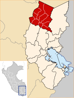
Sandia Province is a province of the Puno Region in Peru. The capital of the province is the city of Sandia.

Carabaya Province is a province of the Puno Region in the southern part of Peru. It is bounded on the north by the Madre de Dios Region, on the east by the Sandia Province, on the south by the provinces of Azángaro, Melgar and Putina and on the west by the Cusco Region. The capital of the province is the city of Macusani.
Cuyocuyo District is one of ten districts of the province Sandia in Peru.
Quiaca District is one of ten districts of the province Sandia in Peru.
Wila Quta or Wilaquta may refer to:

Ritipata is a 5,350-metre-high (17,552 ft) mountain in the Apolobamba mountain range in the Andes of Peru. It is located in the Puno Region, Putina Province, Ananea District, as well as in the Sandia Province, Quiaca District. Ritipata is situated south-east of the mountain Vilacota, east of the mountain Ananea and north-west of the mountain Chapi, next to it.

Lake Jochajucho is a lake in Peru located in the Puno Region, Sandia Province, Patambuco District. Lake Jochajucho lies west of Patambuco, north-west of the village of Punayllu and north-east of the mountain Pacchapata.

Pumajolluni is a mountain in the Carabaya mountain range in the Andes of Peru at a lake of the same name. The mountain is about 5,200 metres (17,060 ft) high. It is located in the Puno Region, Carabaya Province, on the border of the districts Ajoyani, Coasa and Ituata. It lies southwest of the mountain Chullumpirini.

Jorhuari or Ccorhuari is a mountain in the Apolobamba mountain range in the Andes of Peru, about 5,200 metres (17,060 ft) high. It is located in the Puno Region, Putina Province, Ananea District, and in the Sandia Province, Cuyocuyo District. It lies southwest of the mountain Vilacota.

Utkhuqaqa or Utkhu Qaqa is a 5,049-metre-high (16,565 ft) mountain in the Apolobamba mountain range in the Andes of Peru. It is located in the Puno Region, Sandia Province, Cuyocuyo District. It lies northwest of the mountain Wilaquta and northeast of Qurwari and Janq'u Uma. Little streams named Qullqipirwa (Jolljepirhua), Janq'u Uma (Janjouma) and Utkhuqaqa (Utjujaja) flow along its slopes. They are the origin of the river Lawa Lawani which runs to the north. It belongs to the watershed of the Inambari River.

Janq'u Uma is a mountain in the north of the Apolobamba mountain range in the Andes of Peru, about 4,900 metres (16,076 ft) high. It is located in the Puno Region, Sandia Province, Cuyocuyo District. Janq'u Uma lies northwest of the mountain Wilaquta, northeast of Qurwari and southwest of Utkhuqaqa. Two little streams named Janq'u Uma (Janjouma) and Qullqipirwa (Jolljepirhua) originate west and east of the mountain. They flow to the river Lawa Lawani which runs to the north. It belongs to the watershed of the Inambari River.

Riticunca is a mountain in the Andes of Peru, about 5,000 metres (16,404 ft) high. It is located in the Puno Region, Carabaya Province, Crucero District, and in the Sandia Province, Patambuco District, northwest of the mountain Laramani. East of Riticunca there is a group of small lakes, among them Riticocha and Yanacocha. The lake Jochajucho is situated in the Ritipata valley southeast of the mountain.

K'ayrani is a mountain north of the Apolobamba mountain range in the Andes of Peru, about 4,600-metre (15,092 ft) high. It is located in the Puno Region, Sandia Province, Quiaca District. Near K'ayrani there are various little lakes. The largest of them is Ch'uxñaquta in the southwest.

Qaqinkurani is a mountain north of the Apolobamba mountain range in the Andes of Peru, about 4,200 metres (13,780 ft) high. It is located in the Puno Region, Sandia Province, Quiaca District, southwest of Quiaca. It lies at the Chuqichampi River.

Aricoma is a mountain in the Andes of Peru, about 5,350 metres (17,552 ft) high. It is located in the Puno Region, Carabaya Province, Crucero District, and in the Sandia Province, Limbani District. The mountain lies east of Aricoma Lake and northwest of Jalahuana.

Jalahuana or Jalahuaña is a 5,325-metre-high (17,470 ft) mountain in the Andes of Peru. It is located in the Puno Region, Carabaya Province, Crucero District, and in the Sandia Province, on the border of the Limbani District and the Patambuco District. Jalahuana lies east of Aricoma Lake between the mountain Aricoma in the northwest and Riticunca in the southeast to south.

Apachita is a 5,168-metre-high (16,955 ft) mountain in the Andes of Peru. It is located in the Puno Region, Carabaya Province, Crucero District. Apachita lies west of the peaks of Ariquma, north of Ariquma Lake and northeast of Wiluyuq Qucha and the peak of Wiluyuq Urqu.

Qaqa Wasi or Qaqawasi is a mountain in the Andes of Peru, about 4,800 metres (15,748 ft) high. It is located in the Puno Region, Sandia Province, Patambuco District. It lies northeast of the mountain Rit'ikunka. South of Qaqa Wasi there is a group of small lakes, among them Rit'iqucha and Yanaqucha. The lake Quchak'uchu is situated in the Rit'ipata valley southeast of the mountain.

Puka Pukayuq is a mountain in the Andes of Peru, about 4,800 metres (15,748 ft) high. It is located in the Puno Region, Sandia Province, Limbani District It lies northeast of the peaks of Ariquma, Ankayuq K'uchu and Wirta Pata, and north of a lake named Ch'uxñaquta.

Pukara is a mountain in the Andes of Peru, about 4,200-metre (13,800 ft) high, with an archaeological site on top. It is located in the Puno Region, Sandia Province, Patambuco District, southwest of Patambuco. The pre-Inca funerary site is also known as Trinchera. The place was declared a National Cultural Heritage by Resolución Directoral Nacional No. 296/INC-2003 by the National Institute of Culture. It consists of tombs, walls, houses, squares and tunnels.


