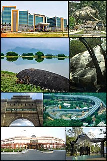
Erode District is a district in the Kongu Nadu region of the state of Tamil Nadu, India. It was the largest district by area in the state before the formation of Tirupur District. The headquarters of the district is Erode. It is divided into two revenue divisions, Erode and Gobichettipalayam, and is further subdivided into 10 taluks. Periyar district was a part of Coimbatore District before its division into two on September 17, 1979 and was renamed as Erode District in 1996.It is consider to be a largest city by area in Tamil Nadu covering above 8000 sq.km. As of 2011, the district had a population of 2,251,744 with a sex-ratio of 993 females for every 1,000 males, much above the national average of 929.
Dharmapuri is a city in Kongu Nadu region in the western part of Tamil Nadu, India. The city is located at 126 km from Bangalore, 200 km from Coimbatore, 260 km from Mysore, and 300 km from Chennai. It is located between latitudes N 11 47’ and 12 33’ and longitudes E 77 02’ and 78 40’. The total geographical area of Dharmapuri District is 4497.77 km2, that is, 3.46% of Tamil Nadu. And it is one of top leading Mango cultivator and producer of state.

Kadayanallur is the second largest town in Tirunelveli district in Tamil Nadu, India.

Tirunelveli district is a district of Tamil Nadu state in South India. It is the largest district in terms of area with Tirunelveli as its headquarters. Tirunelveli District was formed on 1 September 1790 by the British East India Company, and comprised the present Tirunelveli and Thoothukudi districts and parts of Virudhunagar and Ramanathapuram district. As of 2011, the district had a population of 3,077,233.

Gudalur is a municipality and taluk in Nilgiris district in the Indian state of Tamil Nadu. Gudalur is one of the major towns in West TamilNadu and is located at 52 km from Ooty in the hilly terrain of The Nilgiris district. It is situated at the junction of Tamil Nadu, Kerala and Karnataka. Gudalur is derived from Moundadan Chetty Community language, Godalu + Ooru (village). It is also believed that the name derived from Tamil words "koodal" and "ooru" (village). Tea plantations dot the whole region, and the regional economy is heavily dependent on the tea industry.This land was an offspring to the exploration done by the British during the pre-independence period to cultivate tea plantation. Being a satellite town between Ooty and Mysore, both tourist spots, Gudalur has the prospect of developing into another tourist destination. Gudalur is a place where one can see people from the three states of Tamil Nadu, Kerala, and Karnataka live together cordially.
Tiruchengode is a City and Municipality located in the southern Indian state of Tamil Nadu. And it is the first city formed in Namakkal district and the second most populated urban area in Namakkal district, And it is a major Suburb for both The cities Namakkal and Erode. It is famous for the ancient hilltop temple of Arthanāreeshwara, dedicated to the unique combined male-female form of Lord Shiva and Goddess Parvathi .This important place of pilgrimage is mentioned in the Tamil work Silapathikaram as 'Nedulkundru' and is celebrated in the hymns of Saivite saints. The equally famous Chenkottu Velavar Temple, dedicated to Lord Murugan, is situated on the same hill. As of 2011, the town had a population of 95,335. As per population, Tiruchengode is the largest city in Namakkal district.

Tirupathur is a town in Vellore District, India, one of the oldest places in Tamil Nadu. It is approximately 40 km from Krishnagiri, 85 km from Hosur, 85 km from Thiruvannamalai, 210 km from Chennai, and 125 km from Bangalore.
Batlagundu is a town in Dindigul district in the Madurai Region state of Tamil Nadu, India. The name Vettrilaikkundru later transformed and changed to Vatthalagundu. The town is the major gateway to Kodaikanal. Subramaniya Siva was writer and activist born in Batlagundu. Batlagundu is the 5th largest town in the dindigul district. Batlagundu having the maximum number of voters in Nilakottai Constituency.
Edappadi is one of the developing town and a municipality in Salem district in the state of Tamil Nadu, India. Edappdi was once known for its thriving powerloom industry. The economy is diversified. The main modes of income are agriculture, lorry & heavy truck transport, granite, textile powerloom, entertainment and foundry. It is second largest town in Salem Dt. next to Attur. The rocks around the Edappadi is expected to have more number of rare minerals. The name is derived from a group of family name 'Edayar'. Now it is an ideal place for peaceful life and harmony synchronize with nature living. The water was supplied by Cauvery river and 'Periya-yeri' (Big-lake) near Edappadi. It is surrounded by many lakes like, Periyayeri, ChettiYeri, Punka-yeri, Reddipatti-Yeri, Kavadikaranoor-Yeri(Aachampalli Yeri). It is an Ideal spot for Cinema shootings. As of 2011, the town had a population of 55,385.

Jayankondam is a Second Grade Municipality in Ariyalur district of Tamil Nadu in India. It is also called Jayamkondacholapuram. As of 2011, the town had a population of 33,945.
.
Krishnagiri is a city in state of Tamil-Nadu, India and it serves as the administrative headquarters of Krishnagiri District formed in 2004. It's located in the part of Kongu Nadu region in western part of Tamil Nadu. It is located at the bottom of Krishnadevarayar Hills, and the town is fully surrounded by Hill rocks. It is located 90 kilometres (56 mi) from Bangalore and 45 km from Hosur. and 40 km from Dharmapuri.Krishnagiri is known as "Mango Capital of India" as Mango is cultivated as the main crop, and the land here is extremely fertile with rich access to fresh water making it amenable to growing crops. Krishnagiri is a rapidly growing Mango Town and is the site of significant business and residential development. The Krishnagiri Dambu lt in 1967 iis currently undergoing expansion and a variety of small-scale industry zones are being set up. As of 2011, the town had a population of 199,657.
Eriyodu is a panchayat town is Located in Madurai Region in the state of Tamil Nadu, India. Eriyodu is in the administrative district of Dindigul. Eriyodu is located in Dindigul next to Karur State Highway road.

Viluppuram(pronunciation ) is a Municipality and the administrative headquarters of Viluppuram district, the largest district in the state of Tamil Nadu, India.
Hosur is an Industrial city in Indian state of Tamil Nadu. It is located about 35 kilometres (22 mi) from Bangalore, 48 kilometres (30 mi) from Krishnagiri, 82 kilometres from Dharmapuri, 174 km West of Vellore and 306 kilometres (190 mi) west of Chennai, the state capital. Hosur is the gateway to Karnataka's Capital City from Tamil Nadu and serves as the satellite town of Bengaluru.
Valapady taluk is a taluk of Salem district of the Indian state of Tamil Nadu. The headquarters of the taluk is the town of Valapady.
Thirukkattuthurai is a small village located in Karur District in the Indian state of Tamil Nadu. It is the first of the three wards of the Thirukkattuthurai village Panchayat. The village is situated on the bank of the river Cauvery. The village Co-operative water pumping station is the first of its kind in Tamil Nadu planned by O.K.Ramaswamy Gounder and inaugurated by K.Kamarajar, Chief Minister of Tamil Nadu in that period. It is about 4.5 km from TNPL Pugalur. The adjacent towns and villages are Aalamarathumeydu, Karapalayam, Nadayanur, Velayuthampalayam, Kattipalayam and Thavittupalayam. The adjacent town Velayuthampalayam have the hill named Pugali Malai/Arunattan Malai, which houses Lord Murugan.
Koothanallur is a town in Tiruvarur district in the South Indian state of Tamil Nadu. The town is located at a distance of 20 km (12 mi) from the district headquarters Tiruvarur and 350 km (220 mi) from the state capital Chennai. Koothanallur is known for the Big Mosque. Sri Ramanatha Swamy Thirukovil, an ancient temple at Tirurameshwaram, is located 7 km far to Koothanallur, southerly.
Ulundurpettai is a Panchayat town in Kallakurichi district in the Indian state of Tamil Nadu. It is in the Ulundurpettai State assembly constituency for Tamil Nadu, and is the taluk headquarters for Ulundurpet Taluk in the Eastern region of Kallakurichi district, and is in Ulundurpettai revenue block. Close to the Cuddalore district and Villupuram district borders, this prominent town is at the intersection of NH 68 and NH 45 between Chennai and Trichy. The town of Kallakurichi is 39 km by road to the east.

Karipatti is the one of the most developed villages in the Salem district of Tamil Nadu, India. It is located 15 km towards East from District headquarters Salem. 6 km from Ayodhiyapattinam. 308 km from State capital Chennai. Karipatti Pin code is 636106 and postal head office is Karipatti. Tamil is the Local Language here. National Highway 68 is pass through this village. It is one of the important highways in Tamil Nadu which is connecting the district headquarters Salem to the state headquarters Chennai. A Karipatti Police Station is located in this village.