Villa Luro is a barrio (district) of Buenos Aires, Argentina. It is located near the western end of the City of Buenos Aires.
The district owes its name to Dr. Pedro Luro, a prominent local physician and real-estate developer who, during the 1870s, sold most of his property in the area as residential lots. The neighborhood, which at the time was on the outskirts of the city, grew rapidly following the inaugural in 1911 of the Buenos Aires Western Railway's Villa Luro station (today a stop along the Sarmiento Line).
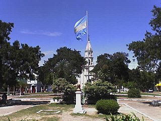
Santiago Chiérico's "La Cautiva", in Vicente Bellini Square.
The district's largest park, Plaza Ejército de los Andes, was opened in 1939. A defunct Western Railway line that divided the neighbourhood diagonally was converted into the Avenida del Justicialismo in 1951, and this avenue was in turn replaced by the Perito Moreno Expressway in 1980. Villa Luro is also accessible from downtown Buenos Aires (11 kilometres (7mi) to the east) via Rivadavia Avenue, and the most of the high-rises in the largely low-density district were built along it. A more upscale section within the district, Villa Luro Hollywood, was later developed along Ramón Falcón Avenue one block south of Rivadavia Avenue.
Notable neighbourhood institutions include the Church and Institute of Our Lady of Perpetual Help (1911), the Valle Miñor Social Club (1928), the Villa Luro Association of Plastic Arts (2000), and the Alejandro Olmos Cultural Center (2009).
Balvanera is a barrio or neighborhood of Buenos Aires, Argentina.
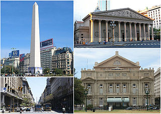
San Nicolás is one of the neighbourhoods of Buenos Aires, Argentina, sharing most of the city and national government Neighborhood of Buenos Aires with neighboring Montserrat and home to much of the financial sector. It is referred usually as El Centro, and the part east of the 9 de Julio Avenue is known as Microcentro.
Almagro is a mostly middle-class barrio or neighbourhood of Buenos Aires, Argentina.
July 9 Avenue is a major thoroughfare in the city centre of Buenos Aires, Argentina. Its name honors Argentina's Independence Day, July 9, 1816.
Morón is a city in the Argentine province of Buenos Aires, capital of the Morón partido, located in the Greater Buenos Aires metropolitan area, at 34°39′S58°37′W. Located 20 km (13 mi) west of Downtown Buenos Aires, Morón is easily reached via bus along Avenida Rivadavia, via National Highway 7, and the Sarmiento railway line.
Liniers is a barrio (neighborhood) of Buenos Aires on the edge of the city, centered on Rivadavia Avenue. It is also an important train station and bus hub, connecting western Gran Buenos Aires with the Buenos Aires Metro.
Caballito is a barrio (neighborhood) of the Argentine capital, Buenos Aires. It is the only barrio in the administrative division Comuna 6.
Federico Lacroze railway station is a passenger railway station in Buenos Aires, Argentina. The station is located in the city's outlying barrio (neighbourhood) of Chacarita in a predominantly residential area. It is just a short distance north of the Cementerio de la Chacarita, the city's largest cemetery. The station is named after Federico Lacroze, a prominent 19th century Argentine railway and transport pioneer who obtained the concession for building the Buenos Aires Central Railway in 1884. When the Argentine railway network was nationalised in 1948 the station became the Buenos Aires terminus for the lines that became part of the General Urquiza Railway (FCGU).
Chacarita is a barrio or neighborhood in the north-central part of Buenos Aires, Argentina. Located between Colegiales, Palermo, Villa Crespo, La Paternal and Villa Ortúzar, this is a quiet neighbourhood with tree-lined streets, a combination of vintage rowhouses and apartment buildings. Locally, it's probably best known for the 95 hectare Chacarita Cemetery.
Flores is a middle-class barrio or district in the center part of Buenos Aires city, Argentina. Flores was considered a rural area of the Province of Buenos Aires until 1888 when it was integrated into the city. Flores is the birthplace of Pope Francis.
Ciudadela is a city in Greater Buenos Aires, Buenos Aires Province, Argentina. It is located in the Tres de Febrero Partido, immediately to the west of the neighborhood of Liniers in Buenos Aires city proper. It is separated from the city by General Paz avenue.
Merlo is the head town of the eponymous partido of Merlo and seat of the municipal government, located in the Greater Buenos Aires urban area of Buenos Aires Province, Argentina.
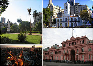
Monserrat or Montserrat is a neighbourhood in the east of the Buenos Aires CBD. The district features some of the most important public buildings in Buenos Aires, including city hall, the city legislature, Casa Rosada, the Colegio Nacional de Buenos Aires and the Libertador Building, among others.
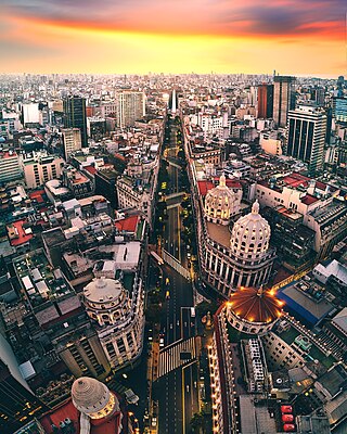
Avenida Roque Sáenz Peña, better known as Diagonal Norte, is an important avenue in the San Nicolás neighborhood of Buenos Aires, Argentina. It is oriented south-east/north-west, diagonally bisecting the city blocks (manzanas) which give the city centre a checkerboard plan. It is named after President Roque Sáenz Peña, who held power from 1910 to 1914 and passed the law which established universal suffrage, secret ballot and an electoral register.
Villa del Parque is a barrio (neighbourhood) or district within the city of Buenos Aires, Argentina. Its name translates as Village of the Park and was derived from its earliest beginnings, when several haciendas were all that existed, alongside a growing agricultural park in this section of Buenos Aires Province.
Villa Pueyrredón is a neighbourhood of Buenos Aires, the capital of Argentina. It is located between the neighborhoods of Villa Urquiza, Villa Devoto, and Agronomía. It is a middle class residential neighborhood with streets in draught-board, and surrounded by many squares and parks. The General Mitre Railway links Villa Pueyrredon with Retiro railway station in Buenos Aires CBD.
Versalles is a barrio (district) of Buenos Aires, Argentina. It is part of Commune 10 along with Villa Real, Monte Castro, Floresta, Velez Sarsfield and Villa Luro. Versalles is located on the western end of Buenos Aires; its boundaries are marked by the following streets: Nogoyá, Irigoyen, Juan B. Justo Avenue, and the General Paz Expressway.
Avenida Rivadavia is one of the principal thoroughfares in Buenos Aires, Argentina, extending 23 miles (37 km) from downtown Buenos Aires to the western suburb of Merlo. It is considered the third longest avenue in the world after Yonge Street (Toronto) and Western Avenue (Chicago).
Avellaneda Park is a public park in Buenos Aires, Argentina. It is located at the heart of the Parque Avellaneda neighbourhood, which takes its name from the park.
Córdoba Avenue is one of the principal thoroughfares in Buenos Aires, Argentina.
This page is based on this Wikipedia article Text is available under the CC BY-SA 4.0 license; additional terms may apply. Images, videos and audio are available under their respective licenses.