Belgrano is a northern and leafy barrio or neighborhood of Buenos Aires, Argentina.
La Paternal or Paternal is a neighborhood or district in the centre of Buenos Aires city, Argentina. It was founded in 1904 by a city decree (decreto) and was named 'La Paternal' after the train station in the neighbourhood, a former industrial zone.

Núñez is a barrio or neighbourhood of Buenos Aires, Argentina. It is on the northern edge of the city on the banks of the Rio de la Plata. The barrio of Belgrano is to the southeast; Saavedra and Coghlan are to the west; and Vicente López, in Buenos Aires Province, is to the north.

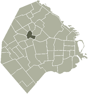
Villa Urquiza is a barrio or neighborhood of Buenos Aires, Argentina. It is located between the barrios of Villa Pueyrredón, Belgrano, Villa Ortúzar, Coghlan, Saavedra and Agronomía. Its limits are the streets and avenues Constituyentes, Crisólogo Larralde, Galván, Núñez, Tronador, Roosevelt, Rómulo S. Naón and La Pampa.

Coghlan is a barrio (neighbourhood), of the city of Buenos Aires, Argentina.

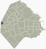
Agronomía is a barrio or district in the centre part of City of Buenos Aires, Argentina. It gets its name from the University of Buenos Aires Faculty of Agronomy based in the neighborhood. Its boundaries are Avenida San Martín, Campana, Avenida Salvador María del Carril, Avenida de los Constituyentes, and Avenida Chorroarín.

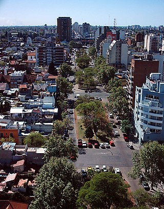
Morón is a city in the Argentine province of Buenos Aires, capital of the Morón partido, located in the Greater Buenos Aires metropolitan area, at 34°39′S58°37′W. Located 20 km (13 mi) west of Downtown Buenos Aires, Morón is easily reached via bus along Avenida Rivadavia, via National Highway 7, and the Sarmiento railway line.

Villa Devoto is a neighborhood or district located in the northwestern area of the city of Buenos Aires, Argentina. Its administrative limits are defined by Lope de Vega, General Paz, San Martín, and Francisco Beiró Avenues; and Joaquín V. González, Baigorría, and Campana streets.

Ciudadela is a city in Greater Buenos Aires, Buenos Aires Province, Argentina. It is located in the Tres de Febrero Partido, immediately to the west of the neighborhood of Liniers in Buenos Aires city proper. It is separated from the city by General Paz avenue.
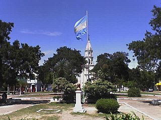
Merlo is the head town of the eponymous partido of Merlo and seat of the municipal government, located in the Greater Buenos Aires urban area of Buenos Aires Province, Argentina.

Villa Soldati is a neighbourhood in Buenos Aires, Argentina, located in the South-West of the city. It has a population of approximately 41,000 people, 40% of which live in Barrio Soldati, a public housing development built between 1973 and 1979.

Villa Lugano is a barrio (neighbourhood) in Buenos Aires, Argentina, located in the south of the city. It has a population of approximately 114,000 people. It is delimited by Avenida Eva Perón, Avenida General Paz, Calle José Barros Pazos, Avenida Lisandro de la Torre, Avenida Coronel Roca and Avenida Escalada. To the south-east it limits with La Matanza Partido.
Saavedra is a barrio or neighbourhood of Buenos Aires, Argentina. It is located in the Northern end of the city, close to Nuñez and Villa Urquiza. Its northern border is Avenida General Paz. Among the main features of the neighbourhood is the Parque Saavedra, which has large picnic areas and sports facilities. Many inhabitants of Buenos Aires pass through Saavedra en route to their weekends in the country.

Villa del Parque is a barrio (neighbourhood) or district within the city of Buenos Aires, Argentina. Its name translates as Village of the Park and was derived from its earliest beginnings, when several haciendas were all that existed, alongside a growing agricultural park in this section of Buenos Aires Province.

Villa Luro is a barrio (district) of Buenos Aires, Argentina. It is located near the western end of the City of Buenos Aires.

Villa Riachuelo is a barrio (district) of Buenos Aires, Argentina. It is the southernmost barrio in Capital Federal, and contains the Autódromo Juan y Oscar Gálvez, home of the Argentine Grand Prix until 1998.

Villa Santa Rita is a barrio (district) of Buenos Aires, Argentina. It is located in the western part of Capital Federal.

Córdoba Avenue is one of the principal thoroughfares in Buenos Aires, Argentina.

Estación Liniers is a railway station located in the Liniers barrio of Buenos Aires, Argentina.
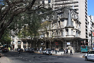
The Palacio Haedo is a 19th-century building on the Avenida Santa Fe in Buenos Aires, Argentina. It is located to the south of the Torre de Los Ingleses and the Plaza San Martín and Monument del libertador Jose de Plaza San Martín, in close proximity to the Consulate of Colombia and the Gran Hotel Buenos Aires. It was built in the late 19th century as a residence for the Haedo family by architects Passeroni and Brizuela in the Neo-Gothic style.