
Varzob is a settlement in Varzob District, Districts of Republican Subordination, Tajikistan, in central Asia. It is the administrative center for the Varzob District.

Tapacarí is a town and the capital of Tapacarí Province in Cochabamba Department, Bolivia. It is located at an elevation of 2,997 m. At the time of census 2001 it had a population of 411. Most of the population lives either in adjacent rural areas or in the city of Cochabamba and they only occupy local dwellings during carnival or other festivals, or on business trips.

Azurduy Province is a province in the Chuquisaca Department in Bolivia. Its seat is the town of Azurduy. It was named in honor of revolutionary guerrilla Juana Azurduy de Padilla. In the 2012 census it had a population of 24,855.
Chelif River is a 700-kilometre-long (430 mi) river in Algeria and also the longest one in the country. It rises in the Saharan Atlas near the city of Aflou, flows through the Tell Atlas and empties into the Mediterranean Sea north of the city of Mostaganem. The water level in the river often fluctuates. The river is being used for irrigation.

The Turkwel River is a river flowing from Mount Elgon on the border of Kenya and Uganda to Lake Turkana. The river is called the Suam River from its source to the border at West Pokot County of Kenya. The name Turkwel is derived from the Turkana name for the river, Tir-kol, which means a river that "withstands the wilderness". The Turkwel begins on the lush green slopes of Mount Elgon and the Cherangani Hills, then traverses the Southern Turkana Plains, crosses the Loturerei Desert near Lodwar and empties into the world's largest desert lake, Lake Turkana. The river's flow is seasonally varied, and it is subject to flash floods in the rainy season.
Hurlingham is an Argentine city, capital of the Hurlingham Partido in the province of Buenos Aires. It is located in the western part of Greater Buenos Aires.

Al Abraq is a town in Libya, in the Derna District. It is located 23 km east of Bayda, Other names include the transliterations Al Labrag, Al Labraq, Al Lazraq, and El-Abràgh, as well as the Italian Luigi di Savoia. According to the census of 2006, the city had a population of 8861 people.

The Varada River is a river in central Karnataka, India. It is a tributary of the Tungabhadra River.
Cacongo is a municipality in Cabinda Province, an exclave of Angola. Its principal town is Cacongo. Landana lies on the coast of the Atlantic Ocean, adjacent to Landana Bay. The municipality covers 1,679 square kilometres (648 sq mi) and had a population of 39,076 at the 2014 Census; the latest official estimate is 44,974.

Paungbyin, also known as Pyaungbin or Phaungbyin, is a town in Mawlaik District, Sagaing Division, of Myanmar, on the Chindwin River. It is the principal town of Paungbyin Township.

The Chiloango River is a river in western Central Africa. It forms the westernmost part of the border between the Democratic Republic of the Congo and the Republic of Congo, and then forms approximately half of the border between the DRC and Cabinda, Angola passing just south of the town of Necuto. The river then bisects Cabinda, making it the most important river in the province. It enters the Atlantic Ocean just north of the town of Cacongo.

Cacongo is a town, with a population of 15,000 (2014), in Cacongo municipality, Cabinda Province, in Angola. The former Lândana municipality is now known as Cacongo, and the town is sometimes still known as Lândana. It is located on Lândana Bay about a kilometer south of the mouth of the Chiloango River.

Chearoco, Chiaraco or Chiaroco is a mountain in the Cordillera Real in the Andes of Bolivia. It has a height of about 6,127 m (20,102 ft). It is situated in the La Paz Department, Larecaja Province, Guanay Municipality, southeast of the peak of Aman Pata. Chearoco lies between Qalsata in the northwest and Chachakumani in the southeast.

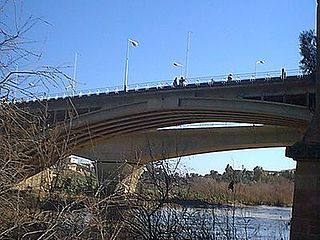
Karabiga (Karabuga) is a town in Biga District, Çanakkale Province, in the Marmara region of Turkey. It is located at the mouth of the Biga River, on a small east-facing bay, known as Karabiga Bay. Its ancient name was Priapus or Priapos.

The Parapetí River is a river in Bolivia that has its source on the eastern side the Andes, flows through the Gran Chaco of Bolivia and ends in the marshes of the Bañados de Izozog depression. The drainage basin is 25,300 km2, and with the inclusion of the Bañados of Izozog is 61,903 km2.

Oulad H'Cine is a small town and rural commune in Sidi Slimane Province, Rabat-Salé-Kénitra, Morocco. At the time of the 2004 census, the commune had a total population of 27,972 people living in 4389 households.

Cherangani Hills Forest is a collection of thirteen forest reserve blocks in western Kenya, located in the Cherangani Hills on the western ridge of the East African Rift. The forested area is about 1,200 square kilometres (463 sq mi), 956 square kilometres (369 sq mi) of which has been gazetted into forest reserves. These forest reserves form the upper catchments of the Kerio and Nzoia and Turkwel rivers.

Lumë is a village in the former Shtiqën Municipality, Kukës County, Albania, beside the Kirit River. At the 2015 local government reform it became part of the municipality Kukës. It is about 21 kilometres (13 mi) northwest of Shkodër by road.
The Simiyu River is a river in Tanzania. It flows into Lake Victoria in the African Great Lakes region. As one of the six main inlets to Lake Victoria, it forms part of the upper headwaters of the Nile.

The Pajarito Mountains are a small mountain range in the Sierra Madre Occidental. They are located in the state of Sonora in northwestern Mexico.
