Zwolle is a city and municipality in the Northeastern Netherlands. It is the capital of the province of Overijssel. Zwolle is located on the border with Gelderland, which follows the river IJssel, not far from Flevoland to the northwest and Drenthe to the northeast. With a population of 130,592 as of 1 December 2021, it is the second-largest municipality in Overijssel after Enschede.

Ommen is a municipality and a Hanseatic city in the eastern Netherlands. It is located in the Vecht valley of the Salland region in Overijssel. Historical records first name Ommen in the early 12th century and it was officially founded as a city in 1248. The municipality had a population of 17,813 in 2019 and covers an area of 182.01 km2 (70.27 sq mi).

Mariënberg is a village in the Dutch province of Overijssel. It is located in the municipality of Hardenberg, and lies on the westside of the Vecht river, between Hardenberg and Ommen.
Horssen is a village in the Dutch province of Gelderland. It is a part of the municipality of Druten, and lies about 10 km northwest of Wijchen.

Linschoten is a village in the Dutch province of Utrecht. It is a part of the municipality of Montfoort, and lies about 3 km southeast of Woerden.

Maarsbergen is a settlement in the Dutch province of Utrecht. It is a part of the municipality of Utrechtse Heuvelrug, and lies about 18 km east of Utrecht.
Hoevelaken is a town in the Dutch province of Gelderland. It is a part of the municipality of Nijkerk, and lies about 5 km east of Amersfoort.
Zeesse is a hamlet in the Dutch province of Overijssel. It is a part of the municipality of Ommen, and lies about 23 km east of Zwolle.

Besthmen is a hamlet in the Dutch province of Overijssel. It is a part of the municipality of Ommen, and lies about 22 km east of Zwolle.

Giethmen is a hamlet in the Dutch province of Overijssel. It is a part of the municipality of Ommen, and lies about 21 km east of Zwolle.

Varsen is a hamlet in the Dutch province of Overijssel. It is a part of the municipality of Ommen, and lies about 19 km east of Zwolle.
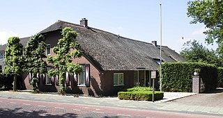
Lemele is a village in the Dutch province of Overijssel. It is a part of the municipality of Ommen, and lies about 20 km northwest of Almelo.

Kerk-Avezaath is a village in the Dutch province of Gelderland. It is a part of the municipality of Buren, and lies about 3 km west of Tiel.

Rossum is a village in the Dutch province of Gelderland. It is a part of the municipality of Maasdriel, and lies about 11 km southwest of Tiel.

Roden is a town in the Dutch province of Drenthe. It is located in the municipality of Noordenveld, about 16 km southwest of Groningen.

Oosterwolde is a village in the Dutch province of Gelderland. It is located in the municipality of Oldebroek, about 15 km southwest of Zwolle. Oosterwolde was a separate municipality until 1818, when it was merged with Doornspijk.

Balkbrug is a village in the Dutch province of Overijssel. It is located in the municipality Hardenberg, about 5 km west of Dedemsvaart.

Huis ter Heide is a village in the central Netherlands. It is located in the municipality of Zeist, Utrecht, about 2 km northeast of the centre of the town Zeist.
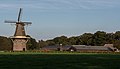
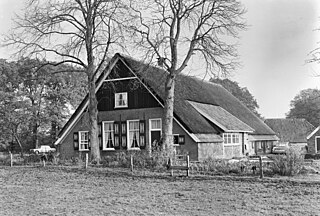
Lemelerveld is a village in the municipality of Dalfsen in the province of Overijssel, Netherlands. The village developed around a sugar beet factory.

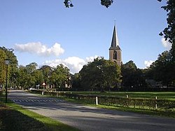
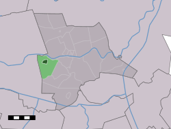
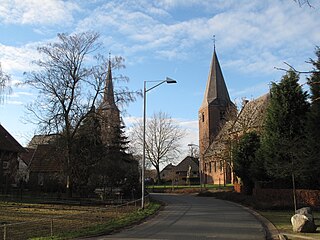
Windesheim is a village in the municipality of Zwolle in the province of Overijssel, Netherlands. The Congregation of Windesheim was located in Windesheim from 1387 until 1577.