Vukova Gorica

Last updated
Vukova Gorica
Village
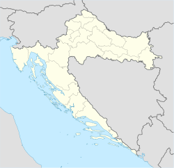
Croatia location map.svg
Red pog.svg
Vukova Gorica
Coordinates: 45°27′N15°20′E / 45.450°N 15.333°E / 45.450; 15.333
CountryFlag of Croatia.svg Croatia
County Karlovac County
Municipality Netretić
Area
[1]
 • Total
2.7 km2 (1.0 sq mi)
Population
 (2021) [2]
 • Total
52
 • Density19/km2 (50/sq mi)
Time zone UTC+1 (CET)
 • Summer (DST) UTC+2 (CEST)

Vukova Gorica is a village in Croatia. It is connected by the D3 highway.

Contents

Name

It was recorded as Vukouagoritza on the 1673 map of Stjepan Glavač  [ hr ]. [3]

History

In 1544, Nikola Šubić Zrinski settled Catholics from Rmanj in the nearby Vukova Gorica, Prilišće and Rosopajnik. [4] : 3 

After the Lujzijana was built, the Družtvo lujzinske ceste constructed an inn in Vukova Gorica together with a stable and a cistern. In 1874, the society would sell all its assets along the road, including those in Vukova Gorica. [5]

Politics

It is the seat of the Local Committee  [ hr ] of Vukova Gorica, encompassing itself and Račak. [6]

Notable residents

References

  1. ↑ Register of spatial units of the State Geodetic Administration of the Republic of Croatia. Wikidata   Q119585703.
  2. ↑ "Population by Age and Sex, by Settlements" (xlsx). Census of Population, Households and Dwellings in 2021. Zagreb: Croatian Bureau of Statistics. 2022.
  3. ↑ Melem Hajdarović 2023
  4. ↑ Strohal, Rudolf (1932). Grad i selo Severin u Gorskom Kotaru na Kupi[The Town and Village of Severin in Gorski Kotar on the Kupa] (in Croatian). Zagreb: Jugoslovenska štampa.
  5. ↑ Družtvo lujzinske ceste (1874-07-25). "Oglas. Kr. pov. družtvo lujzinske ceste nakanilo je sve svoje vlastite medju Riekom i Karlovcem nuz lujzinsku cestu ležeće kuće i zemljište razprodati". Primorac (in Croatian). Vol. 2, no. 59. p. 4. ISSN   1333-7440.
  6. ↑ DGU (2025). "Mjesna samouprava". Geoportal.dgu.hr (in Serbo-Croatian).

Bibliography

Further reading