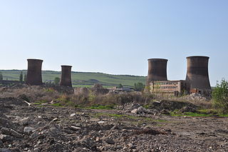
Călan is a town in Hunedoara County, Romania. Twelve villages are administered by the town: Batiz (Batiz), Călanu Mic (Kiskalán), Grid, Nădăștia de Jos (Alsónádasd), Nădăștia de Sus (Felsőnádasd), Ohaba Streiului (Sztrigyohába), Sâncrai (Szentkirály), Sântămăria de Piatră (Kőboldogfalva), Strei, Strei-Săcel (Sztrigyszacsal), Streisângeorgiu (Sztrigyszentgyörgy) and Valea Sângeorgiului (Szentgyörgyválya).

The Mureș is a 789-kilometre-long (490 mi) river in Eastern Europe. Its drainage basin covers an area of 30,332 km2 (11,711 sq mi). It originates in the Hășmașu Mare Range in the Eastern Carpathian Mountains, Romania, rising close to the headwaters of the river Olt, and joins the Tisza at Szeged in southeastern Hungary. In Romania, its length is 761 km (473 mi) and its basin size is 27,890 km2 (10,770 sq mi).
The Ghimbășel is a left tributary of the river Bârsa in Romania. Its source is in the northern part of the Bucegi Mountains. Originally it discharged directly into the Olt, but much of its flow has been diverted into the Bârsa, another tributary of the Olt, near Colonia Bod. Its length is 67 km (42 mi) and its basin size is 533 km2 (206 sq mi). The former lower course of the Ghimbășel, downstream of this diversion, still exists and is used for the discharge of local inflows. It flows into the Olt north of Bod. Its length is 6 km (3.7 mi) and its basin size is 8 km2 (3.1 sq mi).

The Geoagiu is a right tributary of the river Mureș in Transylvania, Romania. It discharges into the Mureș in Teiuș. Its length is 49 km (30 mi) and its basin size is 187 km2 (72 sq mi).
The Ohaba is a right tributary of the river Strei in Romania. The river rises under mount Chicera Izvorului. It flows southwestwards and in the proximity of Mount Plopi it enters a sinkhole. The river emerges in cave Șura Mare, near the village of Ohaba-Ponor, being locally referred to as Lunca Ponorului. It joins the Strei near the village of Ponor. Its length is 15 km (9.3 mi) and its basin size is 44 km2 (17 sq mi).
The Petriș is a right tributary of the river Mureș in Romania. It discharges into the Mureș in Seliște. Its length is 14 km (8.7 mi) and its basin size is 111 km2 (43 sq mi).

The Strei is a left tributary of the river Mureș in Transylvania, Romania. The upper reach of the river, upstream of the village of Baru, is also known as Râul Petros. It flows through the town Călan and the villages Petros, Baru, Livadia, Pui, Galați, Băiești, Ohaba de sub Piatră, Ciopeia, Subcetate, Covragiu, Bretea Română, Bretea Streiului, Ruși, Strei, Streisângeorgiu, Batiz, Băcia and Simeria Veche. It discharges into the Mureș near Simeria. Its length is 93 km (58 mi) and its basin size is 1,983 km2 (766 sq mi).
The Rușor is a left tributary of the Strei in Romania. It flows into the Strei in the village Rușor. Its length is 12 km (7.5 mi) and its basin size is 29 km2 (11 sq mi).
The Sasu is a river in the Șureanu Mountains, north of Petroșani, Romania. It is a left tributary of the Strei. Its length is 10 km (6.2 mi) and its basin size is 17 km2 (6.6 sq mi).
The Râul Alb is a left tributary of the river Strei in Romania. The upper reach of the river is also known as Vasielu. It flows into the Strei in Ohaba de sub Piatră. Its length is 22 km (14 mi) and its basin size is 44 km2 (17 sq mi).
The Paroș is a left tributary of the river Strei in Romania. Its source is in the Retezat Mountains. It flows into the Strei in Ohaba de sub Piatră. Its length is 17 km (11 mi) and its basin size is 27 km2 (10 sq mi).

The Râul Mare is a left tributary of the river Strei in Romania. It discharges into the Strei in Subcetate. Its source is in the Retezat Mountains. It flows through the reservoirs Gura Apelor, Ostrovul Mic, Păclișa and Hațeg. Its length is 64 km (40 mi) and its basin size is 915 km2 (353 sq mi).
The Crivadia is a left tributary of the river Strei in Romania. It flows into the Strei in Baru. Its length is 15 km (9.3 mi) and its basin size is 69 km2 (27 sq mi).
The Muncel is a left tributary of the river Crivadia in Romania. It flows into the Crivadia in Baru, close to its confluence with the Strei. Its length is 9 km (5.6 mi) and its basin size is 23 km2 (8.9 sq mi).
The Turdaș is a left tributary of the river Mureș in Romania. It discharges into the Mureș in the village Turdaș. Its length is 14 km (8.7 mi) and its basin size is 65 km2 (25 sq mi).
The Borzontul Mare is a left tributary of the river Mureș in Romania. It discharges into the Mureș near Joseni. The upper reach of the river is also known as Putna. Its length is 15 km (9.3 mi) and its basin size is 46 km2 (18 sq mi).
The Bărbat is a left tributary of the river Strei in Romania. It discharges into the Strei in Pui. Its length is 30 km (19 mi) and its basin size is 98 km2 (38 sq mi).
The Silvaș is a left tributary of the river Strei in Romania. It flows into the Strei near Plopi. Its length is 20 km (12 mi) and its basin size is 36 km2 (14 sq mi).
The Valea Luncanilor is a right tributary of the river Strei in Romania. It discharges into the Strei in Streisângeorgiu. Its length is 27 km (17 mi) and its basin size is 148 km2 (57 sq mi).
The Sălaș is a left tributary of the river Strei in Romania. It discharges into the Strei in Ohaba de sub Piatră. Its length is 17 km (11 mi) and its basin size is 32 km2 (12 sq mi).
