
A municipality is usually a single administrative division having corporate status and powers of self-government or jurisdiction as granted by national and regional laws to which it is subordinate. It is to be distinguished (usually) from the county, which may encompass rural territory or numerous small communities such as towns, villages and hamlets.
Amt is a type of administrative division governing a group of municipalities, today only in Germany, but formerly also common in other countries of Northern Europe. Its size and functions differ by country and the term is roughly equivalent to a US township or county or English shire district.

The municipalities of Brazil are administrative divisions of the Brazilian states. At present, Brazil has 5,570 municipalities, making the average municipality population 34,361. The average state in Brazil has 214 municipalities. Roraima is the least subdivided state, with 15 municipalities, while Minas Gerais is the most subdivided state, with 853.
Gleichen is the name of two groups of castles in Germany, thus named from their resemblance to each other.

In law, an unincorporated area is a region of land that is not governed by a local municipal corporation; similarly an unincorporated community is a settlement that is not governed by its own local municipal corporation, but rather is administered as part of larger administrative divisions, such as a township, parish, borough, county, city, canton, state, province or country. Occasionally, municipalities dissolve or disincorporate, which may happen if they become fiscally insolvent, and services become the responsibility of a higher administration. Widespread unincorporated communities and areas are a distinguishing feature of the United States and Canada. In most other countries of the world, there are either no unincorporated areas at all, or these are very rare; typically remote, outlying, sparsely populated or uninhabited areas.

Arnstadt is a town in Ilm-Kreis, Thuringia, Germany, on the river Gera about 20 kilometres south of Erfurt, the capital of Thuringia. Arnstadt is one of the oldest towns in Thuringia, and has a well-preserved historic centre with a partially preserved town wall. The town is nicknamed Das Tor zum Thüringer Wald because of its location on the northern edge of that forest. Arnstadt has a population of some 27,000. The city centre is on the west side of Gera. The municipality has absorbed several neighbouring municipalities: Angelhausen–Oberndorf (1922), Siegelbach (1994), Rudisleben (1999) and Wipfratal (2019). The neighbouring municipalities are Amt Wachsenburg, Alkersleben, Dornheim, Bösleben-Wüllersleben, Stadtilm, Ilmenau, Plaue and Geratal.
An incorporated town is a town that is a municipal corporation.
Sebastian Bodinus was a German composer about whom very little is known. Bodinus was born in the village of Amt Wachsenburg-Bittstädt in Saxe-Gotha and trained as a violinist. It is known that in 1718 he entered the service of the Margrave Karl III of Baden-Durlach at the court in Karlsruhe. Bodinus worked elsewhere but always returned to Karlsruhe and was concertmaster there for two periods. He left Karlsruhe in 1752, returned in a disoriented state in 1758 and was committed to an insane asylum in Pforzheim where he died.

Kirchheim is a village and a former municipality in the district Ilm-Kreis, in Thuringia, Germany. Since 1 January 2019, it is part of the municipality Amt Wachsenburg.
Ichtershausen is a village and a former municipality in the district Ilm-Kreis, in Thuringia, Germany. Since 31 December 2012, it is part of the municipality Amt Wachsenburg.
Thörey is a village near Ichtershausen in Ilm-Kreis, Thuringia, Germany, with about 250 inhabitants. It is part of the municipality Amt Wachsenburg.
The Division of Chemnitz settled the succession in the Landgraviate of Thuringia.
Wachsenburg may refer to:

Wachsenburg Castle is a castle in Amt Wachsenburg in the Ilm-Kreis, Thuringia, Germany. It is one of the Drei Gleichen, three hilltop castles east of Gotha. It was originally built in the 10th century. The castle was extensively reconstructed in the 17th and 19th century. The well-preserved castle now houses a museum, a hotel and a restaurant.

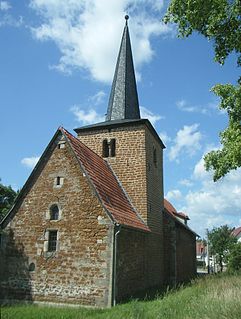
Amt Wachsenburg is a municipality in the district Ilm-Kreis, in Thuringia, Germany. The municipality is named after the Wachsenburg Castle which is located in its center. It was formed on 31 December 2012 from the former municipalities Wachsenburggemeinde and Ichtershausen. The former municipality Kirchheim was merged into Amt Wachsenburg in January 2019. It consists of the villages Bechstedt-Wagd, Bittstädt, Eischleben, Haarhausen, Holzhausen, Ichtershausen, Kirchheim, Rehestädt, Röhrensee, Sülzenbrücken, Thörey and Werningsleben.
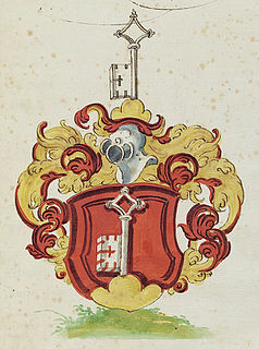
Schlüsselberg was a Franconian aristocratic family which was a member of the high nobility. Until it died out in 1347, the family was able to establish itself firmly in the region of Franconian Switzerland and turned out to be unwelcome competition for the bishops of Bamberg. The Schlüsselbergs founded inter alia the town of a number of Schlüsselfeld in 1336 as well as Schlüsselau Abbey.


