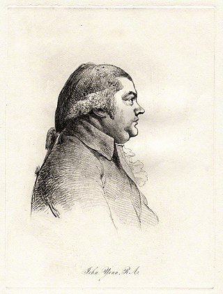
John Yenn (1750–1821) was a notable 18th-century English architect.

Cokethorpe School is a private day school in Witney, West Oxfordshire. The school was found in 1957 by Francis Brown. It is a member of HMC, IAPS, and The Society of Heads. The school has approximately 660 students from age 4 to 18.

Goring Heath is a hamlet and civil parish in the Chiltern Hills in South Oxfordshire. The civil parish includes the villages of Whitchurch Hill and Crays Pond and some small hamlets. Goring Heath is centred 3 miles (4.8 km) southeast of Goring-on-Thames and about 4 miles (6.4 km) northwest of Reading, Berkshire. In 1724 Henry Alnutt, a lawyer of the Middle Temple in London, established a set of almshouses at Goring Heath. They form three sides of a courtyard, flanking a chapel of the same date. In the 1880s a school was built beside the almshouses in what was intended to be the same architectural style. A post office was added in 1900.

Cassington is a village and civil parish in Oxfordshire about 5 miles (8 km) northwest of Oxford. The village lies on gravel strata about 1⁄2 mile (800 m) from the confluence of the River Evenlode with the River Thames. The parish includes the hamlet of Worton northeast of the village and the site of the former hamlet of Somerford to the south. Somerford seems to have been abandoned early in the 14th century. Cassington is formed of two parts, "upper" and "lower", each with its own village green. The 2011 Census recorded the parish's population as 750.

Shipton-on-Cherwell is a village in the civil parish of Shipton-on-Cherwell and Thrupp, in the Cherwell district, in the county of Oxfordshire, England. It is on the River Cherwell about 2 miles (3 km) north of Kidlington in Oxfordshire, England.
Anchetil de Greye was a Norman chevalier and vassal of William FitzOsbern, 1st Earl of Hereford, one of the great magnates of early Norman England.
Duns Tew is an English village and civil parish about 7+1⁄2 miles (12 km) south of Banbury in Oxfordshire. The 2011 Census recorded the parish's population as 478. With nearby Great Tew and Little Tew, Duns Tew is one of the three villages known collectively as "The Tews". A 'tew' is believed to be an ancient term for a ridge of land.

Barford St Michael is a village and former civil parish, now in the parish of Barford St. John and St. Michael, in the Cherwell district, in the county of Oxfordshire, England. It is on the south bank of the River Swere, about 5 miles (8 km) south of Banbury.
Brighthampton is a hamlet which is contiguous with the village of Standlake, about 4 miles (6.4 km) south of Witney, in West Oxfordshire, in the county of Oxfordshire, England.
Middle Aston is a hamlet and civil parish in the English county of Oxfordshire, about 7 miles (11 km) northwest of Bicester. It used to have a country house, Middle Aston House, but this was demolished early in the 19th century. The house was replaced in the 1890s by extending the manor farmhouse. The building is now a conference center.

Milcombe is a village and civil parish about 5 miles (8 km) southwest of Banbury, Oxfordshire.
Worton is a hamlet in Cassington civil parish, 4.5 miles (7.2 km) northwest of Oxford.
Shipton-on-Cherwell and Thrupp is a civil parish in the Cherwell district, in the county of Oxfordshire, England. It was formed in 1955 by removing the hamlet of Thrupp from the parish of Kidlington and merging it with the parish of Shipton-on-Cherwell. It covers 6.04 km² and as at the 2011 census had 493 residents.
Hanborough is a civil parish in West Oxfordshire. The parish includes the villages of Church Hanborough and Long Hanborough. The village of Freeland was transferred from Eynsham civil parish to Hanborough in 1932 and then detached to form a separate civil parish in 1948. Both Church Hanborough and Long Hanborough are served by Hanborough railway station.

The Honour of Wallingford was a medieval English feudal barony which existed between 1066 and 1540 with its caput at Wallingford Castle in present-day Oxfordshire.

Little Tew is an English village and civil parish about 4+1⁄2 miles (7 km) northeast of Chipping Norton and 8+1⁄2 miles (14 km) southwest of Banbury in Oxfordshire. The parish is bounded to the northwest by the River Swere and a road between Little Tew and Hook Norton, to the north by a tributary of the River Cherwell and to the south by an ancient drovers' road called Green Lane. The remaining parts of the parish bounds are field boundaries. The 2011 Census recorded the parish's population as 253.
James Huxley was an English politician who sat in the House of Commons in 1660.

Steeple Barton is a civil parish and scattered settlement on the River Dorn in West Oxfordshire, about 8+1⁄2 miles (13.7 km) east of Chipping Norton, a similar distance west of Bicester and 9 miles (14 km) south of Banbury. Most of the parish's population lives in the village of Middle Barton, about 1 mile (1.6 km) northwest of the settlement of Steeple Barton. The 2011 Census recorded the parish's population as 1,523. Much of the parish's eastern boundary is formed by the former turnpike between Oxford and Banbury, now classified the A4260 road. The minor road between Middle Barton and Kiddington forms part of the western boundary. Field boundaries form most of the rest of the boundaries of the parish.

Nether Worton is a hamlet in the civil parish of Worton, in the West Oxfordshire district, in the county of Oxfordshire, England. It is about 6+1⁄2 miles (10.5 km) south of Banbury and 7 miles (11 km) east of Chipping Norton. In 1931 the parish had a population of 42. On 1 April 1932 the parish was abolished and merged with Over Worton to form "Worton".

Over Worton is a hamlet in the civil parish of Worton, in the West Oxfordshire district, in the county of Oxfordshire, England, about 7 miles (11 km) south of Banbury and 7+1⁄2 miles (12 km) east of Chipping Norton. In 1931 the parish had a population of 72. On 1 April 1932 the parish was abolished and merged with Nether Worton to form "Worton".
