
Petra, originally known to its inhabitants as Raqmu or Raqēmō, is a historic and archaeological city in southern Jordan. Famous for its rock-cut architecture and water conduit system, Petra is also called the "Rose City" because of the colour of the stone from which it is carved; it was famously called "a rose-red city half as old as time" in a poem of 1845 by John Burgon. It is adjacent to the mountain of Jabal Al-Madbah, in a basin surrounded by mountains forming the eastern flank of the Arabah valley running from the Dead Sea to the Gulf of Aqaba. Access to the city is through a famously picturesque 1.2-kilometre-long gorge called the Siq, which leads directly to the Khazneh.

The Nabataeans or Nabateans were an ancient Arab people who inhabited northern Arabia and the southern Levant. Their settlements—most prominently the assumed capital city of Raqmu —gave the name Nabatene to the Arabian borderland that stretched from the Euphrates to the Red Sea.

South Sinai Governorate is the least populated governorate of Egypt. It is located in the east of the country, encompassing the southern half of the Sinai Peninsula. Saint Catherine's Monastery, an Eastern Orthodox Church monastery and UNESCO World Heritage Site of world renown, is located in the central part of the governorate.
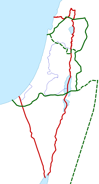
Palestine is a geographical region in West Asia. Situated in the Southern Levant, it is usually considered to include Israel and the State of Palestine, though some definitions also include parts of northwestern Jordan. Other historical names for the region include Canaan, the Promised Land, the Land of Israel, or the Holy Land.
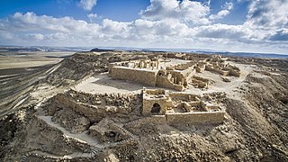
Avdat, also known as Abdah and Ovdat and Obodat, is a site of a ruined Nabataean city in the Negev desert in southern Israel. It was the most important city on the Incense Route after Petra, between the 1st century BCE and the 7th century CE. It was founded in the 3rd century BCE, and inhabited by Nabataeans, Romans, Byzantines, and during the early Islamic period. Avdat was a seasonal camping ground for Nabataean caravans travelling along the early Petra–Gaza road in the 3rd – late 2nd century BCE. The city's original name was changed to Avdat in honor of Nabataean King Obodas I, who, according to tradition, was revered as a deity and was buried there.

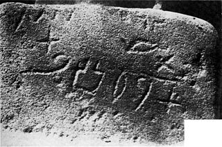
The Nabataean script is an abjad that was used to write Nabataean Aramaic and Nabataean Arabic from the second century BC onwards. Important inscriptions are found in Petra, the Sinai Peninsula, and other archaeological sites including Abdah and Mada'in Saleh in Saudi Arabia.
Proto-Sinaitic is found in a small corpus of c. 40 inscriptions and fragments, the vast majority from Serabit el-Khadim in the Sinai Peninsula, dating to the Middle Bronze Age. They are considered the earliest trace of alphabetic writing and the common ancestor of both the Ancient South Arabian script and the Phoenician alphabet, which led to many modern alphabets including the Greek alphabet. According to common theory, Canaanites or Hyksos who spoke a Proto-Northwest Semitic language repurposed Egyptian hieroglyphs to construct a different script.

Pre-Islamic Arabia refers to the Arabian Peninsula before the emergence of Islam in 610 CE.

Mount Serbal is a mountain located in Wadi Feiran in southern Sinai. At 2,070 metres (6,791 ft) high, it is the fifth highest mountain in Egypt. It is part of the St. Catherine National Park. It is thought by some to be the Biblical Mount Sinai. Among others this was claimed by Ludwig Schneller, because it fits best with the biblical tradition taking into account the route and speed of the Israelites and the surroundings of the mountain, as Rephidim is identified with Wadi Feiran.

The Besor or Wadi Gaza is a wadi in southern Israel and Palestine. The stream begins at Mount Boker, and spills into the Mediterranean Sea near Al-Zahra in the Gaza Strip. Further upstream it was marked as Wadi esh-Shallaleh on the 1878 Survey of Western Palestine map. The area has several important archaeological sites.
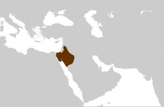
The Nabataean Kingdom, also named Nabatea, was a political state of the Nabataeans during classical antiquity.
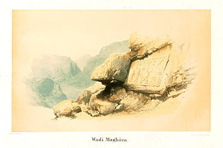
Wadi Maghareh is an archaeological site located in the southwestern Sinai Peninsula, Egypt. It contains pharaonic monuments and turquoise mines dating from the Old, Middle and New Kingdoms of Ancient Egypt. The Ancient Egyptians knew the site as "the Terraces of Turquoise."

The Qedarites were a largely nomadic ancient Arab tribal confederation centred in the Wādī Sirḥān in the Syrian Desert. Attested from the 9th century BC, the Qedarites formed a powerful polity which expanded its territory over the course of the 9th to 7th centuries BC to cover a large area in northern Arabia stretching from Transjordan in the west to the western borders of Babylonia in the east, before later moving westwards during the 6th to 5th centuries BC to consolidate into a kingdom stretching from the eastern limits of the Nile Delta in the west till Transjordan in the east and covering much of southern Palestine, the Sinai Peninsula and the Negev.

Saint Catherine is a town in the South Sinai Governorate of Egypt, situated at the foot of the mountain Mount Sinai. The city is the site of Saint Catherine's Monastery. The city is 1,586 metres (5,203 ft) above sea level and is 120 kilometres (75 mi) from Nuweiba. In 1994, its population was 4,603 people. In 2002, The Saint Catherine area has been declared a UNESCO world heritage site.

Wadi Murabba'at, also known as Nahal Darga, is a ravine cut by a seasonal stream which runs from the Judean desert east of Bethlehem past the Herodium down to the Dead Sea 18 km south of Khirbet Qumran in the West Bank. It was here in caves that Jewish fighters hid out during the Bar Kochba revolt, leaving behind documents that include some letters signed by Simon Bar Kochba.
Transjordan, the East Bank, or the Transjordanian Highlands, is the part of the Southern Levant east of the Jordan River, mostly contained in present-day Jordan.
The Bostran era was a calendar era with an epoch corresponding to 22 March 106 AD. It was the official era of the Roman province of Arabia Petraea, introduced to replace dating by regnal years after the Roman annexation of the Nabataean Kingdom. It is named after the city of Bostra, which became the headquarters of the Sixth Legion stationed in the province.

Beno Rothenberg was an Israeli archaeologist, photographer and one of the founders of archaeometallurgy.


