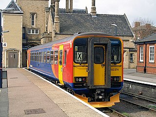
The Nottingham–Lincoln line is a railway line in central England, running north-east from Nottingham to Lincoln.
The British School in Panchkula near Chandigarh, India is an international school, affiliated to the University of Cambridge International Examination. The second extension of this school in Chandigarh Tricity is located at Sector 70, Mohali. The British School was offering International General Certificate of Secondary education certification till 2015. Now the school has switched over to CBSE pattern till class Xth. The IGCSE Examination is conducted by the University of Cambridge International Examination. Students prepare for the IB Diploma Programme.
M'daourouch is a municipality in Souk Ahras, Algeria, occupying the site of the Berber-Roman town of Madauros in Numidia.

The weightlifting competition at the 1964 Summer Olympics in Tokyo consisted of seven weight classes, all for men only.
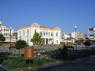
Sparta is a town and municipality in Laconia, Greece. It lies at the site of ancient Sparta. The municipality was merged with six nearby municipalities in 2011, for a total population of 35,259, of whom 17,408 lived in the city.
Porsgrunn/Skien is a Norwegian urban area located in Grenland in southern Telemark.
Parkgate railway station was a station on the single track Hooton to West Kirby branch of the Birkenhead Railway, on the Wirral Peninsula, Cheshire, England. The station served the village of Parkgate.

Candas is a commune in the Somme department in Hauts-de-France in northern France.
Kędzierzyn is a village in the administrative district of Gmina Bielsk, within Płock County, Masovian Voivodeship, in east-central Poland.
Zygmuntowo is a village in the administrative district of Gmina Wilczyn, within Konin County, Greater Poland Voivodeship, in west-central Poland.

Høybergodden is the most western point of the volcanic island of Jan Mayen.

Çamlıgöze Dam is an embankment dam on the Kelkit River in Sivas Province, Turkey. The development was backed by the Turkish State Hydraulic Works.
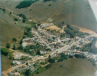
Maripá de Minas is a municipality in the state of Minas Gerais in the Southeast region of Brazil.

All Hallows is an Anglican church in Tottenham, North London. It is one of the oldest buildings in the London Borough of Haringey, being built as All Saints Church in the 12th century, then re-dedicated as All Hallows in the 15th century. It stands adjacent to Bruce Castle and Tottenham Cemetery. It is reputed to have been given to Tottenham by King David I of Scotland, strengthening its connection with the Bruce family who were owners of Bruce Castle. The church is part of the Diocese of London and its clergy have included William Bedwell and John Howard Churchill, later Dean of Carlisle. The church was restored between 1875 and 1877 by the architect William Butterfield. It has been painted many times, including by William Ellis, John Preston Neale, William Henry Prior, John Thomas Smith, Jean Baptiste Claude Chatelain and John Constable.
Rankova Reka is a village in the municipality of Prokuplje, Serbia. According to the 2002 census, the village has a population of 22 people.
Cham Quleh is a village in Shabab Rural District, in Shabab District of Chardavol County, Ilam Province, Iran. At the 2006 census, its population was 287, in 58 families.
Yenecik is a village in the District of Gerede, Bolu Province, Turkey. As of 2010, it had a population of 41 people.

Peaseholme House or Peasholme House is a Georgian house near Peasholme Green in York, England.

Bahutali is a village and a gram panchayat in Suti I CD Block in Jangipur subdivision of Murshidabad district in the state of West Bengal, India.

Segelfluggelände Farrenberg is a fully equipped infrastructure for take-off and landing of aircraft located in the southeast of the city of Mössingen, Baden-Württemberg, Germany.


