
Shivaji University established in 1962, is a state university located at Kolhapur, Maharashtra, India. The university, with a campus spread over 853 acres, is named after Shivaji, founder of the Maratha Empire. It was inaugurated on 18 November 1962 by Sarvepalli Radhakrishnan, the then president of India. Yashwantrao Chavan and Balasaheb Desai took the lead in establishing this university. Educational institutions from Kolhapur, Sangli, and Satara districts come under its jurisdiction with 279 affiliated colleges and recognised institutes. One of the major objectives behind its foundation was to cater to the educational needs of South Maharashtra region. The University's efforts towards excellence are being recognised by the substantial grants received from funding agencies such as University Grants Commission (India), Department of Science and Technology (India), and DBT. The university is self reliant in water, which is stored on campus during the rainy season. It has a biodiversity-rich campus.

Solapur is a city located in the south-western region of the Indian state of Maharashtra, close to its border with Karnataka. Solapur is located on major Highway, rail routes between Mumbai, Pune, Bangalore and Hyderabad, with a branch line to the cities of Bijapur and Gadag in the neighbouring state of Karnataka.Solapur international Airport is under construction. It is classified as A1 Tier and B-1 class city by House Rent Allowance (HRA) classification by the Government of India. It is the 5th biggest city in Maharashtra and the 49th most populous city in India and 43rd largest urban agglomeration.
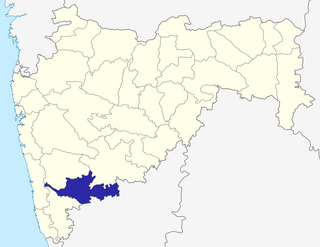
Sangli District is a district of Maharashtra State in west-central India. Sangli City is the district headquarters. The district is 25.11% urban. Sangli and Miraj are the largest cities. The industrial town of Kirloskarwadi is also located in the Sangli District. Industrialist Laxmanrao Kirloskar started his first factory here. It is known as the sugar bowl of India due to its high sugarcane productivity. Sangli District is one of the most fertile and highly developed districts in Maharashtra. The District is very popular as a political power house in the state. It has provided many politicians and bureaucrats and is often referred to as the Heaven of Farmers.
Tasgaonpronunciation (help·info) is a city and a municipal council in Sangli district in the Indian state of Maharashtra. Tasgaon was given as Jahagir to Parshuram Bhau Tasgaonkar by Narayan Ballal Peshava in 1774. Tasgaon sansthan was lapsed by British during ruling of Shrimant Ganapatrao Tasgaonkar. Tasgaon Grapes from the city from Tasgaon are famous grapes in Maharashtra. Tasgaon has rapidly merged with Sangli city as a satellite suburb and will soon become part of Sangali Urban Agglomeration.
Urun Islampur is a city and a municipal council in Sangli district in the Indian state of Maharashtra.

Chandoli National Park is a National Park spread over Satara, Kolhapur and Sangli Districts, Maharashtra State, India, established in May 2004. Earlier it was a Wildlife Sanctuary declared in 1985. Chandoli Park is notable as the southern portion of the Sahyadri Tiger Reserve, with Koyna Wildlife Sanctuary forming the northern part of the reserve
Ashta is a town and a municipal council in Sangli district in the state of Maharashtra, India. It is located at 16.95°N 74.4°E. It has an average elevation of 567 metres (1860 ft). The name "Ashta" comes from the legend that Lord Shri Ram established eight (Asht) Lord Mahadev temples in this area. The city is divided into 19 wards for which elections are held every 5 years. The Ashta Municipal Council has the population of 37,105 of which 19,171 are males while 17,934 are females as per the report released by Census India 2011.

Ugar Budruk is a village in the southern state of Karnataka, India. It is located in the Athni taluk of Belgaum district in Karnataka. This place is very well known as Jain people maa Parshwa Padmavati Mondir is very popular in north Karnataka state and South Maharashtra every year all Jain people celebrate Navratri festival is big festival.it has a parshwanat gharderasar for the Jain shewtamber community.It is around 38 km from the city of sangli, Maharashtra.Ugar comes under the Kagwad constituency.
Prachitgad is a fort in the Sahyadri mountain range in Maharashtra state, India. It covers an area of 5 acres (20,000 m2).
Karajagi is a village in jath, in the state of Maharashtra]], India. It is located in the [jath]] taluk of sangli district.

The Deccan Education Society is an organisation that runs 43 education establishments in Maharashtra, India. Its main branch is situated in Pune.
Kadegaon is a city and taluka of Sangli district of Maharashtra in India. About kadegaon-
Diggewadi is a village in Raybag taluk in Belgaum Panchayat in the southern state of Karnataka, India. The official language of Diggewadi is Kannada.

Karjat taluka, is a taluka in Karjat subdivision of Ahmednagar district in Maharashtra State of India.

Sangli State was one of the 11-gun salute Maratha princely states of British India. It was under the Kolhapur-Dekkan Residency in the Bombay Presidency, and later the Deccan States Agency.
Bhood is a village in Khanapur tehsil of Sangli district in Maharashtra, India. It is located near the city Vita.
Arag is a small town in Sangli district in the Indian state of Maharashtra. It is approximately 30 km south east of the much larger urban conglomeration of Sangli-Miraj.
Vashi is a Village in the state of Maharashtra, India. Administratively, Vashi is under Walwa Taluka of Sangli District in Maharashtra. Vashi is the only village in its gram panchayat. The village of Vashi is 21 km by road south of the city of Uran Islampur and 33 km by road west of the city of Ashta.

Kotij is a suburb of Sangli District in the Indian state of Maharashtra.
Shigaon is a village in Sangli District, Maharashtra State, India. In 2011, it had a population of 6,844: 3,457 males and 3,387 females.