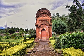
Binika is a town and a notified area council in Subarnapur district in the state of Odisha, India.
Jiribam is a town governed by a municipal council in the Jiribam district of the state of Manipur, India. It is one of the fastest-growing towns in Manipur.
Khongman is a census town in Imphal East district in the Indian state of Manipur.
Kilpennathur is a Panchayat Town in Tiruvanamalai district in the Indian state of Tamil Nadu. Kilpennathur is one of the taluks of Tiruvannamalai district and an assembly constituency of Tamil Nadu. The MLA of Kilpennathur assembly constituency is DMK party Mr. K. Pichandi. Vettavalam is the most populous town panchayat in this taluk. Kilpennathur is located a 12.25 degrees latitude and 79.224 degrees longitude. Nearest towns are Avalurpet, Vettavalam, Gingee and Tiruvannamalai, and Chennai is about 177 km away.
Kodala is a town and a Notified Area Council in Ganjam District in the Indian State of Odisha.
Kwakta is a town and a Municipal Council in Bishnupur district in the Indian state of Manipur. It is in the Moirang subdivision, between the town of Moirang and the Kuki-dominated villages such as Kangvai and Torbung. It has a population of about 8,000 people, mainly Meitei Pangals (Muslims).
Lamsang is a town and a Municipal Council in Imphal West district in the Indian state of Manipur.
Lilong Chajing (Imphal West) is a town and a municipality in Imphal West district in the Indian state of Manipur.
Lilong (Thoubal) is a town with Municipal Council in Thoubal District in the Indian state of Manipur.
Mayang Imphal is a town and municipal council in Imphal West district in the Indian state of Manipur. Pin code of Mayang Imphal is 795132.
Naoriya Pakhanglakpa is a census town in Imphal West district in the Indian state of Manipur.
Oinam is a town in Bishnupur district in the Indian state of Manipur. Oinam is an assembly constituency and part of Inner Manipur Lok Sabha constituency. People belonging to this area sometimes add it to their name as a surname.
Sekmai Bazar is a town and a municipal council in Imphal West district in the Indian state of Manipur.
Thiruporur is a panchayat town in Chengalpattu district in the Indian state of Tamil Nadu. The Thiruporur Kandaswamy temple is situated in the center of the town. There is a large temple tank in the vicinity of the temple. Thiruporur is located on Old Mahabalipuram Road and is flanked by Kelambakkam on one side and Alathur Pharmaceutical Industrial Estate on the other side, both of which are also on Old Mahabalipuram Road.
Thongkhong Laxmi Bazar is a town and a nagar panchayat in Imphal West district in the Indian state of Manipur.

Thoubal is a town and municipal council with 18 wards, serving as the district headquarters in Thoubal district, in the Indian state of Manipur. The name 'Thoubal' derives from 'Athouba,' meaning brave people, symbolizing the courageous residents of the district. It is one of the larger towns in Manipur, known for its idyllic setting, featuring numerous lakes, rivers, paddy fields, and gardens. Thoubal is also a gateway to Southeast Asia, with the Trans-Asian Highway (AH1) passing through it, and is well-connected to Imphal, Kakching, Moreh, and Yairipok.
Wangjing is a town and a municipal council in Thoubal district in the Indian state of Manipur. It is about 6 km from district headquarters and an agricultural town in Thoubal district in the Indian state of Manipur. It is bordered by Heirok village in the east, Tentha village in the south-west, and on the other side by agricultural land. Wangjing River, a rivulet flowing down from the eastern hills, runs through the middle of the town, serving as a natural spring. It is connected to other parts of the state by the Imphal–Moreh national highway. It is the junction between Heirok and Tentha village.

Bishnupur is a town in Bishnupur district in the state of Manipur, India. It derived its name from an ancient Vishnu temple located in the town. There is no official record of when exactly the town was named but it is likely during the reign of Bhagyachandra in the mid 18th century. Bishunupur is the administrative headquarters of Bishnupur District.

Andro is a town and a nagar panchayat in Imphal East district in the state of Manipur, India.
Heirok is a town and a nagar panchayat in Thoubal district in the Indian state of Manipur.


