Related Research Articles
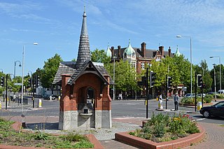
Ilford is a large town in East London, England, 9 miles (14 km) northeast of Charing Cross. Part of the London Borough of Redbridge, Ilford is within the ceremonial county of Greater London. It had a population of 168,168 in 2011, compared to 303,858 for the entire borough.

Snaresbrook is a district in the London Borough of Redbridge, in East London. It is located eight miles east of Charing Cross.
Wanstead is an area in East London, England, in the London Borough of Redbridge. It borders South Woodford to the north, Redbridge to the east and Forest Gate to the south, with Leytonstone and Walthamstow to the west. It is located 8 miles northeast of Charing Cross.

The London Borough of Redbridge is a London borough established in 1965.
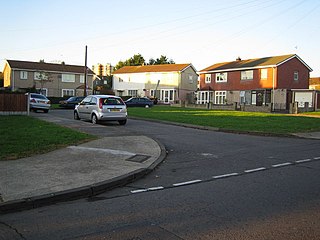
Hainault is a large suburban area of Ilford in East London, England, in the London Borough of Redbridge, 12.5 miles (20.1 km) northeast of Charing Cross. Most of the housing in Hainault was built by the London County Council between 1947 and 1953. Originally spanning the parishes of Chigwell, Dagenham, and Ilford, in 1965 the estate was combined in a single London borough and became part of Greater London.

Epping Forest District is a local government district in Essex, England. It is named after the ancient woodland of Epping Forest, a large part of which lies within the district. The district covers northeastern parts of the urban area of London, including the suburban towns of Epping, Loughton, Waltham Abbey, Chigwell, and Buckhurst Hill, as well as rural areas beyond it. The district is situated in the west of the county, bordering north-eastern Greater London.

The River Roding rises at Molehill Green, Essex, England, then flows south through Essex and London and forms Barking Creek as it reaches the River Thames.

Stoke Bardolph is a village and civil parish in the Gedling district of Nottinghamshire. The population of the civil parish taken at the 2011 census was 170, increasing to 598 residents at the 2021 census. It is to the east of Nottingham, and on the west bank of the River Trent. Nearby places include Burton Joyce and Radcliffe on Trent.

The London Borough of Redbridge, one of the north-eastern peripheral London boroughs, has within its boundaries parts of two large open spaces: Epping Forest and Wanstead Flats. Apart from many smaller parks, gardens and sports grounds, the following are the main open spaces in Redbridge:

Wanstead Flats is the southernmost portion of Epping Forest, in Leytonstone and Wanstead, London. The flats and by extension the forest ends at Forest Gate directly to the south. It now falls wholly within the boundaries of the London Boroughs of Redbridge and Waltham Forest, though until 1994 two parts of it were in the London Borough of Newham: one of these was the section between Aldersbrook Road and Capel Road east of the junction between Aldersbrook Road and St Margaret's Road, whilst the other was the strip running along Capel Road between its junctions with Centre Road and Ridley Road. As part of Epping Forest, the Flats is managed by the City of London Corporation.
Wanstead and Woodford was a constituency in North East London represented in the House of Commons of the Parliament of the United Kingdom. It elected one Member of Parliament (MP) by the first past the post system of election. It existed between 1964 and 1997.

Wanstead Park is a municipal park covering an area of about 140 acres, in Wanstead, in the London Borough of Redbridge. It is also a district of the London Borough of Redbridge, which was in Essex until 1965.
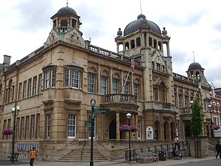
Redbridge is an area of Ilford in East London, England. It gives its name to the London Borough of Redbridge, a local government district of Greater London, with which it should not be confused.
The Hainault Loop, originally opened as the Fairlop Loop, is a 6.5-mile (10.5 km) branch line of the Great Eastern Railway (GER). It once connected Woodford on the Ongar branch to Ilford on the Main Line, with an eastward connection for goods, excursions and stock transfers to Seven Kings. The loop opened to freight on 20 April 1903 and to passengers on 1 May 1903. In 1923, the GER was "grouped" into the London & North Eastern Railway (LNER), who provided passenger services until December 1947. After this date, the route was electrified for London Underground services from both the Woodford and Leytonstone directions, the link to Ilford closed, and today it forms the greater part of the Hainault Loop on the Central line, having been served by Tube trains since 1948.

Woodford is a town in East London, England, within the London Borough of Redbridge. It is located 9.5 miles (15.3 km) north-east of Charing Cross. Woodford historically formed an ancient parish in the county of Essex. It contained a string of agrarian villages and was part of Epping Forest. From about 1700 onwards, it became a place of residence for affluent people who had business in London; this wealth, together with its elevated position, has led to it being called the Geographical and social high point of East London. Woodford was suburban to London and after being combined with Wanstead in 1934 it was incorporated as a municipal borough in 1937. It has formed part of Greater London since 1965 and comprises the neighbourhoods of Woodford Green, Woodford Bridge, Woodford Wells and South Woodford. The area is served by two stations on the Central line of the London Underground: Woodford and South Woodford.

Blackburn Meadows is an area of land just inside the Sheffield city border at Tinsley, England. It became the location of the main sewage treatment works for the city in 1884, and is now one of the largest treatment works in Britain. The treatment process was rudimentary, with sludge being removed to ponds and then to drying beds, after which it was used as manure or transferred by rail to a tip at Kilnhurst. The works progressively expanded to improve the quality of effluent discharged to the River Don and was a pioneer in the use of bio-aeration, following experiments by the works manager during the First World War. This process became known as the "Sheffield System", and was demonstrated to visitors from Great Britain and abroad. Despite these improvements, ammonia levels in the river below the works were high, and fish populations did not survive.

Deephams Sewage Treatment Works is a sewage treatment facility close to Picketts Lock, Edmonton, England. The outflow discharges via Pymmes Brook into the River Lee Navigation at Tottenham Lock. The treatment works was upgraded in 2012/13.

Mogden Sewage Treatment Works is a sewage treatment plant in the Ivybridge section of Isleworth, West London, formerly known as Mogden. Built in 1931–36 by Middlesex County Council and now operated by Thames Water, it is the third largest sewage works in the United Kingdom. It treats the waste water from about 1.9 million people served by three main sewers serving more than the northwest quarter of Outer London and two further main sewers from the south and south-west. The plant has been extended and is constantly being upgraded with new process, most recently in OfWat Amp6 by the Costain Atkins Joint venture who delivered 6MW of Combined Heat and Power (CHP) generation, New process air blowers for Batteries A & B and six gravity sludge thickening streams. The site covers 55 hectares.
Davyhulme Sewage Works is the main waste water treatment works for the city of Manchester, England, and one of the largest in Europe. It was opened in 1894, and has pioneered the improvement of treatment processes.
Wanstead Manor was a manor, historically in the English county of Essex and now in the London Borough of Redbridge. It centred on the manorhouse of Wanstead Hall, later demolished to build Wanstead House.
References
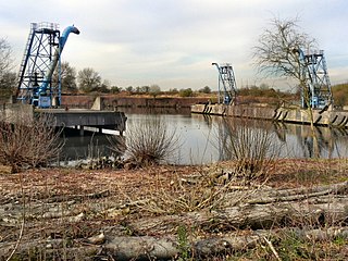
- 1 2 3 4 Paul Ferris. "Sewage Works Site". wansteadwildlife.org.uk. Retrieved 6 October 2018.
- 1 2 "Edith's Streets: Thames Tributary River Roding - Cranbrook". edithsstreets.blogspot.com. Retrieved 7 October 2018.
- 1 2 "Wanstead: Introduction – British History Online". british-history.ac.uk. Retrieved 8 October 2018.
- 1 2 3 John T. Bressey, Surveyor. Local Board Offices, Wanstead, E (28 October 1884). "The Pollution Of Our Rivers" . Letters to the Editor. The Times. No. 31276. London. p. 4. Retrieved 7 October 2018.
{{cite news}}: CS1 maint: multiple names: authors list (link) - ↑ Jabez Hogg (21 October 1884). "The Pollution Of Our Rivers" . Letters to the Editor. The Times. No. 31270. London. p. 3. Retrieved 7 October 2018.
- ↑ "View: London Sheet H (includes: Ilford; Wanstead; Woodford.) - Ordnance Survey Six-inch England and Wales, 1842-1952". maps.nls.uk. 1914. Retrieved 7 October 2018.
- ↑ "View: Essex LXXIII.NE (includes: Cann Hall; East Ham; Ilford; Wanstead; West Ham.) - Ordnance Survey Six-inch England and Wales, 1842-1952". maps.nls.uk. 1898. Retrieved 7 October 2018.
- 1 2 Paul Ferris. "History of the Site". wansteadwildlife.org.uk. Retrieved 7 October 2018.
- ↑ "Wanstead Park – a Chronicle – The Friends of Wanstead Parklands". wansteadpark.org.uk. 19 May 2012. Retrieved 8 October 2018.