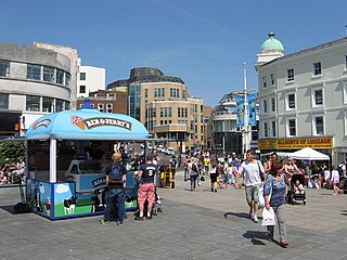
Brighton and Hove is a unitary authority with city status in East Sussex, England. There are multiple villages alongside the seaside resorts of Brighton and Hove in the district. It is administered by Brighton and Hove City Council, which is currently under Labour majority control.

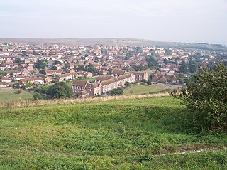
Hamsey is a civil parish in the Lewes District of East Sussex, England. The parish covers a large area and consists of the villages of Hamsey, Offham and Cooksbridge. The main centres of population in the parish are now Offham and Cooksbridge. Around the main settlements are enlarged fields, isolated old cottages and farms. The winding and undulating parish lanes between banks, old hedge rows, trees, flowery verges and ditches are popular with cyclists and give good views of the Downs.

Kingston near Lewes is a village and civil parish in the Lewes District of East Sussex, England. The village is mentioned in the Domesday Book and is located two miles (3.2 km) south of Lewes and is nestled in the South Downs. The parish is par of two Sites of Special Scientific Interest: the Lewes Brooks and Kingston Escarpment and Iford Hill.

St John Without is a small civil parish in the Lewes District of East Sussex, England, covering an area to the north-west of the town of Lewes.

Pyecombe is a village and civil parish in the Mid Sussex District of West Sussex, England. Pyecombe is located 7 miles (11 km) to the north of Brighton. The civil parish covers an area of 887 hectares and has a population of 200, increasing at the 2011 Census to a population of 237.

Moulsecoomb is a suburb of Brighton, Sussex, England, on the northeast side around the A270 Lewes Road, between Coldean and Bevendean, 2+1⁄4 miles (3.6 km) north of the seafront. The eastern edge adjoins Falmer Hill on the South Downs. It is often divided into smaller sections on maps: North Moulsecoomb, East Moulsecoomb and South Moulsecoomb.

Patcham is a suburb in the city of Brighton and Hove, in the ceremonial county of East Sussex, England. It is about 3 miles (5 km) north of the city centre. It is bounded by the A27 to the north, Hollingbury to the east and southeast, Withdean to the south and the Brighton Main Line to the west. The A23 passes through the area.

Wild Park is a 239.8-hectare (593-acre) Local Nature Reserve adjacent to Lewes Road in Brighton, East Sussex. It is owned and managed by Brighton and Hove City Council. It includes Hollingbury Castle, an Iron Age hillfort which is a Scheduled Monument, and Hollingbury Park golf course.

Sussex is a historic county and cultural region in the south of England corresponding roughly in area to the ancient Kingdom of Sussex. It is bounded on the north by Surrey, north-east by Kent, south by the English Channel, and west by Hampshire, and is divided for local government into West Sussex and East Sussex and the city of Brighton and Hove. The city of Brighton & Hove was created a unitary authority in 1997, and was granted City status in 2000. Until then Chichester had been Sussex's only city. By convention, Chichester is Sussex's capital city and Lewes is Sussex's county town.

Brighton to Newhaven Cliffs is a 165.4-hectare (409-acre) biological and geological Site of Special Scientific Interest and Geological Conservation Review site, which stretches along the coast between Brighton and Newhaven in East Sussex. An area of 16.4 hectares is the Castle Hill, Newhaven Local Nature Reserve

Black Rock is an area of beach and promenade located to the west of Brighton Marina and south of Sussex Square in Kemptown in the city of Brighton and Hove. It is has one of the terminus stations of the Volk's railway, hosts a 200-year-old living wall, designated as a local wildlife site and including ninety plants such as Euonymus japonicus, and has area of vegetated shingle on the beach, recreated using plants such as Crambe maritima, Glaucium flavum and Solanum dulcamara (bittersweet) under the guidance of horticulturalists at Kew’s Millennium Seed Bank.

Westdene is an area of the city of Brighton and Hove, East Sussex. It is an affluent northern suburb of the city, west of Patcham, the A23 and the London to Brighton railway line, north of Withdean and northeast of West Blatchington. It is on the Brighton side of the historic parish boundary between Brighton and Hove and is served by Preston Park railway station. It is known for its greenery and woodland and is very close to the South Downs, from which it is separated by the Brighton Bypass, and was built on the slopes of two hills.
Whitehawk Hill is a 50.3-hectare (124-acre) Local Nature Reserve in Brighton, East Sussex. It is owned and managed by Brighton and Hove City Council.
The Brighton and Lewes Downs Biosphere Reserve is a UNESCO Biosphere Reserve located in Sussex on the southeast coast of England near the city of Brighton and Hove. Forming a central unit of the hills of the South Downs National Park, it is centred on the Brighton chalk block that lies between the River Adur in the west and the River Ouse in the east. Chalk downland makes up the principal terrestrial landscape of the area, bounded at each end by the two river valleys. The coastline is dominated by high chalk cliffs in the east and urbanized plains in the west, running to the estuary of the River Adur at Shoreham-by-Sea.

Beacon Hill is an 18.6-hectare (46-acre) Local Nature Reserve in Rottingdean, on the eastern outskirts of Brighton in East Sussex. It is owned and managed by Brighton and Hove Council.

Benfield Hill is an 11.8-hectare (29-acre) Local Nature Reserve (LNR) on the northern outskirts of Hove in East Sussex and is within the boundaries of the South Downs National Park. It is owned and managed by Brighton and Hove City Council.

Bevendean Down is a 64.6-hectare (160-acre) Local Nature Reserve in the Bevendean district in Brighton, East Sussex and is within the boundaries of the South Downs National Park. It is owned by Brighton and Hove Council and managed by tenant farmers and others. It is mainly chalk grassland and there are also areas of woodland and scrub. This site is in five separate blocks.

Ladies Mile is a 13.6-hectare (34-acre) Local Nature Reserve to the east of Patcham, on the northern outskirts of Brighton in East Sussex. The area was designated in 2003 and is owned and managed by Brighton and Hove City Council.

East Brighton Park is located on the eastern edge of the city of Brighton and Hove, England. Bounded by Wilson Avenue and East Brighton golf course, the park extends into Sheepcote Valley and covers around 60 acres. Within the park, there are pitches for football and cricket, tennis courts, a café and a children's playground, beyond it is the South Downs National Park. It was created in 1925.

David Bangs is a field naturalist, social historian, public artist, author and conservationist. He has written extensively on the countryside management, both historically and present day in the English county of Sussex.
