
Carlisle is a border city and the county town of Cumbria, as well as the administrative centre of the City of Carlisle district in North West England. Carlisle is located 8 miles (13 km) south of the Scottish border at the confluence of the rivers Eden, Caldew and Petteril. It is the largest settlement in the county of Cumbria and serves as the administrative centre for both Carlisle City Council and Cumbria County Council. Carlisle is also in the historic county of Cumberland. At the time of the 2001 census, the population of Carlisle was 71,773, with 100,734 living in the wider city. Ten years later, at the 2011 census, the city's population had risen to 75,306, with 107,524 in the wider city.
Cumberland is a historic county of North West England that had an administrative function from the 12th century until 1974. It is bordered by the historic counties of Northumberland to the northeast, County Durham to the east, Westmorland to the southeast, Lancashire to the south, and the Scottish counties of Dumfriesshire and Roxburghshire to the north. It formed an administrative county from 1889 to 1974 and now forms part of Cumbria.

The City of Carlisle is a local government district of Cumbria, England, with the status of a city and non-metropolitan district. It is named after its largest settlement, Carlisle, but covers a far larger area which includes the towns of Brampton and Longtown, as well as outlying villages including Dalston, Scotby and Wetheral. In 2011 the district had a population of 107,524, and an area of 1,039.97 square kilometres (402 sq mi).
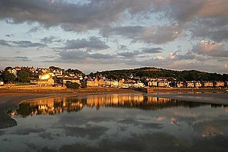
Arnside is a village and civil parish in Cumbria, historically part of Westmorland, near the border with Lancashire, England. The Lake District National Park is located a few miles North. Travelling by road, Arnside is 22 miles (35 km) to the south of Kendal, 25.3 miles (40.7 km) to the east of Ulverston, 35.2 miles (56.6 km) to the east of Barrow-in-Furness, 15.7 miles (25.3 km) to the west of Lancaster and 14.3 miles (23.0 km) to the east of Grange-over-Sands. In the 2001 census the parish had a population of 2,301, increasing at the 2011 census to 2,334.

Bardon Mill is a small village in Northumberland, within the vicinity of the ancient Hadrian's Wall. It is located around 10.5 miles (17 km) from Hexham, 26.5 miles (43 km) from Carlisle, and 32 miles (51 km) from Newcastle upon Tyne.

Tebay is a village and civil parish in Cumbria, England, within the historic borders of Westmorland. It lies in the upper Lune Valley, at the head of the Lune Gorge. The parish had a population of 728 in the 2001 census, increasing to 776 at the Census 2011.

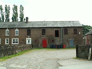
Birdoswald is a former farm in the civil parish of Waterhead in the English county of Cumbria. It stands on the site of the Roman fort of Banna.

Burgh by Sands is a village and civil parish in the City of Carlisle district of Cumbria, England, situated near the Solway Firth. The parish includes the village of Burgh by Sands along with Longburgh, Dykesfield, Boustead Hill, Moorhouse and Thurstonfield. It is notable as the site of the first recorded North African (Moorish) military unit in Roman Britain, garrisoning the frontier fort of Aballava on Hadrian's Wall in the 3rd century CE. It is also where Edward I of England died in 1307.

St Cuthbert Without, or simply St Cuthbert, is a civil parish within the City of Carlisle in Cumbria, England.
Stanwix is a district of Carlisle, Cumbria in North West England. The ward population had a population taken at the 2011 census of 5,934. It is located on the north side of River Eden, across from Carlisle city centre. Although long counted as a suburb it did not officially become part of the city until 1912 when part of the civil parish of Stanwix became part of the parish, city and municipal borough of Carlisle. Further areas were added to the city, which was by then a county borough, in 1934 and 1951. The remaining part of the parish was eventually renamed Stanwix Rural in 1966.

Milecastle 48 , is a milecastle on Hadrian's Wall. Its remains lie near the village of Gilsland in Cumbria where it was historically known as "The King's Stables", owing to the well-preserved interior walls. Unusually a substantial section of stone stairs has survived within the milecastle. The two turrets associated with this milecastle have also survived as above-ground masonry.
Gilsland is a village in northern England about 20 miles (32 km) west of Hexham, and about 18 miles (29 km) east of Carlisle, which straddles the border between Cumbria and Northumberland. The village provides an amenity centre for visitors touring Hadrian's Wall and other features of historical interest in this area of rugged Border country, popularised by the Romantic novelist Sir Walter Scott.

Burtholme refers to any of a civil parish in Cumbria, England, a hamlet within that parish or a family name originally linked to the place. It also appears in Burtholme Beck, which marks a significant point on Hadrian's Wall.

Irthington is a village and civil parish within the City of Carlisle district in Cumbria, England, situated to the north-east of Carlisle Lake District Airport. The population in 2011 was 860 according to the 2011 census.
Henshaw is a small village and civil parish in Northumberland, within the vicinity of the ancient Hadrian's Wall. It is located around 11.5 miles (19 km) from Hexham, 25.5 miles (41 km) from Carlisle, and 33 miles (53 km) from Newcastle upon Tyne.
St Mary Magdalene’s Church is a small mid-Victorian Anglican church on an isolated hillside in north-east Cumbria, England. Dedicated to Jesus' companion Mary Magdalene, it is the parish church of Gilsland, but is almost a mile from the village and may have been intended as much for the use of visitors to the nearby Gilsland Spa hotel as for the village. It is noteworthy in that the founder, G.G. Mounsey, a local landowner and first elected mayor of Carlisle, published a detailed summary of his reasons for building the church and thus threw into relief some of the reasoning behind Victorian church building and restoration.

New Hutton is a village and civil parish in South Lakeland, Cumbria, England. At the 2011 Census, it had a population of 348.
Kingmoor is a civil parish in the City of Carlisle district of Cumbria, England, to the north west of Carlisle city centre. At the 2011 census it had a population of 735.

Kingwater is a civil parish in City of Carlisle district, Cumbria, England. At the 2011 census it had a population of 170.

Kirklinton Middle is a civil parish in City of Carlisle district, Cumbria, England. At the 2011 census it had a population of 384.
