
St Albans is a cathedral city in Hertfordshire, England, east of Hemel Hempstead and west of Hatfield, 20 miles (32 km) north-west of London, 8 miles (13 km) south-west of Welwyn Garden City and 11 miles (18 km) south-east of Luton. St Albans was the first major town on the old Roman road of Watling Street for travellers heading north and became the city of Verulamium. It is within the London commuter belt and the Greater London Built-up Area.

Watling Street is a historic route in England that crosses the River Thames at London and which was used in Classical Antiquity, Late Antiquity, and throughout the Middle Ages. It was used by the ancient Britons and paved as one of the main Roman roads in Britannia. The route linked Dover and London in the southeast, and continued northwest via St Albans to Wroxeter. The line of the road was later the southwestern border of the Danelaw with Wessex and Mercia, and Watling Street was numbered as one of the major highways of medieval England.

St Albans, also known as the City and District of St Albans, is a local government district with city status in Hertfordshire, England. Its council is based in St Albans, the largest settlement in the district. The district also includes the town of Harpenden and several villages. The district borders North Hertfordshire, Welwyn Hatfield, Hertsmere, Watford, Three Rivers, Dacorum, and Central Bedfordshire.

London Colney is a village and civil parish in Hertfordshire, England. It is located to the north of London, close to Junction 22 of the M25 motorway.

The Colne is a river and a tributary of the River Thames in England. Just over half its course is in south Hertfordshire. Downstream, it forms the boundary between Buckinghamshire and the London Borough of Hillingdon. The confluence with the River Thames is on the Staines reach at Staines-upon-Thames.

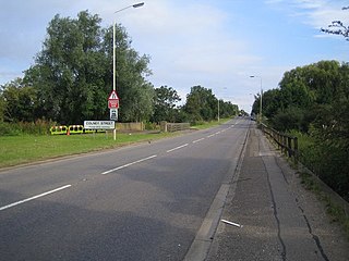
The A1081 is a road in the south of England. It starts at Luton Airport in Bedfordshire and runs to High Barnet in Greater London via Harpenden, St Albans and London Colney, a distance of around 20.5 miles (33.0 km). For most of its length, the A1081 follows the route of the original A6.

The Abbey Line, also known as the St Albans Abbey branch line, is a railway line from Watford Junction to St Albans Abbey. The 6.5-mile (10.5 km) route passes through town and countryside in the county of Hertfordshire, just outside the boundaries of the Oyster Card and London fare zones. Its northern terminus, St Albans Abbey, is located in the south of the city, around 0.75 miles (1.21 km) away from the larger St Albans City station on the Midland Main Line. It is a semi-rural line and, due to its single-track operation, service frequencies are limited. The service is sometimes referred to locally as the Abbey Flyer.

St Albans is a constituency represented in the House of Commons of the UK Parliament since 2019 by Daisy Cooper, a Liberal Democrat.

Hertsmere is a constituency in Hertfordshire, England, represented in the House of Commons since 2015 by Oliver Dowden, who currently serves as deputy prime minister.

Park Street is a small village in Hertfordshire, England. It is on the southern outskirts of St Albans, around 2 miles (3.2 km) south of the city centre, and is separated from the rest of the city's contiguous built-up area by a buffer to the north.

London Colney Football Club is a football club based in London Colney, near St Albans, England. They are currently members of the Combined Counties League Division One and play at Cotlandswick Park.
St Peter Rural was a civil parish in Hertfordshire, England from 1894 to 1947. The local council was St Peter Rural Parish Council.
Colney Street is a hamlet in the English county of Hertfordshire.

The A405 is a 4.8 miles dual carriageway road in Hertfordshire, England, from the A41 at Leavesden Green, near Watford, to the A414 at Park Street Roundabout near St Albans.

Watling Chase Community Forest is an area of 72 square miles located in north London and south Hertfordshire around the towns of Potters Bar, Radlett, Borehamwood and Barnet. It includes Aldenham Country Park, Scratchwood, Moat Mount Open Space and the Watling Chase Timberland Trail, a waymarked walk of 16 kilometres.

All Saints Pastoral Centre is a complex of buildings at London Colney on the southern outskirts of St Albans, Hertfordshire, England. It was built as a convent for the Anglican Society of All Saints Sisters of the Poor.

Barnet Gate Wood is a public open space in Barnet Gate, Barnet, London. It is owned and managed by the London Borough of Barnet, and is part of the Watling Chase Community Forest.

New Southgate Cemetery is a 22-hectare cemetery in Brunswick Park in the London Borough of Barnet. It was established by the Colney Hatch Company in the 1850s and became the Great Northern London Cemetery, with a railway service running from near Kings Cross station to a dedicated station at the cemetery, similar to the service of the London Necropolis Company to Brookwood Cemetery in Surrey.

Broad Colney Lakes is an 11 hectare nature reserve previously managed by Herts and Middlesex Wildlife Trust in London Colney in Hertfordshire. It has recently been sold to an anonymous buyer but reports in The Herts Advertiser says "the selected buyer has stated that the site will continue to be used for fishing, with the woodland managed for the benefit of wildlife.” It has three lakes, created as a result of gravel extraction in the 1920s. Otters travel through Long Lake on their journeys along the River Colne, which flows through the lake, and great crested grebes nest at the edge. Small Lake is marshy and a breeding area for fish, while North Lake has tufted ducks, coots and mallards.
